Mount Shinn facts for kids
Quick facts for kids Mount Shinn |
|
|---|---|

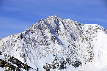
Mount Shinn from North East
|
|
| Highest point | |
| Elevation | 4,661 m (15,292 ft) |
| Prominence | 961 m (3,153 ft) |
| Listing |
|
| Geography | |
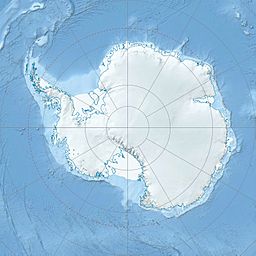
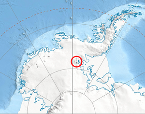
| Location | Antarctica |
| Parent range | Sentinel Range, Ellsworth Mountains |
| Climbing | |
| First ascent | 21 December 1966 by Barry Corbet, Charles Hollister, Sam Silverstein and Richard Wahlstrom |
Mount Shinn is a very tall mountain in Antarctica. It stands 4,661 meters (about 15,292 feet) high. This makes it one of the highest peaks on the continent!
Mount Shinn is located in the Sentinel Range of the Ellsworth Mountains. It is about 6 kilometers (4 miles) southeast of another mountain called Mount Tyree. Around Mount Shinn, you can find several large ice rivers called glaciers. These include the Ramorino Glacier to the north and the Crosswell Glacier to the northeast.
Discovery and Naming
Mount Shinn was first seen during special flights in January 1958. These flights were part of the International Geophysical Year (IGY). The IGY was a big science project where countries worked together to study Earth.
The mountain was named by the Advisory Committee on Antarctic Names (US-ACAN). They named it after Lieutenant Commander Conrad S. (Gus) Shinn. He was a pilot for the United States Navy. He flew some of the planes that discovered the mountain.
Conrad Shinn was also famous for another reason. On October 31, 1956, he piloted the first plane to ever land at the geographic South Pole. This was a very important moment in exploration!
Measuring the Mountain
For a long time, people thought Mount Shinn was even taller, over 4,800 meters high. But in 2001, scientists measured it again.
Damien Gildea and Rodrigo Fica from the Omega Foundation used a special GPS device. They also used a system from the Australian government to process their data. Their new measurements showed that Mount Shinn is 4,661 meters tall.
Maps of the Area
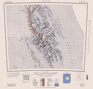
Scientists and explorers use detailed maps to understand the mountains in Antarctica. One important map of this area is:
- Vinson Massif. Scale 1:250 000 topographic map. Reston, Virginia: US Geological Survey, 1988.
See also
 In Spanish: Monte Shinn para niños
 | Emma Amos |
 | Edward Mitchell Bannister |
 | Larry D. Alexander |
 | Ernie Barnes |


