
Ellsworth Mountains facts for kids
Quick facts for kids Ellsworth Mountains |
|
|---|---|

The central part of Ellsworth Mountains with Mount Tyree, Mount Shinn and Mount Vinson; Nimitz Glacier in the foreground
|
|
| Highest point | |
| Peak | Mount Vinson |
| Elevation | 4,892 m (16,050 ft) |
| Dimensions | |
| Length | 360 km (220 mi) NNW-SSE |
| Width | 48 km (30 mi) WE |
| Geography | |

Location in Antarctica
|
|
| Continent | Antarctica |
| State/Province | Ellsworth Land |
| Range coordinates | 78°45′S 85°00′W / 78.750°S 85.000°W |
The Ellsworth Mountains are the highest mountain range in Antarctica. They form a long chain of mountains, about 350 kilometers (217 miles) long and 48 kilometers (30 miles) wide. These mountains stretch from north to south. They are located on the western edge of the Ronne Ice Shelf in Marie Byrd Land.
The mountains are split into two main parts by the Minnesota Glacier. The northern part is called the Sentinel Range. The southern part is known as the Heritage Range. The Sentinel Range is much taller and more impressive. It includes Mount Vinson, which is the highest point in all of Antarctica, standing at 4,892 meters (16,050 feet) tall. The Ellsworth Mountains are located in the area claimed by Chile in Antarctica.
Discovering the Mountains
These mountains were first seen on November 23, 1935. An explorer named Lincoln Ellsworth discovered them during a flight across Antarctica. He flew from Dundee Island to the Ross Ice Shelf. He first called them the Sentinel Range because they looked like sentinels, or guards.
Later, between 1958 and 1966, the United States Geological Survey (USGS) and the United States Navy mapped the mountains in great detail. They used surveys from the ground and photos taken from the air. During this mapping, it became clear that there were two distinct mountain ranges.
Because of this, the Advisory Committee on Antarctic Names decided to keep the name Sentinel Range only for the tall northern mountains. They named the southern mountains the Heritage Range. The committee also suggested naming the entire group of mountains after their discoverer, Lincoln Ellsworth.
How the Mountains Formed
The Ellsworth Mountains are made of a special block of continental crust called the Ellsworth-Whitmore Mountain terrane. This block of land was once part of a supercontinent called Gondwana a very long time ago.
The mountains are made up of very thick layers of rock that have been folded. These rock layers are about 13,000 meters (42,650 feet) thick. They formed between the Cambrian and Permian periods. Scientists believe this land block might have been part of the Cape Fold Belt in southern Africa. It then broke away when Gondwana split apart and later became part of Antarctica.
The rocks include different types like sandstone, siltstone, and coal. Over millions of years, these rocks were pushed and folded. This process created the tall mountains we see today.
Climate and Visiting
The weather in the Ellsworth Mountains is very cold. The average temperature is about -30 degrees Celsius (-20 degrees Fahrenheit). The best time to visit is during the Antarctic summer, from November to January.
However, planning a trip to these mountains is very difficult. It usually requires official scientific support. It can also be very expensive to arrange an expedition there.
Gallery
-
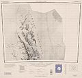
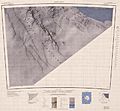
Northern Sentinel Range, USGS map
-
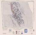
Central and southern Sentinel Range, USGS map
-
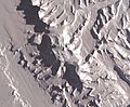
The central part of the mountains with Vinson Plateau, NASA satellite image
-
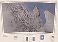
Northern Heritage Range, USGS map
-
Southern Heritage Range, USGS map


.jpg)

.jpg)
_from_East_by_Christian_Stangl_(flickr).jpg)
.jpg)
See also

- In Spanish: Montes Ellsworth para niños
