Vinson Plateau facts for kids
The Vinson Plateau is a high, flat area at the very top of the Vinson Massif. This massif is a huge mountain group in the Sentinel Range, which is part of the Ellsworth Mountains in Antarctica. Think of a plateau as a very high, flat tableland.
This plateau stretches for about 9 kilometers (5.6 miles) between two mountain passes called Goodge Col and Hammer Col. It connects the Vinson Massif to the northern part of the Sentinel Range and to another large mountain group called Craddock Massif. The plateau is also about 4.5 kilometers (2.8 miles) wide, reaching from Branscomb Peak and Silverstein Peak in the west to Schoening Peak and Marts Peak in the east.
The Vinson Plateau sits very high, between 4,000 meters (13,123 feet) and 4,600 meters (15,092 feet) above sea level. The tallest mountain in all of Antarctica, Mount Vinson, rises from this plateau. Mount Vinson is 4,892 meters (16,050 feet) tall! Several other tall peaks are also found here, including Clinch Peak (4,841 m), Corbet Peak (4,822 m), Silverstein Peak (4,790 m), Schoening Peak (4,743 m), and Hollister Peak (4,729 m).
At the southern end of the plateau, you'll find slightly lower peaks like Fukushima (4,634 m) and Opalchenie (4,500 m). The middle part of the plateau has glaciers that drain its ice. The Roché Glacier and another glacier in Jacobsen Valley flow from here, both eventually joining the Branscomb Glacier.
The plateau gets its name from the Vinson Massif. The massif itself was named after a very important American politician, Carl Vinson (1883-1981). He was a statesman who served in the U.S. Congress for many years and was known for his work on naval affairs.
Where is the Vinson Plateau?
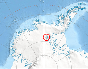
The Vinson Plateau is located at 78°32′00″S 85°35′00″W / 78.53333°S 85.58333°W. This means it's deep in the southern part of the world, in Antarctica. Maps of this area were created by the United States in 1961, 1988, and 2007 to help people understand its geography.
Maps of the Area
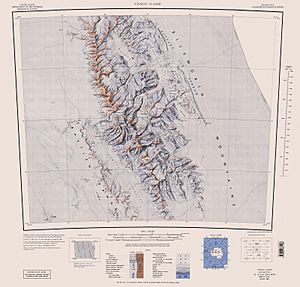
If you want to see more details about the Vinson Plateau and the surrounding mountains, you can look at special maps. One example is:
- D. Gildea and C. Rada. Vinson Massif and the Sentinel Range. This is a very detailed map, scaled at 1:50,000, made by the Omega Foundation in 2007.
 | Aaron Henry |
 | T. R. M. Howard |
 | Jesse Jackson |


