Branscomb Glacier facts for kids
Quick facts for kids Branscomb Glacier |
|
|---|---|

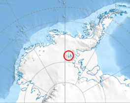
Location of Vinson Massif in Western Antarctica
|
|
| Type | tributary |
| Location | Ellsworth Land |
| Coordinates | 78°32′S 86°05′W / 78.533°S 86.083°W |
| Length | 6 nmi (11 km; 7 mi) |
| Thickness | unknown |
| Terminus | Nimitz Glacier |
| Status | unknown |
The Branscomb Glacier (78°32′S 86°05′W / 78.533°S 86.083°W) is a large river of ice located in Antarctica. It is about 11 nautical miles (20 km) long. This glacier flows west from the northwest side of Vinson Massif. The Vinson Massif is the highest mountain in all of Antarctica.
The Branscomb Glacier eventually flows into another, even larger glacier called the Nimitz Glacier. Both of these glaciers are found in the Sentinel Range, which is part of the Ellsworth Mountains. The Branscomb Glacier gets more ice from areas like Goodge Col and Jacobsen Valley. Another smaller glacier, the Roché Glacier, also joins it near Príncipe de Asturias Peak.
Contents
Exploring Branscomb Glacier
This icy river is an important part of the Antarctic landscape. Glaciers like Branscomb Glacier are huge, slow-moving bodies of ice. They form over many years as layers of snow pile up and get compressed.
Where is Branscomb Glacier?
The Branscomb Glacier is located in a very cold and remote part of the world. It is in Ellsworth Land, a region of West Antarctica. This area is known for its vast ice sheets and towering mountains. The coordinates 78°32′S 86°05′W / 78.533°S 86.083°W show its exact position on the map.
How Big is Branscomb Glacier?
The Branscomb Glacier stretches for about 11 nautical miles (20 km). This makes it a significant feature in the Sentinel Range. While its exact thickness is not known, it is part of a massive system of ice that covers most of Antarctica.
Naming and Discovery
The Branscomb Glacier was first mapped and studied by scientists and explorers. This work helps us understand more about Earth's changing climate.
Who Mapped the Glacier?
The United States Geological Survey (USGS) played a key role in mapping the Branscomb Glacier. The USGS is a science agency of the U.S. government. They study the Earth, its natural resources, and natural hazards. They used surveys and aerial photographs taken by the United States Navy (USN) between 1957 and 1960. These photos were taken from airplanes flying over the area.
Why is it Called Branscomb Glacier?
The glacier was named by the Advisory Committee on Antarctic Names (US-ACAN). This committee is responsible for naming features in Antarctica. They named it after Lewis M. Branscomb. He was an important scientist who served as the Chairman of the National Science Board from 1982 to 1984. Naming features after scientists and explorers is a way to honor their contributions.
 | Misty Copeland |
 | Raven Wilkinson |
 | Debra Austin |
 | Aesha Ash |


