Marie Byrd Land facts for kids
Marie Byrd Land is a large part of Antarctica. It is located between the Ross Ice Shelf and the Ross Sea on its west side. To the north, it faces the Pacific Ocean. It stretches eastwards to a line between the top of the Ross Ice Shelf and Eights Coast. This area is found between 158°W and 103°24'W longitude.
The Rockefeller Plateau and Eights Coast are also part of this region. It was named in 1929 by Rear Admiral Richard E. Byrd. He was an important explorer of the area. Admiral Byrd named the land after his wife, Marie.
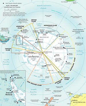
This area is very remote, even for Antarctica. Because of this, most of it has not been claimed by any country. This unclaimed part is east of 150°W. Marie Byrd Land is not a country itself. This makes it the largest single unclaimed territory on Earth. Together with Eights Coast, it covers about 1,610,000 square kilometers.
In 1939, US President Franklin D. Roosevelt asked an Antarctic expedition to claim some land. Members of this and later trips seemed to do so. However, no official claims were made before 1959. That is when the Antarctic Treaty System was set up. Some maps in the United States have shown this area as US territory. The US Defense Department also said there was a good reason for a claim. This was because of the activities there before 1959.
The part of Marie Byrd Land west of 150°W is part of Ross Dependency. This area is claimed by New Zealand.
Marie Byrd Land is divided into five main areas. They are listed from west to east:
| No. | Area Name | Western Border | Eastern Border |
|---|---|---|---|
| 1 | Saunders Coast | 158°00'W | 146°31'W |
| 2 | Ruppert Coast | 146°31'W | 136°50'W |
| 3 | Hobbs Coast | 136°50'W | 127°35'W |
| 4 | Bakutis Coast | 127°35'W | 114°12'W |
| 5 | Walgreen Coast | 114°12'W | 103°24'W |
| Marie Byrd Land (Total) | 158°00'W | 103°24'W |
Research Stations
Marie Byrd Land has been home to several research stations. One important base was Byrd Station. It was part of Operation Deep Freeze. This station started in 1957. It was located inland from Bakutis Coast.
For many years, Byrd Station was the only large base in West Antarctica's interior. In 1968, scientists drilled the first ice core here. This core went all the way through the Antarctic Ice Sheet. The station was used all year round until 1972. After that, it was only used during the summer months. It was renamed Byrd Surface Camp. Byrd Station was reopened in 2009-2010. This was to help with research in northern West Antarctica.
In 1998 and 1999, a camp was set up at the Ford Ranges. This camp helped with an airborne survey by the US Antarctic Program (USAP). This survey used planes to study the land.
Another large camp, Thwaites (THW), was built in 2004-05. It was about 150 kilometers north of Byrd Station. This camp also supported a big airborne survey of eastern Marie Byrd Land.
In 2006, an important camp called WAIS Divide (WSD) was built. It was located in eastern Marie Byrd Land. This camp was made to drill a very detailed ice core over the next three years.
On the Ruppert Coast of Marie Byrd Land, there is a Russian station called Russkaya. It was used from 1980 to 1990. Today, it is also used only during the summer.
See also
 In Spanish: Tierra de Marie Byrd para niños
 | Aaron Henry |
 | T. R. M. Howard |
 | Jesse Jackson |


