Mount Sonder facts for kids
Quick facts for kids Mount Sonder(Rwetyepme) |
|
|---|---|

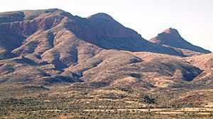
Mount Sonder from the east
|
|
| Highest point | |
| Elevation | 1,380 m (4,530 ft) AHD |
| Naming | |
| Etymology | Dr. Otto Wilhelm Sonder |
| Native name | Error {{native name}}: an IETF language tag as parameter {{{1}}} is required (help) |
| Geography | |
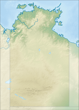
| Location | Northern Territory, Australia |
| Parent range | MacDonnell Ranges |
| Climbing | |
| Easiest route | Hike |
Mount Sonder, also known by its Aboriginal name Rwetyepme, is a tall mountain in the Northern Territory, Australia. It stands about 1,380 meters (4,528 feet) high. This makes it the fourth highest mountain in the Northern Territory. The highest mountain, Mount Zeil, is about 27 kilometers (17 miles) to the west.
Contents
Where is Mount Sonder Located?
Mount Sonder is found about 130 kilometers (81 miles) west of Alice Springs. It is part of the MacDonnell Ranges. This area is protected as the West MacDonnell National Park. The mountain is famous for being one end of the Larapinta trail. This long walking track stretches for 223 kilometers (139 miles) all the way to Alice Springs.
What Does Mount Sonder Look Like?
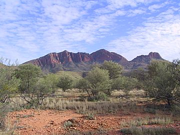
Mount Sonder has a unique shape with two peaks. From far away, it's easy to see these two tops. However, when you are standing on the summit, it can be a bit harder to tell them apart. You can see Mount Sonder from many parts of the western Larapinta trail. It stays in view until you reach a place called Ormiston Pound.
Who Named Mount Sonder?
An explorer named Ernest Giles gave the mountain its name. He named it after a German scientist, Dr. Otto Wilhelm Sonder. Dr. Sonder was a botanist, which means he studied plants.
Hiking to the Top of Mount Sonder
There is a clear path for hikers to climb Mount Sonder. This walking track goes up the western side of the mountain. The path is about 12 kilometers (7.5 miles) long.
What to Expect on the Hike?
Hikers can find water from a tank near the carpark. This tank is about 50 meters (164 feet) from where you park your car. At the top of the main hiking path, there is a special plate that points out different landmarks.
It's important to know that this spot is not the very highest point of the mountain. The true summit is about 750 meters (2,460 feet) further away. The main viewpoint was chosen to keep hikers safe.
Views from the Summit
From the top of Mount Sonder, you can see amazing views. To the west, you can spot the even taller Mount Zeil. Looking east, you'll see the rest of the West MacDonnell Range. A nearby resort called Glen Helen is also visible to the east. If you look to the south-west, you might even see the Gosses Bluff crater, which is a large impact crater.
 | Kyle Baker |
 | Joseph Yoakum |
 | Laura Wheeler Waring |
 | Henry Ossawa Tanner |


