Mount Trickett facts for kids
Quick facts for kids Mount Trickett |
|
|---|---|

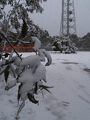
Mount Trickett under snow, 2007
|
|
| Highest point | |
| Elevation | 1,362 m (4,469 ft) AHD |
| Geography | |
| Location | Central Tablelands, New South Wales, Australia |
| Parent range | Great Dividing Range |
| Climbing | |
| Easiest route | drive |
Mount Trickett is a mountain in New South Wales, Australia. It is part of the Great Dividing Range. You can find it about 6 kilometers (about 4 miles) west of Jenolan Caves. This area is known as the Central Tablelands.
Mount Trickett stands 1,362 meters (about 4,469 feet) above sea level. You can easily spot it from the nearby road that connects Jenolan and Oberon. The highest point of Mount Trickett is actually about 800 meters (half a mile) further west along Edith Road from where a tall tower stands. This tower, sometimes called "The Porcupine," is about 1,349 meters high. It rises more than 500 meters (about 1,640 feet) above Jenolan Caves, which are in the valley below.
What to Expect at Mount Trickett
Snow often falls on Mount Trickett from autumn through spring. There are usually ten to fifteen snowfalls each season. About five or six of these snowfalls are heavy enough to close the roads near the top of the mountain.
During colder months, icy roads can make driving tricky. However, most regular cars can usually get through. If there's a very cold weather front, it's safer to approach Mount Trickett from the Oberon side rather than the Jenolan Caves side.
Near the summit, you'll find a gravel turnoff leading to a brick building. A sign there says "Navigational Facility." Like nearby Mount Bindo and Shooters Hill, Mount Trickett is a popular spot for people from Sydney and the Blue Mountains who want to see snow.
How Mount Trickett Got Its Name
Mount Trickett was likely named after Oliver Trickett. He was a licensed surveyor, which means he measured and mapped land. He also created models of the Jenolan Caves for over twenty years, from the late 1800s to the early 1900s.
Oliver Trickett also surveyed and mapped many other major limestone caves in New South Wales. He even surveyed and modeled mining areas, especially the silver, lead, and zinc mines at Broken Hill. He did all this work while employed by the NSW Department of Lands and the NSW Department of Mines. Later, in the early 1900s, he became the chief superintendent of Jenolan Caves. This meant he was in charge of all the improvements made to help people visit the caves.
 | Bessie Coleman |
 | Spann Watson |
 | Jill E. Brown |
 | Sherman W. White |


