Mucurubá facts for kids
Quick facts for kids
Mucurubá
|
|
|---|---|
| Country | Venezuela |
| States | Mérida |
| Municipalities | Rangel Municipality |
| Elevation | 2,407 m (7,897 ft) |
| Population | |
| • Total | 4,700 |
| Time zone | UTC-4:30 |
| Climate | Cfb |
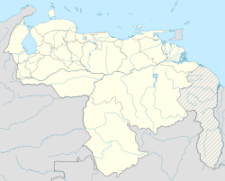
Mucurubá is a small community located in the Mérida state of Venezuela. It sits in the lower parts of the Cordillera Oriental mountain range. This town is quite high up, about 2,407 meters (7,900 feet) above sea level. It's also about 32 kilometers (20 miles) away from the city of Mérida. Mucurubá is part of the Rangel Municipality.
The name "Mucurubá" has an interesting history. It comes from the language of the people who lived there a very long time ago, before Europeans arrived. The name means "place of the ruba," where "ruba" was a plant similar to a potato. The settlement was officially founded in 1586 by a person named Bartolomé Gil Naranjo.
Climate and Farming in Mucurubá
The weather in Mucurubá is generally cool and dry. The average temperature is around 16.5 degrees Celsius (61.7 degrees Fahrenheit). This kind of climate is great for growing many different types of plants and crops.
Growing Food for the Community
Farmers in Mucurubá use special watering systems, called irrigation, to help their crops grow. They produce a variety of foods that are important for the community. Some of the main crops include potatoes, carrots, lettuce, and garlic. They also grow fruits like blackberries, strawberries, peaches, and figs.
Long ago, when the area was a colony, corn was a very important crop for the people living in Mucurubá. They would use water mills to grind the corn into flour. This was a common way to prepare food in those times.
See also
 In Spanish: Mucurubá para niños


