Mursalitsa Peak facts for kids
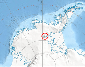
Mursalitsa Peak is a tall mountain in Antarctica. It is mostly covered in ice and snow. This peak is found on the western side of the northern Sentinel Range, which is part of the Ellsworth Mountains. Mursalitsa Peak rises to a height of 2,400 meters (about 7,874 feet). It sits on a smaller ridge that branches off from Mount Sharp, which is on the main line of mountains in the range.
The peak got its name from Mursalitsa Ridge. This ridge is located far away in the Rhodope Mountains in Bulgaria.
Where is Mursalitsa Peak?
Mursalitsa Peak is located in a very cold and remote part of Antarctica. Its exact position is at 77 degrees, 55 minutes, 16 seconds South, and 86 degrees, 21 minutes, 10 seconds West (77°55′16″S 86°21′10″W / 77.92111°S 86.35278°W).
This icy peak is surrounded by other interesting features in the Sentinel Range:
- It is about 5.8 kilometers (3.6 miles) southwest of Mount Barden.
- It lies 7.24 kilometers (4.5 miles) west of Mount Sharp.
- It is located 11.73 kilometers (7.3 miles) north of Brocks Peak.
- You can find it 24.7 kilometers (15.3 miles) east of Helfert Nunatak.
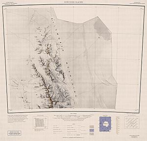
The area around Mursalitsa Peak was first mapped by the United States in 1961. This mapping helped scientists and explorers understand more about this distant part of Antarctica.


