Musquaro River facts for kids
Quick facts for kids Musquaro River |
|
|---|---|

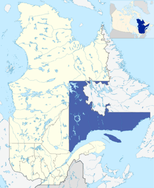
Administrative region of Côte-Nord in relation to Quebec.
|
|
| Country | Canada |
| Province | , Quebec |
| Region | Côte-Nord |
| Physical characteristics | |
| River mouth | Gulf of Saint Lawrence Kegaska, Quebec, Côte-Nord, Quebec, Canada 0 m (0 ft) 50°12′29″N 61°03′41″W / 50.20806°N 61.06139°W |
| Length | 150 km (93 mi) |
The Musquaro River is a river in Quebec, Canada. It flows south through the Côte-Nord region. This area is also known as the North-Shore. The river is located in the municipality of Côte-Nord-du-Golfe-du-Saint-Laurent. It eventually flows into the Gulf of Saint Lawrence.
Contents
River's Location and Size
The Musquaro River is about 150 kilometers (93 miles) long. It starts near Lake Doré. The river's basin, which is the land area that drains into the river, covers 3,638 square kilometers (1,405 square miles).
Neighboring Rivers
The Musquaro River is located between two other rivers. To its west is the Kegaska River. To its east is the Musquanousse River.
Where the River Starts
The Musquaro River begins a few miles east of Lake Doré. This is about 15 kilometers (9 miles) southwest of the Olomane West River. As it flows south, the river winds and creates several lakes.
Musquaro Lake
A very important water source for the Musquaro River is Musquaro Lake. The river flows out of a bay in the southern part of this lake. Musquaro Lake is about 32.5 kilometers (20 miles) northeast of the village of Kegaska.
The River's Path
The Musquaro River and the Musquanousse River flow almost side-by-side. The Musquaro River starts at the end of Musquaro Lake. From there, its water flows south and southwest.
Lakes and Bays Along the Way
As the river continues its journey, it passes through several interesting places. It crosses Grand Lake and Lake Folding Camp John. Then, it heads southeast through Lake Bonenfant.
Further along its path, the river goes past "Pointe à la Loutre" (Otter Point). It also crosses the "Bay of the third fall." The river flows past "île des Rats Musqués" (Muskrats Island) and the "Baie du Français" (Bay of French Island). It also crosses the "île de la Ligne du Télégraphe" (Telegraph Line Island).
Where the River Ends
Finally, the Musquaro River empties into Kauahinekaut Bay. This bay is close to several islands, including Menahkunakat, Kahakaut, and Mantuh. These islands are part of the Washicoutai archipelago. The bay is located between Tip Musquaro to the west and Tip Chicoutal to the east.
History of the Trading Post
The Musquaro area was once home to an important trading post. This post was located at the mouth of the Musquaro River. It was between the towns of La Romaine and Kegaska.
Early Trading Posts
The first trading post was set up around 1710 by the French. It was a place where people traded goods, especially furs. A second fur trade post took its place in 1770.
Companies and Ownership
In 1780, the Quebec Labrador Company was given control of the Musquaro territory. In 1803, this company transferred its trading rights to the North West Company. Later, in 1821, the Hudson's Bay Company took over the rights. The Hudson's Bay Company finally closed the post in 1925. The Musquaro township was officially recognized by the Government of Quebec in 1869.
Rich Wildlife
The Musquaro River is known for having lots of fish. The area around the river is also rich in wildfowl (birds) and animals with valuable furs.
Name of the River
The name "River Musquaro" was officially recognized on December 5, 1968. This was done by the Commission de toponymie du Quebec, which is Quebec's geographical names board.
 | Emma Amos |
 | Edward Mitchell Bannister |
 | Larry D. Alexander |
 | Ernie Barnes |

