Musquodoboit River facts for kids
Quick facts for kids Musquodoboit River |
|
|---|---|

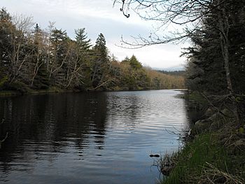
View of the lower reaches of the Musquodoboit River
|
|
| Country | Canada |
| Province | Nova Scotia |
| Physical characteristics | |
| River mouth | Musquodoboit Harbour |
| Length | 97 km (60 mi) |
| Basin features | |
| Basin size | 1,409 km2 (544 sq mi) |
The Musquodoboit River is a cool river in Nova Scotia, Canada. It's located in the central part of the Halifax Regional Municipality. This river is about 97 kilometers (60 miles) long. You can paddle along most of it, about 88 kilometers (55 miles)! The area of land that drains into the river, called its watershed, is about 1409 square kilometers (544 square miles).
Contents
What's in a Name?
The name "Musquodoboit" comes from the Mi'kmaq language. It roughly means "beautiful water." This name perfectly describes the river!
Where Does the River Flow?
The Musquodoboit River starts in the very northeastern part of Halifax County. It's close to the borders of Pictou and Guysborough counties.
River's Journey
It begins in the Cobequid Mountains. From there, it flows southwest through a rich valley called the Musquodoboit Valley. On one side, you'll see Glenmore Mountain, and on the other, a series of smaller hills.
About halfway along its path, the river makes a sharp turn. It then flows southeast. Finally, it empties into a bay on the Atlantic Ocean called Musquodoboit Harbour.
Communities Along the River
Several communities are located along the Musquodoboit River. These include:
- Middle Musquodoboit
- Moose River
- Elderbank
- Meaghers Grant
- Upper Musquodoboit
Also, water from Dollar Lake flows into the Musquodoboit River.
Fun Things to Do on the River
The Musquodoboit River is a popular spot for outdoor fun in central Nova Scotia. It's known for being calm and not having many rapids or waterfalls. This makes it perfect for paddling sports!
Paddling Adventures
If you love being on the water, this river is ideal for:
Its gentle flow means you can enjoy a relaxing trip.
People Living Near the River
Many people live in the area around the Musquodoboit River. In 2011, about 27,846 people lived within the river's watershed. This is the entire land area that drains into the river.
 | Jewel Prestage |
 | Ella Baker |
 | Fannie Lou Hamer |

