Musquodoboit Valley facts for kids
Quick facts for kids
Musquodoboit Valley
|
|
|---|---|
|
Valley
|
|
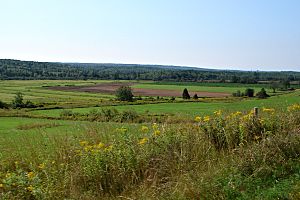
Musquodoboit Valley at Greenwood
|
|
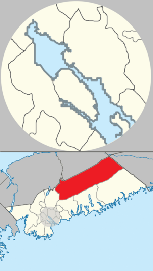
Map of Musquodoboit Valley/Dutch Settlement planning area in Halifax, Nova Scotia
|
|
| Country | |
| Province | |
| Municipality | Halifax Regional Municipality |
| Area | |
| • Total | 714 km2 (276 sq mi) |
| Time zone | UTC-4 (AST) |
| • Summer (DST) | UTC-3 (ADT) |
| Communities | Caribou Mines, Chaplin, Dean, Pleasant Valley, Sheet Harbour Road, Upper Musquodoboit, Fraser Settlement, Kent, Centre Musquodoboit, Reid, Newcomb Corner, Lindsay Lake, Elmsvale, Higginsville, Brookvale, Glenmore, Middle Musquodoboit, South Section, Murchyville, Mooseland, Chaswood, Cooks Brook, Carrolls Corner, Elderbank, Lake Egmont, Meaghers Grant, Meagher, Lower Meaghers Grant, Musquodoboit Harbour, Greenwood |
| Highways | |
The Musquodoboit Valley (pronounced MUS-kə-DOB-it) is a beautiful area in Nova Scotia, Canada. It's part of the Halifax Regional Municipality. Some communities on the western side are close enough for people to travel to work in Halifax.
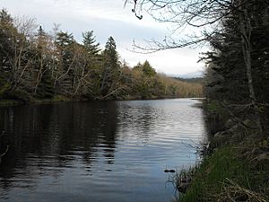
The lovely Musquodoboit River winds its way through most of the valley. It flows past many communities in the area. This river is about 97 kilometers (60 miles) long. It starts in the far northeastern part of the valley. The name "Musquodoboit" comes from the Mi’kmaq language. It means "rolling out in foam," describing the river's movement.
Contents
Exploring the Musquodoboit Valley's Landscape
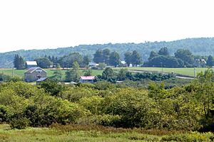
The Musquodoboit Valley is in the northeastern part of the Halifax Regional Municipality. It is a completely rural area. This means it has more farms and forests than big cities. Its economy is similar to nearby rural areas. These include parts of Pictou and Colchester counties.
The valley's economy mostly depends on forestry and agriculture. The Musquodoboit River cuts through the middle of the valley. It starts where its North and South branches meet. The river's water flows into an area of about 1,316 square kilometers (508 square miles). The river then empties into Musquodoboit Harbour, which flows into the Atlantic Ocean.
A Glimpse into the Valley's Past
The name of the valley and its communities comes from the Mi'kmaw word Mooskudoboogwek. This word means "suddenly widening out after a narrow entrance at its mouth." Musquodoboit is the English version of this native name.
English settlers first came to the area around present-day Musquodoboit Harbour in the 1750s. The first land grants in the Middle Musquodoboit area were given in the 1780s. The Mi'kmaw people called this place Natkamkik. This means "the river extends up hill." For a while, the area was known as Laytonville.
In the 20th century, gold mining was important in the region. A famous gold mine was in the community of Moose River Gold Mines. In 1936, this community was the site of a mine cave-in. This event received attention across Canada.
Life and Work in the Musquodoboit Valley
The upper part of the Musquodoboit Valley has the largest farming area in the Halifax Regional Municipality. Over time, these farms have changed. They used to be small family farms. Now, many are large commercial farms. This helps them meet the needs of today's market.
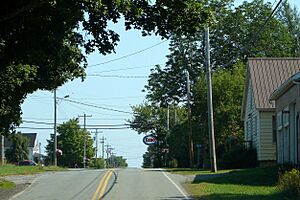
Most of the businesses not related to farming are in Upper Musquodoboit and Middle Musquodoboit.
Middle Musquodoboit: A Community Hub
Middle Musquodoboit has a fire station and a police detachment. The Natural Resources Education Centre is also located here. It offers programs based on school subjects. It also has three kilometers (1.9 miles) of hiking trails. The community has a federal post office and a bank. Middle Musquodoboit also hosts the yearly Halifax County Exhibition.
Upper Musquodoboit: Local Services
Upper Musquodoboit has a convenience store for daily needs. It also has a volunteer fire station. An auto-body shop is available for vehicle repairs. There is also a limestone mine in the area.
Healthcare in the Valley
The Musquodoboit Valley Memorial Hospital is the only hospital in the valley. It is located in Middle Musquodoboit. It is across the river from the main downtown area. Next to it is the Braeside Nursing Home.
Learning in the Valley: Schools
There are three schools in the Musquodoboit Valley region.
Musquodoboit Rural High School
Musquodoboit Rural High School (MRHS) is the only high school in the valley. It teaches students from grades 7 to 12. The school offers an Intensive French program. The building was built in 2008. In 2018, about 270 students attended the school.
Musquodoboit Valley Education Centre
Musquodoboit Valley Education Centre (MVEC) is a school that sends students to MRHS. It is in Middle Musquodoboit. This school teaches grades primary (kindergarten) through six. The school building was constructed in 2001. In 2018, it had 113 students.
Upper Musquodoboit Consolidated Elementary School
Upper Musquodoboit Consolidated Elementary School is in Upper Musquodoboit. This school also sends its students to MRHS. It serves students from primary through grade six. The school was built in 1962. In 2018, there were thirty students enrolled here.
Valley Weather: Climate Overview
| Climate data for Middle Musquodoboit, 1981–2010 normals, extremes 1961–present | |||||||||||||
|---|---|---|---|---|---|---|---|---|---|---|---|---|---|
| Month | Jan | Feb | Mar | Apr | May | Jun | Jul | Aug | Sep | Oct | Nov | Dec | Year |
| Record high °C (°F) | 16.5 (61.7) |
17.0 (62.6) |
28.0 (82.4) |
30.5 (86.9) |
33.3 (91.9) |
33.9 (93.0) |
34.5 (94.1) |
35.6 (96.1) |
33.0 (91.4) |
26.7 (80.1) |
23.5 (74.3) |
16.0 (60.8) |
35.6 (96.1) |
| Mean daily maximum °C (°F) | −0.9 (30.4) |
0.2 (32.4) |
3.9 (39.0) |
9.6 (49.3) |
16.1 (61.0) |
21.3 (70.3) |
24.7 (76.5) |
24.6 (76.3) |
20.3 (68.5) |
14.0 (57.2) |
7.8 (46.0) |
2.2 (36.0) |
12.0 (53.6) |
| Daily mean °C (°F) | −6.2 (20.8) |
−5.2 (22.6) |
−1.3 (29.7) |
4.4 (39.9) |
9.9 (49.8) |
14.8 (58.6) |
18.5 (65.3) |
18.4 (65.1) |
14.2 (57.6) |
8.5 (47.3) |
3.5 (38.3) |
−2.4 (27.7) |
6.4 (43.5) |
| Mean daily minimum °C (°F) | −11.4 (11.5) |
−10.6 (12.9) |
−6.4 (20.5) |
−0.9 (30.4) |
3.7 (38.7) |
8.3 (46.9) |
12.2 (54.0) |
12.2 (54.0) |
7.9 (46.2) |
2.9 (37.2) |
−1.0 (30.2) |
−7.1 (19.2) |
0.8 (33.4) |
| Record low °C (°F) | −34.0 (−29.2) |
−33.0 (−27.4) |
−31.0 (−23.8) |
−15.0 (5.0) |
−7.8 (18.0) |
−3.0 (26.6) |
1.1 (34.0) |
−1.5 (29.3) |
−4.5 (23.9) |
−10.6 (12.9) |
−21.0 (−5.8) |
−34.0 (−29.2) |
−34.0 (−29.2) |
| Average precipitation mm (inches) | 129.8 (5.11) |
100.5 (3.96) |
124.2 (4.89) |
109.0 (4.29) |
105.4 (4.15) |
99.8 (3.93) |
103.8 (4.09) |
91.9 (3.62) |
110.7 (4.36) |
116.7 (4.59) |
136.8 (5.39) |
129.1 (5.08) |
1,357.6 (53.45) |
| Average rainfall mm (inches) | 80.4 (3.17) |
62.1 (2.44) |
92.8 (3.65) |
99.5 (3.92) |
104.9 (4.13) |
99.8 (3.93) |
103.8 (4.09) |
91.9 (3.62) |
110.7 (4.36) |
116.7 (4.59) |
128.6 (5.06) |
97.2 (3.83) |
1,188.3 (46.78) |
| Average snowfall cm (inches) | 49.4 (19.4) |
41.3 (16.3) |
31.4 (12.4) |
9.5 (3.7) |
0.5 (0.2) |
0.0 (0.0) |
0.0 (0.0) |
0.0 (0.0) |
0.0 (0.0) |
0.0 (0.0) |
8.2 (3.2) |
31.9 (12.6) |
172.2 (67.8) |
| Average precipitation days (≥ 0.2 mm) | 14.8 | 12.1 | 13.7 | 15.0 | 14.9 | 14.0 | 12.7 | 12.7 | 12.3 | 14.7 | 15.8 | 14.5 | 167.1 |
| Average rainy days (≥ 0.2 mm) | 7.5 | 6.0 | 9.4 | 14.0 | 14.8 | 14.0 | 12.7 | 12.7 | 12.3 | 14.7 | 14.8 | 10.1 | 143.1 |
| Average snowy days (≥ 0.2 cm) | 9.0 | 7.5 | 5.4 | 1.8 | 0.08 | 0.0 | 0.0 | 0.0 | 0.0 | 0.0 | 1.9 | 6.2 | 31.8 |
| Source: Environment Canada | |||||||||||||
The Musquodoboit Valley experiences a varied climate throughout the year. Summers are generally warm, while winters are cold with significant snowfall. The area gets a good amount of rain and snow each year.
 | Valerie Thomas |
 | Frederick McKinley Jones |
 | George Edward Alcorn Jr. |
 | Thomas Mensah |


