Mymensingh Division facts for kids
Quick facts for kids
Mymensingh Division
ময়মনসিংহ বিভাগ
|
|
|---|---|

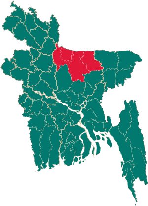
Map of Bangladesh showing Mymensingh Division
|
|
| Country | |
| Area | |
| • Total | 10,485 km2 (4,048 sq mi) |
| Population
(2011 census)
|
|
| • Total | 11,370,000 |
| • Density | 1,084.4/km2 (2,808.6/sq mi) |
| Time zone | UTC+6 (BST) |
Mymensingh Division is one of the eight main administrative areas, called divisions, in Bangladesh. It's like a big region or state within the country. This division covers an area of about 10,485 square kilometers. That's roughly the size of a small country! In 2011, about 11.37 million people lived here.
Mymensingh Division is located in the northern part of Bangladesh. It shares a border with the Indian state of Meghalaya to the north. To its south, you'll find Dhaka Division. To the east, it's next to Sylhet Division, and to the west, it borders Rangpur and Rajshahi Division.
Contents
What is a Division?
In Bangladesh, a division is a very large administrative area. It's bigger than a district but smaller than the whole country. Divisions help the government manage different parts of Bangladesh more easily. Each division has several smaller areas called districts.
Geography of Mymensingh
Mymensingh Division has a varied landscape. It includes plains, rivers, and some hilly areas, especially near the Indian border. The land is mostly fertile, which is great for farming. Many rivers flow through the division, making the soil rich and suitable for growing crops.
Rivers and Waterways
The division is crisscrossed by many rivers. These rivers are important for transportation, farming, and providing water for people and animals. They also create beautiful natural scenery.
People and Culture
The people of Mymensingh Division are known for their rich culture and traditions. Most people speak Bengali, which is the official language of Bangladesh. The division has a long history, and this is reflected in its local customs, music, and food.
Local Traditions
You might find unique folk songs and dances in Mymensingh. Festivals are celebrated with great enthusiasm, often involving traditional music and delicious local dishes. The people are generally very welcoming and friendly.
History of Mymensingh
The area that is now Mymensingh Division has a long and interesting history. It has been an important region for centuries. The division itself was created more recently, in 2015, by taking parts from the older Dhaka Division. This was done to help manage the growing population and development in the region.
Formation of the Division
Before 2015, the districts that now form Mymensingh Division were part of Dhaka Division. The government decided to create a new division to improve administration and bring services closer to the people living in this northern part of Bangladesh.
Images for kids
-
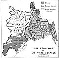
Provincial Map of Bengal showing the Greater Mymensingh Area (present Division with Tangail and Kishoreganj) in 1917.
See also
In Spanish: División de Mymensingh para niños
 | Jackie Robinson |
 | Jack Johnson |
 | Althea Gibson |
 | Arthur Ashe |
 | Muhammad Ali |


