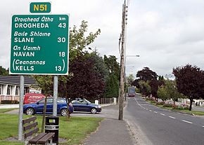
N51 road (Ireland) facts for kids
Quick facts for kids
N51 road |
|
|---|---|
| Lua error in Module:Infobox_road/map at line 15: attempt to index field 'wikibase' (a nil value). | |

N51 leaving Athboy
|
|
| Route information | |
| Length | 52.994 km (32.929 mi) |
| Location | |
| Primary destinations: |
(bypassed routes in italics)
|
| Road network | |
|
|
The N51 road is an important national secondary road in Ireland. It helps people travel across the country. This road stretches for about 53 kilometers (around 33 miles).
The N51 starts in the west, in a town called Delvin in County Westmeath. Here, it connects with another road, the N52. As you travel east, the N51 passes through several towns. These include Athboy, Navan, and Slane, all located in County Meath. In Slane, the N51 crosses paths with the N2 road.
Further along its journey, the N51 crosses the M1 motorway. Finally, it ends near the town of Drogheda in County Louth. The road finishes at a roundabout that connects to the R132. It's a bit unusual for a national secondary road to end at a regional road. However, the R132 used to be the main N1 route. This means it's a very good road, even though it's now called a regional road.
Making the N51 Better
Roads often need updates to handle more traffic and make travel safer. The N51 has also seen some improvements over the years.
On May 15, 2009, a big part of the N51 was opened to traffic. This was called Phase 2B of the N51 Navan Inner Relief Road. This new section created a direct link. It connected the N3/M3 Kells Road with the N51 Athboy Road. This helps drivers get around Navan more easily.
New Road Sections
On the same day, another part of the N51 was opened. This section was about 3.9 kilometers (2.4 miles) long. It was built as part of the M3 motorway project. About 2.5 kilometers (1.5 miles) of this new road is a special type called a Type 1 dual carriageway. A dual carriageway has two separate lanes of traffic going in opposite directions. This makes driving smoother and safer.
 | William M. Jackson |
 | Juan E. Gilbert |
 | Neil deGrasse Tyson |


