
National Register of Historic Places listings in American Samoa facts for kids
This article is about special places in American Samoa that are important to history. These places are officially listed on the National Register of Historic Places in the United States. They include different types of historic spots like old buildings, interesting sites, whole historic areas, and even unique objects.
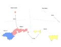
Right now, there are 31 of these special places in American Samoa. They are spread across the three main districts. However, there are no listed sites on the small, faraway atoll called Swains Island.
Contents
How many historic places are there?
Here's a quick look at how many historic places are listed in each part of American Samoa. These numbers might change over time as new places are added or sometimes removed.
| District | Number of Sites |
|---|---|
| Eastern | 15 |
| Manu'a | 2 |
| Rose Atoll | 1 |
| Swains Island | 0 |
| Western | 13 |
| Total: | 31 |
Eastern District's historic treasures
The Eastern District is home to many important historic sites. These places tell stories about American Samoa's past, from old military defenses to government buildings.
| Name on the Register | Image | Date listed | Location | Village | Description | |
|---|---|---|---|---|---|---|
| 1 | Blunts Point Naval Guns |
 |
(#73002128) |
Matautu Ridge 14°17′08″S 170°40′36″W / 14.285556°S 170.676667°W |
Pago Pago | These old naval guns were part of the defenses for Pago Pago Harbor. They were put in place to protect the area during times of war. |
| 2 | Breakers Point Naval Guns |
(#99001231) |
Breakers Point 14°17′11″S 170°39′30″W / 14.286389°S 170.658333°W |
Lauli'i | Similar to Blunts Point, these naval guns also helped protect the harbor. They are a reminder of the island's military history. | |
| 3 | Courthouse of American Samoa |
 |
(#74002180) |
Near Pago Pago Harbor 14°16′41″S 170°41′26″W / 14.277997°S 170.690459°W |
Fagatogo | This building is where important legal decisions are made for American Samoa. It has been a central part of the government for many years. |
| 4 | Government House |
 |
(#72001443) |
Togotogo Ridge 14°16′38″S 170°40′59″W / 14.277224°S 170.683006°W |
Pago Pago | The Government House is where the Governor of American Samoa lives and works. It's an important symbol of the territory's leadership. |
| 5 | Michael J. Kirwan Educational Television Center |
(#09000842) |
American Samoa Highway 118, north side of Utulei 14°16′41″S 170°40′59″W / 14.278056°S 170.683056°W |
Utulei | This center has played a big role in education for the islands, providing television programs for learning. | |
| 6 | Lau'agae Ridge Quarry |
 |
(#99001227) |
Address restricted |
Tula | This site is an ancient quarry, where people long ago dug for stone. It helps us understand how early Samoans built things. |
| 7 | Governor H. Rex Lee Auditorium |
(#10000888) |
American Samoa Highway 001, William McKinley Memorial Highway 14°16′44″S 170°40′59″W / 14.278889°S 170.683056°W |
Utulei | This auditorium is a major place for community events, performances, and gatherings in American Samoa. | |
| 8 | Masefau Defensive Fortifications |
(#12000919) |
Masefau Beach 14°15′26″S 170°37′48″W / 14.257338°S 170.630119°W |
Masefau | These fortifications were built to defend the coast. They show how the islands prepared for potential attacks. | |
| 9 | Navy Building 38 |
(#72001441) |
Pago Pago Harbor 14°16′41″S 170°41′19″W / 14.278056°S 170.688611°W |
Fagatogo | This building was part of the U.S. Navy's operations in American Samoa. It played a role in the naval station's history. | |
| 10 | Navy Building 43 |
 |
(#72001442) |
Pago Pago Harbor 14°16′40″S 170°41′16″W / 14.277778°S 170.687778°W |
Fagatogo | This old Navy building is now the Jean P. Haydon Museum. It's a great place to learn about Samoan culture and history. |
| 11 | Old Vatia |
(#06000956) |
Above Vatia southwest of American Samoa Highway 015 14°15′13″S 170°41′08″W / 14.253611°S 170.685556°W |
Vatia | Old Vatia is a historic district that preserves the traditional layout and feel of an ancient Samoan village. | |
| 12 | Satala Cemetery |
(#05001110) |
American Samoa Highway 001, west of Satala 14°16′14″S 170°41′42″W / 14.270556°S 170.695°W |
Lalopua | This cemetery is a resting place for many people from American Samoa's past. It reflects the community's history. | |
| 13 | Sadie Thompson Building |
 |
(#03000582) |
Along main road 14°16′35″S 170°41′35″W / 14.276389°S 170.693056°W |
Fagatogo | This building is famous for its connection to a well-known story and a movie. It's a landmark in Fagatogo. |
| 14 | Tulauta Village |
|
(#87001980) |
Address restricted |
Tula | This site marks the location of an ancient village. It gives clues about how people lived in Samoa long ago. |
| 15 | U.S. Naval Station Tutuila Historic District |
 |
(#90000854) |
South and west sides of Pago Pago Harbor 14°16′44″S 170°41′09″W / 14.278889°S 170.685833°W |
Fagatogo and Utulei | This historic district includes many buildings and areas that were part of the important U.S. Naval Station. It shows the strong connection between the U.S. Navy and American Samoa's history. |
Manu'a District's historic places
The Manu'a District, made up of smaller islands, also has its own unique historic sites. These places often relate to ancient Samoan culture and leadership.
| Name on the Register | Image | Date listed | Location | Village | Description | |
|---|---|---|---|---|---|---|
| 1 | Faga Village Site |
|
(#99001228) |
Address restricted |
Fitiuta | This site is where an old village once stood. It helps archaeologists learn about early Samoan settlements and daily life. |
| 2 | Tui Manu'a Graves Monument |
(#15000812) |
Northwest of the junction of Ta'u Village and Ta'u Island Roads 14°13′41″S 169°30′58″W / 14.228000°S 169.516100°W |
Ta'u | This monument marks the burial site of the Tui Manu'a, who were the traditional high chiefs and rulers of the Manu'a islands. It's a very important cultural and historical spot. |
Rose Atoll's historic marker
Even the tiny, uninhabited Rose Atoll has a piece of history listed.
| Name on the Register | Image | Date listed | Location | Village | Description | |
|---|---|---|---|---|---|---|
| 1 | Rose Island Concrete Monument |
 |
(#13000920) |
Approximately 160 feet (49 m) east of atoll lagoon 14°32′50″S 168°08′43″W / 14.547210°S 168.145194°W |
Rose Atoll | This concrete marker was placed in 1920 by Governor Terhune when he visited the atoll. It shows that even remote places have a history of exploration and claims. |
Western District's historic sites
The Western District is home to many sites that tell stories of ancient villages, important schools, and even a famous local legend.
| Name on the Register | Image | Date listed | Location | Village | Description | |
|---|---|---|---|---|---|---|
| 1 | A'a Village (AS‑34‑33) |
|
(#87001956) |
Address restricted |
Tapua'ina | This site is the remains of an ancient village, providing valuable information about early Samoan life and communities. |
| 2 | Aasu |
 |
(#72001444) |
Adjacent to Massacre Bay 14°17′33″S 170°45′37″W / 14.292523°S 170.760301°W |
Aasu | This site is known for an event in 1787 where Samoans and French explorers had a conflict. A memorial was placed here later to remember the event. |
| 3 | Afao Beach Site |
(#12000916) |
Afao Beach 14°19′56″S 170°48′01″W / 14.332195°S 170.800226°W |
Afao | Afao Beach is a beautiful coastal area that also holds historical importance, perhaps related to ancient settlements or activities. | |
| 4 | Atauloma Girls School |
 |
(#72001445) |
West edge of Afao 14°19′48″S 170°48′06″W / 14.33°S 170.801667°W |
Afao | Opened in 1900, this was one of the first schools for girls in American Samoa. It helped educate many young women, including those who became nurses. |
| 5 | Fagalele Boys School |
 |
(#72001446) |
South of Leone 14°20′31″S 170°47′10″W / 14.341944°S 170.786111°W |
Leone | This school, possibly built as early as 1850, was the first secondary school in American Samoa. It focused on educating future religious leaders and may be the oldest building still standing on Tutuila. |
| 6 | Fagatele Bay Site |
|
(#87001958) |
Address restricted |
Futiga | Fagatele Bay is a protected marine area, and this site within it holds historical significance, possibly related to ancient use of the bay. |
| 7 | Malaeola Olo |
|
(#15000949) |
Address restricted |
Malaeola Itu'au | The Malaeola Olo is a historic site that represents an ancient fortified lookout or defensive structure. |
| 8 | Maloata Village |
|
(#87001955) |
Address restricted |
Tapua'ina | This site marks the location of the historic Maloata Village, offering insights into past community life. |
| 9 | Poloa Defensive Fortifications |
(#12000917) |
Poloa Beach 14°18′59″S 170°50′03″W / 14.316406°S 170.834151°W |
Poloa | These fortifications, including three pillboxes, were built by American Marines during World War II. They were part of a plan to protect Samoa from a possible invasion. | |
| 10 | Site AS‑31‑72 |
|
(#97000431) |
Address restricted |
Faleniu | This archaeological site provides clues about ancient human activity in the area. |
| 11 | Tataga-Matau Fortified Quarry Complex (AS‑34‑10) |
|
(#87001957) |
Address restricted |
Leone | This complex includes an ancient quarry and defensive structures. It shows how early Samoans used natural resources and protected their communities. |
| 12 | Tupapa Site |
|
(#09000852) |
Address restricted |
A'asufou | The Tupapa Site is an archaeological area that helps researchers understand the history and development of settlements in American Samoa. |
| 13 | Turtle and Shark |
(#14000925) |
2506 Turtle and Shark Road 14°21′26″S 170°44′08″W / 14.357222°S 170.735555°W |
Vaitogi | This site is connected to a very important and famous story in Samoan oral history, the legend of the Turtle and the Shark. |
Images for kids
-
American Samoa districts (clickable map)

