Swains Island facts for kids
|
Olohega, Olosega, Quirós, Isla de la Gente Hermosa, Jennings Island
|
|
|---|---|
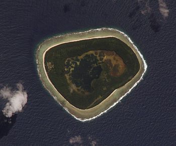
Swains Island as seen from space
|
|
| Geography | |
| Location | Pacific Ocean |
| Coordinates | 11°03′20″S 171°04′40″W / 11.05556°S 171.07778°W |
| Archipelago | Tokelau |
| Area | 2.43 km2 (0.94 sq mi) |
| Administration | |
|
United States
|
|
| Territory | American Samoa |
| Demographics | |
| Population | 17 (2010) |
| Languages | Samoan, Tokelauan, English |
| Ethnic groups | Samoan, Tokelauan, Filipino |
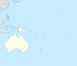
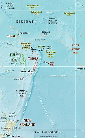
Swains Island is a small, remote coral atoll in the Pacific Ocean. It is located about 340 kilometers (211 miles) north of Pago Pago, the capital of American Samoa. The island is part of the Tokelau island chain.
Swains Island is currently managed by the United States as part of American Samoa since 1925. However, Tokelau also claims the island, leading to an ongoing disagreement. The island has been privately owned by the Jennings family since 1856. It was once a large copra (dried coconut meat) farm until 1967. While not permanently lived on since 2008, the island often welcomes members of the Jennings family, scientists, and amateur radio enthusiasts.
The island is about 180 kilometers (112 miles) south of Fakaofo in Tokelau. It is also 300 kilometers (186 miles) north of Savai‘i in Samoa. The land area is about 2.43 square kilometers (0.94 square miles). Including its central lagoon, the total area is about 3.5 square kilometers (1.4 square miles).
Contents
What's in a Name? The History of Swains Island's Names
Swains Island has several names, each with a story. One common misunderstanding is that it was found by a Portuguese explorer named Pedro Fernandes de Queirós in 1606. He called an island he saw Isla de la Gente Hermosa, meaning "island of the beautiful people." Some thought this was Swains Island. However, later studies showed that the island Queirós described was much bigger. It was likely Rakahanga, an island far to the east.
How Swains Island Got Its Name
Captain William L. Hudson of the USS Peacock saw the island on February 1, 1841. This was during the United States Exploring Expedition. He said he learned about the island from a Captain Swain from Nantucket. Captain Hudson decided to name it Swain's Island. The apostrophe was later removed, making it "Swains Island."
It is not fully clear which Captain Swain he meant. Some think it was Jonathan Swain or William C. Swain. Other clues point to Obed Swain, who was in Tahiti when Captain Hudson was there.
Local Names for the Island
In the Tokelauan language, which was once the main language on Swains Island, the island is called Olohega. This name might refer to the island's location at the end of the Tokelau island chain. Another name is Olosega, used in both Tokelauan and Samoan. It is important not to confuse this with another island named Olosega in American Samoa.
The island is also known as Jennings Island. This name comes from Eli Hutchinson Jennings, who settled there in 1856. His family still owns and manages the island today.
Exploring Swains Island's Geography
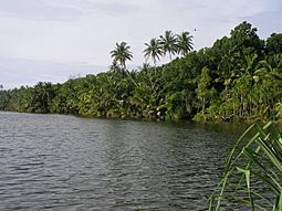
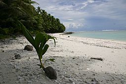
Swains Island is a unique atoll. It has a complete ring of land that surrounds a central lagoon. The lagoon is separated from the ocean. The deepest part of the lagoon is about 12 meters (39 feet). Its water is a bit salty, called "brackish," which means it's good for bathing but not for drinking. People on the island collect rainwater in tanks for drinking.
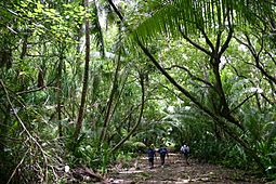
Most of the land on the island is covered with coconut palm trees. There are two main villages. Taulaga (meaning "harbor" or "town") is on the west side. It used to have a central open space called a malae with houses around it. By 2013, only a church, built around 1886, was still standing.
Etena (meaning "Eden") is a village in the south. This is where the Jennings family's old home was. It was built in the 1880s but was badly damaged by a cyclone in 2005. A road called Belt Road used to go around the whole island. In 2013, only the part connecting the two villages could still be used because plants had grown over the rest. The island also has several cemeteries.
Animals of Swains Island
Swains Island is an important place for birds. BirdLife International has named it an Important Bird Area (IBA). This is because it is a breeding ground for white terns.
Scientists have found seven types of reptiles on the island. These include different kinds of geckos and skinks. Green sea turtles used to lay their eggs on the island. Now, they mostly visit the waters around the island.
Who Lives on Swains Island?
| Historical population | ||
|---|---|---|
| Year | Pop. | ±% |
| 1930 | 99 | — |
| 1940 | 147 | +48.5% |
| 1950 | 164 | +11.6% |
| 1960 | 106 | −35.4% |
| 1970 | 74 | −30.2% |
| 1980 | 27 | −63.5% |
| 1990 | 16 | −40.7% |
| 2000 | 37 | +131.2% |
| 2010 | 17 | −54.1% |
| U.S. Decennial Census | ||
Swains Island was first included in the U.S. census in 1930. This was after it became part of American Samoa in 1925.
In the 2010 census, 17 people were counted living in 6 homes. There were 8 males and 9 females. Most were U.S. nationals, and some were from Samoa, Tokelau, and the Philippines. They reported their backgrounds as Samoan, Tokelauan, and Filipino. Most people spoke Samoan, but everyone also spoke English.
However, many visitors have said that no one has lived on Swains Island permanently since 2008. The people counted in the census may have been temporary residents.
A Look Back: The History of Swains Island
Evidence from old stories and studies shows that Polynesians first settled Swains Island. Later, people from Fakaofo in Tokelau took control of the island.
Whaling ships from New England started visiting the island around the 1830s. At that time, some French people began making copra there. The local people left the island because of violence from these foreigners.
Captain William L. Hudson of the USS Peacock saw the island in 1841. He named it Swain's Island after Captain Swain.
The Jennings Family's Role
After Captain Hudson's visit, people from Fakaofo returned to the island. Three Frenchmen also joined them. In 1856, an American named Eli Hutchinson Jennings (1814–1878) moved to Swains Island with his Samoan wife, Malia. Jennings claimed he bought the island from a British captain. The price was said to be 15 shillings per acre and a bottle of gin.
On October 13, 1856, Swains Island became a special settlement owned by the Jennings family. It was under the U.S. flag and stayed this way for about 70 years. The U.S. also claimed it in 1860 under the Guano Islands Act.
Jennings started a coconut farm, which grew well under his son, Eli Jr. Eli Jennings Sr. also played a part in helping Peruvian ships take people from other Tokelau atolls.
Becoming Part of the United States
In 1907, a British official claimed Swains Island belonged to the United Kingdom. He asked for a tax payment. Jennings paid, but then he talked to the U.S. State Department. His money was returned, and the British government agreed that Swains was an American possession.
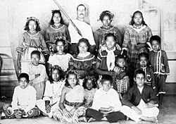
After Eli Jr. and his wife passed away in the early 1920s, the island's ownership was questioned. The United States decided to give the right to manage the island to Eli's daughter Ann and son Alexander. On March 4, 1925, Swains Island officially became part of American Samoa. Alexander Jennings became the managing owner. Around this time, about 100 people lived on the island. During World War II, the island had 125 people and a naval radio station.
In 1953, some Tokelauan workers on Swains Island claimed they had a right to the land because they had lived there for a long time. Alexander Jennings asked 56 workers and their families to leave. The governor of American Samoa stepped in. The governor agreed that Jennings owned the island. However, he also created rules for labor contracts and a local government. This was to protect the rights of the workers. The islanders were also given a representative in the local government.
Recent Issues: Ownership and Trade
On March 25, 1981, New Zealand, which Tokelau depends on, agreed that the U.S. owned Swains Island. This was part of the Treaty of Tokehega. However, in a draft of Tokelau's constitution in 2006, Swains Island was still claimed as part of Tokelau. The Governor of American Samoa, Togiola Tulafono, said in 2007 that his government should keep control of the island.
In 2007, Tokelau's parliament thought about a new flag. It showed Swains Island as a fourth star, along with three others. They later chose a design where the four stars looked like the Southern Cross constellation.
More recently, Alexander Jennings, the representative for Swains Island in American Samoa's government, said he wanted better trade links with Tokelau. The leader of Tokelau, Kuresa Nasau, was interested, and more talks were planned.
Cyclone Percy in 2005
In February 2005, Cyclone Percy hit Swains Island. It caused a lot of damage and almost destroyed the village of Taulaga. The old Jennings family home in Etena was also damaged. Only seven people were on the island at the time. The Coast Guard dropped supplies to make sure the islanders had food and water. A Coast Guard visit in 2007 found 12 to 15 people living there. Most of the island's trees had survived the cyclone.
Power and Radio Connections
Because Swains Island is so far away, it is a special place for amateur radio operators, also known as "ham operators." Several groups have visited the island for "DXpeditions." In 2007, a DXpedition with the call sign N8S made over 117,000 radio contacts worldwide. This was a new record for an expedition using generators and tents.
In 2012, another DXpedition called NH8S visited Swains Island. They made 105,455 radio contacts.
How Swains Island is Governed
Swains Island is governed by an American Samoa "government representative." It also has a village council, a pulenu'u (village head), and a leoleo (policeman). These officials have the same duties and qualifications as those in other villages in American Samoa. The owner of Swains Island or their employees cannot be the government representative.
The government representative has several important jobs:
- They act as the governor's representative on Swains Island.
- They help solve problems between workers and their employer.
- They make sure U.S. and American Samoa laws are followed on the island.
- They enforce village rules.
- They keep the governor updated on the island's situation, especially about health, education, safety, and welfare.
- They ensure Swains Islanders have all their rights and freedoms.
- They make sure the owner's rights to the island are respected.
The government representative can also make arrests and stop disturbances. They can call meetings of the village council.
The village council includes all men over 24 years old who are of sound mind. In 1980, five men fit this description. Swains Island also sends one non-voting delegate to the American Samoan legislature. In 2007, Alexander Jennings held this position.
The Jennings Family's Leadership
Members of the Jennings family called themselves "leaders" or "proprietors" of Swains Island. They ruled almost independently from 1856 to 1925. After 1925, they still owned the island but were under the control of American Samoa.
Jennings family members who led as "proprietors":
- October 13, 1856 – December 4, 1878: Eli Hutchinson Jennings, Sr. (1814–1878)
- December 4, 1878 – October 25, 1891: Malia Jennings, his Samoan wife (died 1891)
- October 25, 1891 – October 24, 1920: Eli Hutchinson Jennings, Jr. (1863–1920), son of Eli, Sr. and Malia. The writer Robert Louis Stevenson called him "King Jennings."
- October 24, 1920 – August 1921: Ann Eliza Jennings Carruthers (1897–1921), shared power with her brother, Alexander Hutchinson Jennings. Both were children of Eli Jr.
- October 24, 1920 – March 4, 1925: Alexander Hutchinson Jennings III
Jennings family members who led under American rule:
- March 4, 1925 – Sometime in the 1940s: Alexander Hutchinson Jennings III
- Sometime between 1940–1954: Alexander E. Jennings
- 1954 to present: Local government was set up by American Samoa. However, the Jennings family still owns the island.
Swains Island in Pop Culture
Swains Island: One of the Last Jewels of the Planet (2014) is a documentary film. It was the first film from American Samoa to be shown at the Blue Ocean Festival in Florida. The 90-minute movie is directed and narrated by Jean-Michel Cousteau. It shows the island's nature and culture, including its coral reef, lagoon, and village life.
The band Te Vaka wrote a song called Haloa Olohega. In Tokelauan, this means "Poor Olohega." The song expresses sadness about Tokelau losing the island.
|
See also
 In Spanish: Isla Swains para niños
 | James Van Der Zee |
 | Alma Thomas |
 | Ellis Wilson |
 | Margaret Taylor-Burroughs |


