Pago Pago, American Samoa facts for kids
Quick facts for kids
Pago Pago
|
|
|---|---|
|
Village
|
|
|
Pago Pago Harbor
American Samoa Fono
High Court of American Samoa
Jean P. Haydon Museum
|
|
| Nicknames:
O le Maputasi ("The Single Chief's House")
|
|
| Country | |
| Territory | |
| Island | Tutuila |
| District | Eastern |
| County | Maoputasi |
| Became Capital | 1899 |
| Named for | Pago Volcano |
| Government | |
| • Body | Village Council |
| Area | |
| • Village | 8.85 km2 (3.42 sq mi) |
| Elevation | 9 m (30 ft) |
| Highest elevation
(Matafao Peak)
|
653 m (2,142 ft) |
| Lowest elevation | 0 m (0 ft) |
| Population
(2020)
|
|
| • Village | 3,000 |
| • Density | 412.5/km2 (1,068/sq mi) |
| • Urban | 15,000 |
| Time zone | UTC−11 (Samoa Time Zone) |
| ZIP code |
96799
|
| Area code(s) | +1 684 |
| Climate | Af |
| FIPS code | 60-62500 |
| Website | www.pagopago.com |
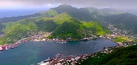
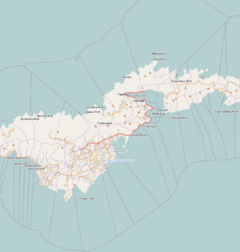
Pago Pago (pronounced PAHNG-gaw PAHNG-gaw) is the capital city of American Samoa. It's located in Maoputasi County on Tutuila, which is the main island of American Samoa.
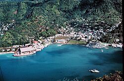
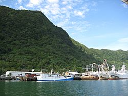
Pago Pago has one of the deepest natural harbors in the South Pacific Ocean. This harbor is protected from strong winds and rough seas. Its location is very important, making it easy to bring in fish for processing. The main industries here are tourism, entertainment, food, and tuna canning. In 1993, Pago Pago was the fourth-largest tuna processor in the world. The value of fish brought into Pago Pago is higher than any other port in the U.S. or its territories. It's also home to the biggest tuna cannery in the world!
Pago Pago is the only modern city in American Samoa. It's the main port and where the government, industries, and most businesses are located. The Greater Pago Pago area includes several villages along Pago Pago Harbor. One of these villages is also called Pago Pago. In 2010, that village had about 3,656 people. The villages that make up the area are Utulei, Fagatogo, Malaloa, Pago Pago, Satala, and Atu'u. Fagatogo is like the downtown area, with the legislature, police, port, shops, and hotels. The executive government offices are in Utulei.
Rainmaker Mountain (Mount Pioa) is near Pago Pago. It helps create a lot of rain, making Pago Pago the harbor with the most rainfall in the world. This mountain also protects the eastern side of Pago Pago, making the harbor a very safe place for ships to anchor.
Historically, Pago Pago Bay's important location helped separate Western and Eastern Samoa. The U.S. first became interested in Tutuila because they wanted to use Pago Pago Harbor as a place to refuel ships with coal. Pago Pago is special because it's the southernmost U.S. capital and the only one in the Southern Hemisphere.
Contents
- Understanding the Name of Pago Pago
- A Look at Pago Pago's History
- Exploring Pago Pago's Geography
- Pago Pago's Climate
- Population of Pago Pago
- Learning and Education
- Pago Pago's Economy
- Tourism in Pago Pago
- Getting Around Pago Pago
- Historic Places to See
- Plants and Animals of Pago Pago
- Famous Landmarks
- Notable People from Pago Pago
- See also
Understanding the Name of Pago Pago
The exact meaning of the name Pago Pago isn't fully known. One idea is that it comes from the Samoan language and means "place of prayer."
The letter "g" in Samoan sounds like "ng," so Pago Pago is pronounced "pahngo pahngo."
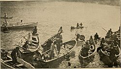
Long ago, Pago Pago was also called Long Bay (O le Fagaloa). This name was used by the first people who lived there. It was also known as O le Maputasi, meaning "The Single Chief's House." This was a compliment to the Mauga, a high chief who lived in Pago Pago.
For a short time in the 1830s, Pago Pago was called Cuthbert's Harbor. This was named after British Captain Cuthbert, who was the first European to enter the harbor.
A Look at Pago Pago's History
Pago Pago was first settled about 4,000 years ago. Scientists have found old pottery and rock structures in the Pago Pago Valley. These show that people lived there at least 1,500 to 1,300 years ago.
The island of Tutuila was part of the Tuʻi Tonga Empire from around 950 CE until 1250. Samoan stories say that a warrior from Pago Pago, Fua’au, helped drive the Tongans out of Tutuila.
When Europeans first visited Tutuila, the Mauga was the main chief of Pago Pago.
The 1800s: A Growing Interest
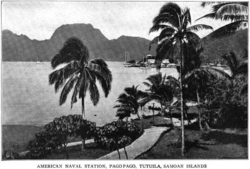
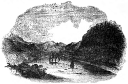
In 1836, a British whaling ship, the Elizabeth, was the first European ship to enter Pago Pago Harbor. Its captain, Cuthbert, is known for "discovering" the harbor.
American interest in Pago Pago grew in 1839. Commander Charles Wilkes of the United States Exploring Expedition surveyed the harbor. The U.S. wanted to use Pago Pago as a coaling station for its ships.
In 1872, the chief of Pago Pago signed a treaty with the U.S. This gave the American government a lot of influence on the island. The U.S. Navy then built a coaling station in 1878. This station was used to refuel both navy and commercial ships.
The first American flag was raised in Pago Pago on April 17, 1900. This ceremony marked American control over the islands. Pago Pago officially became the capital of American Samoa in 1899.
The 1900s: Wars and Space Missions
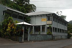

In the early 1900s, Pago Pago became the main port for American Samoa.
During World War I, two German ships in Pago Pago were taken by the U.S. Navy. Pago Pago was also a very important naval base for the U.S. during World War II. In 1940, improvements were made to the naval station. A Marine Corps airfield was built at Tafuna. Guns were placed at Blunts and Breakers Points to protect Pago Pago Harbor.
In January 1942, a Japanese submarine shelled Pago Pago Harbor. This was the only battle action on the islands during World War II.
Pago Pago was also important for NASA's Apollo program from 1961 to 1972. Several Apollo missions, including Apollo 11 (the first Moon landing), landed near Tutuila Island. The astronauts then flew from Pago Pago to Honolulu. The Jean P. Haydon Museum has an American Samoa flag that went to the Moon and moonstones given by President Richard Nixon.
In 1965, a tramway was built at [[Mount ʻAlava]]. It ran across Pago Pago Harbor and was one of the longest single-span cable car routes in the world.
President Lyndon B. Johnson and First Lady Lady Bird Johnson visited Pago Pago in 1966. Johnson is the only U.S. President to have visited American Samoa.
In 1967, Pago Pago became a duty-free port. This meant lower taxes on imported goods.
In November 1970, Pope Paul VI visited Pago Pago on his way to Australia.
In 1970, a fire destroyed the legislative buildings. A new building for the Fono (legislature) was built in Fagatogo.
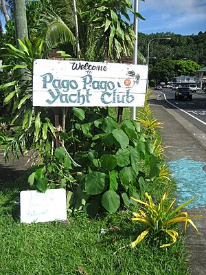
Shipping and flights to Pago Pago increased in the early 1970s. The harbor became a popular stop for yachts.
The 2000s: Tsunami and Modern Times
Since 2000, the East & West High School All-Star Football Game has been held in Pago Pago.
Pago Pago hosted the 10th annual Festival of Pacific Arts in 2008.
In 2010, Tri Marine Group, a large fish supplier, bought a tuna packing plant in Pago Pago.
Mike Pence visited Pago Pago in 2017, becoming the third U.S. vice president to stop there.
The 2009 Tsunami
On September 29, 2009, a powerful earthquake hit the South Pacific. This caused a tsunami that struck Pago Pago and nearby areas. The tsunami caused a lot of damage to homes, buildings, and vehicles. Sadly, 34 people died, and hundreds were injured.
The earthquake was 8.3 magnitude, and the waves reached about 5 feet high in the city. It caused major flooding. A local power plant was damaged, and many homes were destroyed or badly hurt. After the earthquake, President Barack Obama declared a disaster. This helped provide money for temporary housing and other aid.
The biggest wave hit Pago Pago at 6:13 PM local time, reaching about 6.5 feet high.
Exploring Pago Pago's Geography
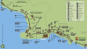
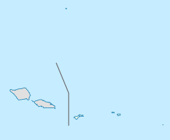
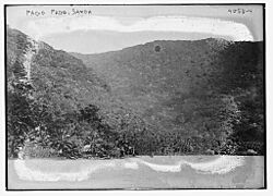
Pago Pago is in the Eastern District of American Samoa. It's about 2,600 miles southwest of Hawaii. The city is located between steep mountains and the harbor.
It's surrounded by mountains like Mount Matafao (2,142 feet) and Rainmaker Mountain (1,716 feet). These mountains help protect Pago Pago Harbor.
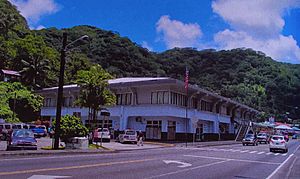
The main downtown area is Fagatogo, on the south side of Pago Pago Harbor. Here you'll find the Fono (the local legislature), the port, the bus station, and the market. Banks and hotels are in Utulei and Fagatogo. The tuna canneries, which employ many people, are in Atu'u on the north side of the harbor. The village of Pago Pago itself is at the western end of the harbor.
Pago Pago Harbor almost cuts Tutuila Island in half. It's about 0.6 miles wide and 2.5 miles long. Mount Pioa (Rainmaker Mountain) is a 1,630-foot-high mountain on the east side of the bay.
Half of American Samoa's people live along the foothills and coastal areas of Pago Pago.
Farming and City Life
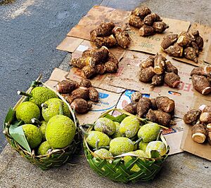
Farming and fishing are still important for local families. They grow crops like breadfruit and taro.
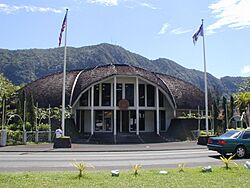
The Greater Pago Pago Area includes several important villages:
- Fagatogo is like downtown Pago Pago. It has the post office, museum, movie theater, bars, and taxis.
- Utulei and Maleimi have some of Pago Pago's hotels.
- Satala and Atu'u are where the tuna industry is located.
- Tafuna is home to the Pago Pago International Airport, about 7 miles southwest of Pago Pago.
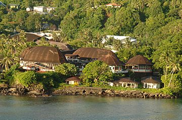
Some houses in Pago Pago are modern, while others are traditional Samoan homes. All houses have running water and plumbing.
Pago Pago Park is a public park by the harbor. It's a 20-acre area with a ball field, sports court, and boat ramp. It also has businesses, basketball and tennis courts, a gym, a bowling alley, and Korean food kiosks.
National Park of American Samoa
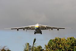
Pago Pago is the main entry point for visiting the National Park of American Samoa. The city is just south of the park. The park's visitor center is at the head of Pago Pago Harbor. It has Samoan artifacts, corals, and seashells.
Other parts of the park, on the islands of Taʻū and Ofu, can be reached by flights from Pago Pago International Airport.
The national park has tropical rainforests, tall mountains, beaches, and some of the world's tallest sea cliffs (3,000 feet). It was created to protect the rainforests, coral reefs, and Samoan culture. It's special because the U.S. government leases the land from local chiefs. The park is home to many animals, including coral reef fish, seabirds, and flying fruit bats. It has over 150 types of coral.
Natural Dangers
Pago Pago can be affected by natural disasters. These include heavy storms, floods, tsunamis, mudslides, and earthquakes. American Samoa has had several cyclones and tropical storms.
The city is located in a sheltered part of Pago Pago Harbor, which helps protect it during hurricanes.
In the last century, Pago Pago has had over 50 small tsunamis. The most damaging tsunami happened in 2009. Waves that were about 1 meter high at the harbor's entrance grew to 7 meters high inside the bay. This caused a lot of damage and led to 34 deaths on Tutuila Island.
Pago Pago's Climate
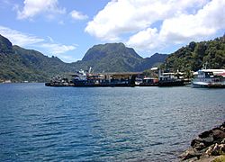
Pago Pago has a tropical rainforest climate. This means it has hot temperatures and a lot of rain all year round. The hottest temperature ever recorded was 99°F (37°C) in 1958. The lowest was 59°F (15°C) in 1964. The average yearly temperature is about 82°F (28°C).
Pago Pago is known as one of the wettest places on Earth. It gets about 128 inches (326 cm) of rain each year. The rainy season is from October to May. This is also hurricane season. The frequency of hurricanes has increased recently.
Rainmaker Mountain, also called Mount Pioa, is a special National Natural Landmark. It's known for causing a lot of rain. This 1,716-foot mountain blocks low clouds, making them drop their moisture on the city. Because of this, Pago Pago gets twice as much rain as nearby Apia in Western Samoa.
Population of Pago Pago
| Historical population | |||
|---|---|---|---|
| Census | Pop. | %± | |
| 1920 | 508 | — | |
| 1930 | 708 | 39.4% | |
| 1940 | 934 | 31.9% | |
| 1950 | 1,586 | 69.8% | |
| 1960 | 1,251 | −21.1% | |
| 1970 | 2,451 | 95.9% | |
| 1980 | 2,491 | 1.6% | |
| 1990 | 3,518 | 41.2% | |
| 2000 | 4,278 | 21.6% | |
| 2010 | 3,656 | −14.5% | |
| 2020 | 3,000 | −17.9% | |
The village of Pago Pago had 3,656 people in 2010. However, the larger Pago Pago area, including nearby villages, had about 11,500 residents in 2011. About 90 percent of American Samoa's population lives around Pago Pago.
In 2000, most of Pago Pago's population (74.5%) were Native Hawaiian or Other Pacific Island people. Many residents were born outside American Samoa, and there are more new residents from countries like South Korea.
Between 2010 and 2020, the population of Pago Pago and the surrounding county decreased.
Learning and Education
The Feleti Barstow Public Library is in Pago Pago. The original library was destroyed by a tropical cyclone in 1991. The current library opened in 2000.
The American Samoa Community College (ASCC) started in 1970. Its first classes were taught in Fagatogo in 1971. The college later moved to its current location in Mapusaga in 1974.
Pago Pago's Economy
Pago Pago is the main business hub in American Samoa. It has all the industries and most of the businesses. It's the top port in the United States for the value of fish landed, bringing in about $200,000,000 each year.
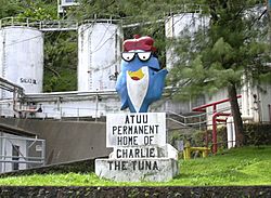
Tuna canning is the most important economic activity. Companies like Chicken of the Sea and StarKist have canneries in Pago Pago. These canneries employ 14 percent of American Samoa's workers. The first cannery opened in 1954. Canned fish and pet food make up most of American Samoa's industrial products.
Pago Pago has many restaurants, entertainment places, and shops. In 2000, there were 225 registered businesses in Pago Pago. Farmland is also found in some areas around Pago Pago.
Shopping centers like Pago Plaza and Fagatogo Square Shopping Center offer various goods. Fagatogo Market is considered the main center of Pago Pago. It has restaurants, shops, bars, and often live music. Tourists can buy handmade crafts there.
Pago Pago is a duty-free port, which means prices on imported goods are lower than in other parts of the South Pacific.
Tourism in Pago Pago
Tourism in American Samoa is mostly focused on Pago Pago. About 34,000 visitors come each year. Most visitors (69.3%) are from the United States.
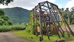
Until 1980, visitors could take an aerial tramway over the harbor to see the view from Mt. Avala. However, a U.S. Navy plane hit the cable during a celebration, causing the tram to close. The tram is currently not in use, but there are plans to fix it.
The Sadie Thompson Inn is a historic hotel and restaurant on the edge of Pago Pago. It's listed on the U.S. National Register of Historic Places.
The Greater Pago Pago Area has more than 10 hotels for visitors.
Getting Around Pago Pago
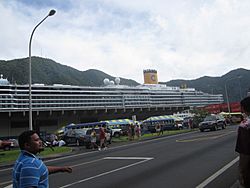
Pago Pago Harbor is where ships arrive in American Samoa. Many cruise ships stop here to refuel and restock supplies. Pago Pago Harbor is one of the world's largest natural harbors. It's known as one of the best deepwater harbors in the South Pacific.
Cruise ships visit Pago Pago, usually arriving in the morning and leaving in the afternoon. In 2017, 13 cruise ships were expected to visit, bringing 31,000 visitors. The harbor can hold two cruise ships at once.
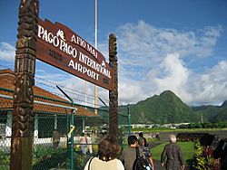
Pago Pago International Airport (PPG) is located in Tafuna, about 8 miles southwest of Pago Pago. There are daily international flights to Samoa. Flights to Honolulu International Airport in Hawaii take about five hours.
You can also take flights to the islands of Taʻū and Ofu from Pago Pago. A ferry called MV Lady Naomi travels between Pago Pago and Apia, Samoa, once a week.
Buses and taxis are available in Fagatogo.
Historic Places to See
Sixteen buildings from the U.S. Naval Station Tutuila Historic District are listed on the U.S. National Register of Historic Places. These include:
- The Government House, a colonial mansion built in 1903.
- The Courthouse, a two-story colonial-style building.
- The Jean P. Haydon Museum, built in 1917, which holds historical items like canoes.
- Navy Building 38, a historic radio station in Fagatogo.
World War II Fortifications
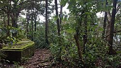
You can find six World War II ammunition bunkers near the Pila F. Palu Co. Inc. Store. A dirt road leads to a large concrete bunker that was used as a naval communications headquarters during the war.
More than 50 pillbox fortifications are along the coastline of Tutuila Island. The largest is the Marine Corps communication bunker in Pago Pago.
During World War II, guns were placed at Blunt's and Breaker's Points to protect Pago Pago Harbor.
Plants and Animals of Pago Pago
Plants (Flora)
In the past, there were many mangrove forests around Pago Pago. Now, most are gone, with only a few trees left.
Animals (Fauna)
Black turtles and Hawksbill turtles have been seen in Pago Pago Harbor. The area also attracts seabirds like the Crested tern and the Blue-gray noddy.
The Cardinal honey-eater is often seen on the ridges above Pago Pago. The Wandering tattler has been spotted along a mountain stream west of town. The Black rat has also been recorded in Pago Pago.
The Red-vented bulbul, a bird brought to the island, is now common on Tutuila. It was first seen in Pago Pago in 1958. The Rock dove was also kept by a family in Pago Pago in the 1950s.
The Grey-backed tern sometimes feeds in Pago Pago Harbor. The Black noddy is often seen flying over the harbor. The Common myna, a bird that adapts well to cities, is common around Pago Pago.
Famous Landmarks
Here are some important landmarks in Pago Pago:
- National Park of American Samoa: Located just north of town, with a visitor center.
- U.S. Naval Station Tutuila Historic District: Includes 16 buildings listed on the U.S. National Register of Historic Places.
- Government House: A colonial mansion built in 1903 on Mauga o Ali'i (the chief's hill).
- The Fono: The building for the territorial legislature.
- The Courthouse: A historic two-story building.
- Jean P. Haydon Museum: Built in 1917, it displays historical artifacts and is named after its founder.
- Blunts Point Battery: Fortifications built after the attack on Pearl Harbor.
- Breakers Point Naval Guns: World War II defensive structures.
- Rainmaker Mountain (Pioa Mountain): A special National Natural Landmark.
- Utulei Beach: A beach in Utulei.
- Navy Building 38: A historic radio station in Fagatogo.
- Tauese PF Sunia Ocean Center: A visitor center for the National Marine Sanctuary of American Samoa.
- Air Disaster Memorial: In Utulei, a monument for those who died in a 1980 airplane crash.
Notable People from Pago Pago
Many interesting people have connections to Pago Pago:
- Peter Tali Coleman: The first Governor of American Samoa of Samoan descent.
- Al Harrington: An actor known for his role in Hawaii Five-O.
- Gary Scott Thompson: A director and television producer.
- John Kneubuhl: A screenwriter.
- Shalom Luani: An NFL player for the Los Angeles Chargers.
- Mauga Moi Moi: A high chief who signed the Deed of Cession.
- Junior Siavii: A former NFL player.
- Jonathan Fanene: A former NFL player.
- Mosi Tatupu: A former NFL player.
- Shaun Nua: A former NFL player.
- Isaac Sopoaga: A former NFL player.
- [[Daniel Teʻo-Nesheim]]: A former NFL player.
- Amata Coleman Radewagen: The current Delegate from American Samoa to the U.S. House of Representatives.
- Fofó Iosefa Fiti Sunia: The first non-voting Delegate from American Samoa to the U.S. House of Representatives.
- Monica Galetti: A UK-based chef and restaurateur.
- Mighty Mo: A kickboxer.
See also
 In Spanish: Pago Pago para niños
 | Delilah Pierce |
 | Gordon Parks |
 | Augusta Savage |
 | Charles Ethan Porter |


