National Register of Historic Places listings in Amherst County, Virginia facts for kids
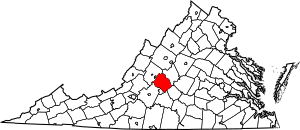
Have you ever wondered about old buildings and places that have a special story? In Amherst County, Virginia, there are many such spots! This list tells you about places here that are part of the National Register of Historic Places. It's like a special club for buildings, areas, and objects that are important to American history.
When a place is on this list, it means it's recognized for its history, architecture, or what it tells us about the past. It helps protect these places so future generations can learn from them. There are 36 amazing places in Amherst County on this list. One place was on the list but was later removed.
What is the National Register of Historic Places?
The National Register of Historic Places is the official list of the United States' historic places worth saving. It's managed by the National Park Service. Being on the Register means a place is important for its history, architecture, archaeology, engineering, or culture.
It's not just about old houses! It can include schools, bridges, churches, and even whole neighborhoods. When a place is listed, it gets some recognition and can sometimes get help for preservation. It also encourages people to learn about and protect these special sites.
Cool Historic Spots to Discover
Amherst County is full of interesting places with long histories. Let's explore a few of them!
Bear Mountain Indian Mission School
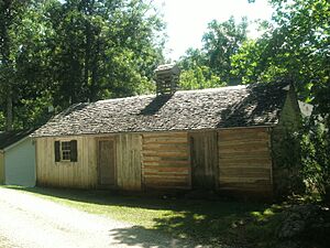
The Bear Mountain Indian Mission School is a very important place. It's located where Virginia Route 643 and Virginia Route 780 meet. This school was listed on the National Register in 1997. It played a big role in the education of Native American children in the area. It reminds us of the history of education and different cultures in Virginia.
Brick House
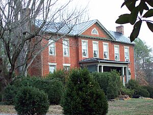
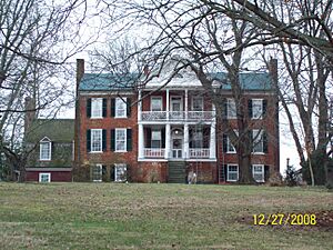
The Brick House, found at 854 Fletcher's Level Road in Clifford, is another historic gem. It was added to the Register in 2006. This house is a great example of older architecture in the county. It shows us how people lived and built homes a long time ago.
Brightwells Mill Complex
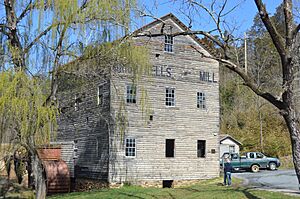
At 586 Brightwells Mill Road in Madison Heights, you'll find the Brightwells Mill Complex. This site was listed in 2016. A "mill complex" usually means there was a mill for grinding grain, along with other buildings. It tells us about how communities used to get their food and how local industries worked.
Clifford-New Glasgow Historic District
The Clifford-New Glasgow Historic District is not just one building, but a whole area! It includes parts of State Route 151 and Fletchers Level Road in Clifford. This district was recognized in 2012. It's special because it has many historic buildings together, showing what a community looked like in the past. It's like a living museum!
Edgewood (1818)
There are two places named Edgewood in Amherst. The one built in 1818 is at 138 Garland Avenue in Amherst. It joined the Register in 2006. This old house gives us a peek into the early 1800s. It shows the style of homes and how people lived during that time.
Galt's Mill Complex
Another important mill site is Galt's Mill Complex, located at 1133 Galt's Mill Road in Madison Heights. It was added to the list in 2009. Like Brightwells Mill, this complex helps us understand the history of industry and daily life in the county. Mills were very important for communities long ago.
Geddes
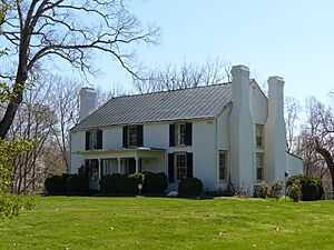
Geddes is a historic farmhouse found on Jefferson Trace in Clifford. It became a registered historic place in 1983. Farmhouses like Geddes are important because they show us how farming communities developed and how homes were built in rural areas many years ago.
The Glebe
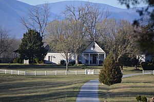
The Glebe, located at 156 State Route 151 near Amherst, was added to the Register in 2008. A "glebe" was often land owned by a church to support its minister. This property has a long history, likely connected to the early churches and communities in the area.
Norfolk Southern Six Mile Bridge No. 58
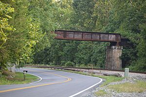
This isn't a building, but a bridge! The Norfolk Southern Six Mile Bridge No. 58 crosses the James River west of the junction of VA 726 and the Norfolk Southern Railroad tracks. It was listed in 1995. Bridges are vital parts of history, showing how people traveled and transported goods. This one is a great example of engineering from its time.
Oak Lawn
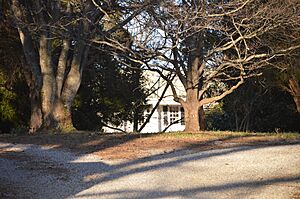
Oak Lawn is a historic home at 155 Winridge Drive in Madison Heights. It was added to the National Register in 2006. Like many other homes on this list, Oak Lawn helps us understand the architectural styles and daily lives of people who lived in Amherst County in the past.
Sweet Briar College Historic District
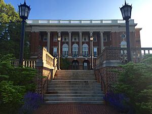
The Sweet Briar College Historic District is a large area that includes many buildings of Sweet Briar. It's located on Sweet Briar Drive, west of U.S. Route 29. This district was listed in 1995. It's special because it represents the history of education, especially for women, in Virginia. The college has many beautiful and historic buildings.
Sweet Briar House
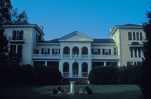
The Sweet Briar House itself is a very old building, listed separately in 1970. It's southwest of the junction of U.S. Route 29 and Sweet Briar Road. This house is a key part of the college's history and tells the story of the family who founded the college.
Tusculum
Tusculum is a historic home at 2077 N. U.S. Route 29 in Amherst. It was added to the National Register in 2004. Homes like Tusculum are important because they show us the different styles of architecture and how families lived in the county over the years.
Winton
Winton is a historic property located west of State Route 151 in Clifford. It was listed in 1974. Winton is known for its beautiful architecture and its connection to important historical figures in Virginia. It's a great example of a large estate from the past.
A Place No Longer Listed
Sometimes, a place might be removed from the National Register. This usually happens if it is destroyed or changed so much that it loses its historic importance.
Athlone
Athlone was a historic place in Amherst, located at the junction of VA 151 and VA 674. It was listed in 1992 but was removed in 2001 because it was sadly destroyed by fire. This shows why it's so important to protect these historic places.
Images for kids


