National Register of Historic Places listings in Bourbon County, Kentucky facts for kids
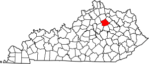
Bourbon County, Kentucky, is a place rich in history! It's home to many special buildings, places, and areas that are listed on the National Register of Historic Places. This is like a national honor roll for sites that are important to American history, architecture, or culture.
There are 61 of these amazing places in Bourbon County. Let's explore some of them and learn about their stories!
Contents
Historic Buildings and Homes
Many of Bourbon County's historic listings are old homes and buildings that tell us about life long ago.
Important Houses in Paris
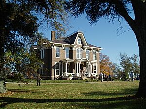
- Airy Castle: This beautiful home, built in 1840, is located northeast of Paris. It's a great example of the grand houses from that time.
- Allen-Alexander House: Found near Paris, this house was added to the Register in 1975. It shows the style of homes from the past in this area.
- Thomas Kennedy House: Southeast of Paris, this house was listed in 1980. Many old homes like this one were part of large farms.
- Kiser Station: North of Paris, this historic site was added in 1977. It's a reminder of early settlements and travel routes.
- James Kiser House: Located right in Paris on Main Street, this house joined the list in 2014. It's a part of the town's downtown history.
- Loudoun Hall: South of Paris, this property was recognized in 1978. It's another example of the area's historic estates.
- Sacred Home: West of Paris, this unique name belongs to a home listed in 1979. It highlights the diverse history of homes in the county.
- Sugar Grove: This property near Paris was listed in 1996. It's a large estate that shows the agricultural roots of the region.
- John Tucker House: Also near Paris, this house was added in 1995. It's an example of a well-preserved historic residence.
- Woodlawn: About two miles north of Paris, Woodlawn was listed in 1996. It's another significant historic home in the area.
- Captain James Wright House and Cabin: Southwest of Paris, this site includes both a house and a cabin, listed in 1976. It gives us a glimpse into earlier pioneer life.
Historic Farms and Rural Areas
Many listings in Bourbon County are not just single buildings but entire farms or rural areas. These show how people lived and worked on the land.
- Jacob Aker Farm: This farm near Paris was listed in 1993. It represents the farming heritage of Bourbon County.
- Cane Ridge Rural Historic District: This large area near Paris was added in 2003. It includes many historic farms and the famous Cane Ridge Meeting House, which is important for religious history.
- Cooper's Run Rural Historic District: This district near Paris was listed in 1998. It covers a wide area with historic farms and landscapes.
- Hillside Farm: Located near Paris, this farm was recognized in 2000. It's another example of the county's agricultural past.
- Owen-Gay Farm: This farm extends into Clark County and was listed in 1997. It shows how historic areas can cross county lines.
- Pocket Rural Historic District: Near Sharpsburg, this district was added in 2003. It's named for its unique landscape.
- Stoner Creek Rural Historic District: This area near Paris was listed in 2001. It includes roads and farms along Stoner Creek.
- West Millersburg Rural Historic District: Near Millersburg, this district was added in 2007. It highlights the historic farming areas around the town.
Other Notable Buildings
- Duncan Tavern: Located in Paris, this tavern was listed in 1973. Taverns were important places for travelers and community gatherings long ago.
- Eades Tavern: Also in Paris, this tavern was added in 1973. It's another example of the historic inns that served the area.
- Johnston's Inn: This inn near Paris was listed in 2008. It continues the tradition of historic lodging in the county.
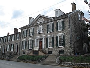
- McKee-Vimont Row Houses: These houses in Millersburg were listed in 1975. Row houses are buildings that share walls, often found in towns.
- Miller's House at Ruddels Mills: Near Millersburg, this house was added in 1983. It was likely home to someone who worked at a mill.
- Paris Railroad Depot: This old train station in Paris was listed in 1973. Train depots were once busy hubs for travel and trade.
Public and Community Places
Some listings are public buildings or monuments that are important to the community.
- Bourbon County Confederate Monument: This monument near Paris was listed in 1997. It's a historical marker from the Civil War era.
- Bourbon County Courthouse: The courthouse in Paris was listed in 1974. Courthouses are central to a county's government and history.
- Cooper's Run Baptist Church: This church near Shawhan was listed in 1983. Churches often play a big role in a community's history.
- Paris Cemetery Gatehouse: The gatehouse at the Paris Cemetery was added in 1978. Cemeteries themselves are often historic, and their entrances can be too.
Historic Districts in Towns
Towns often have "historic districts," which are areas with many old buildings that together tell a story.
- Downtown Paris Historic District: This large area in Paris was listed in 1989. It includes many of the old shops and buildings in the heart of the town.
- Duncan Avenue Historic District: This district in Paris was added in 1988. It's a neighborhood with many historic homes.
- Millersburg Historic District: This district in Millersburg was listed in 1986. It covers the historic center of the town.
- Paris Courthouse Square Historic District: This area around the courthouse in Paris was listed in 1979. It's the very center of the town's historic activity.
Unique and Special Sites
Some listings are unique structures or archaeological sites.
- Colville Covered Bridge: This beautiful covered bridge near Millersburg was listed in 1974. Covered bridges are rare and charming parts of history.
- Jacob Spears Distillery: Located near Shawhan, this distillery was listed in 1983. Kentucky is famous for its distilleries, and this one is a historic example.
- Buckner Site (15BB12): This is an archaeological site near Paris, listed in 1983. It's a place where scientists can learn about ancient cultures.
What is the National Register of Historic Places?
The National Register of Historic Places is the official list of the nation's historic places worth saving. It's managed by the National Park Service, which is part of the United States government.
When a place is added to the Register, it means it's important to the history of a community, state, or the entire country. It might be special because:
- It's connected to important events.
- It's linked to famous people.
- It's a great example of a certain type of architecture or design.
- It has information about the past, like an archaeological site.
Being on the Register helps protect these places. It encourages people to preserve them for future generations to learn from and enjoy. It also makes them eligible for certain grants or tax benefits to help with their upkeep.
Bourbon County is proud to have so many places on this special list, showing its rich and interesting past!
Images for kids


