National Register of Historic Places listings in Cherokee County, Oklahoma facts for kids
Have you ever wondered about the oldest and most important buildings and places in your area? In Cherokee County, Oklahoma, there are many special spots that are officially recognized for their history! This list tells you all about the places in Cherokee County that are on the National Register of Historic Places.
The National Register of Historic Places is like a special club for buildings, sites, and objects that are important to the history of the United States. When a place is added to this list, it means it's worth protecting and remembering for future generations. It helps people learn about the past and understand how our communities grew.
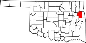
In Cherokee County, there are 21 places on this important list. Two of these are even more special because they are also National Historic Landmarks. This means they are super important to the history of the entire country!
Historic Places in Cherokee County
This section explores some of the amazing historic places you can find in Cherokee County. Each one has a unique story to tell about the past.
Buildings in Tahlequah
Many of the historic places are located in Tahlequah, Oklahoma, the capital city of the Cherokee Nation.
Cherokee National Capitol
The Cherokee National Capitol is one of the most important buildings in Tahlequah. It was built in 1869 and served as the main government building for the Cherokee Nation. Imagine all the important decisions that were made here! It's a National Historic Landmark because of its huge role in Native American history.
Cherokee Female Seminary
The Cherokee Female Seminary was a very important school for young Cherokee women. The building you see today was built in 1889 after the first seminary burned down. It was one of the first schools of its kind for Native American girls and helped many women get an education. Today, it's part of Northeastern State University.
Cherokee National Jail
The Cherokee National Jail was built in 1875. It was used by the Cherokee Nation's justice system. It's a reminder of how the Cherokee Nation had its own laws and ways of keeping order.
Cherokee Supreme Court Building
Right next to the jail is the Cherokee Supreme Court Building, built in 1844. This is where the highest court of the Cherokee Nation met to make important legal decisions. It shows how organized and developed the Cherokee government was.
Alston-Bedwell House
The Alston-Bedwell House is a historic home located at 315 North State Street. It was added to the National Register in 2005.
American Baptist Home Mission House
The American Baptist Home Mission House is another historic building in Tahlequah, located on Summit Street. It was recognized in 2010.
American Legion Hut
The American Legion Hut in Tahlequah City Park is a unique building that was listed in 2006. It likely served as a meeting place for veterans.
M.E. Franklin House
The M.E. Franklin House is a historic residence on North College Avenue, added to the list in 2006.
French-Parks House
The French-Parks House on West Keetoowah Street is another old home that was recognized for its history in 1985.
Indian University of Tahlequah
The Indian University of Tahlequah building, located at 320 Academy, was listed in 1976. This building played a role in higher education for Native Americans.
Dr. Irwin D. Loeser Log Cabin
The Dr. Irwin D. Loeser Log Cabin is a very old and interesting log cabin on East Smith Street. It was added to the Register in 1978, showing an earlier style of building.
Leonard M. Logan House
The Leonard M. Logan House is another historic home on Summit Street, recognized in 2005.
Rosamund
The building known as Rosamund on Seminary Avenue was listed in 2006.
Tahlequah Armory
The Tahlequah Armory on Water Avenue was built for military training and storage. It was added to the list in 1994.
Tahlequah Carnegie Library
The Tahlequah Carnegie Library is a beautiful old library building on South College Street. It was built with money from Andrew Carnegie, a famous businessman who helped build many libraries across the country. It became historic in 2003.
Joseph M. Thompson House
The Joseph M. Thompson House is a historic home on South College Avenue, listed in 1993.
Historic Places in Park Hill
Park Hill, Oklahoma is another town in Cherokee County with important historic sites.
First Cherokee Female Seminary Site
Before the seminary in Tahlequah, the First Cherokee Female Seminary Site was located in Park Hill. This was the very first school for Cherokee girls, established in 1851. Even though the original building is gone, the site itself is important.
Murrell Home
The Murrell Home is a beautiful old plantation house in Park Hill. It was built in the 1840s by George M. Murrell, who was married to a niece of Cherokee Chief John Ross. This home is a National Historic Landmark and gives us a look into life in the Cherokee Nation before the Civil War.
Park Hill Mission Cemetery
The Park Hill Mission Cemetery is a historic burial ground located south of East Murrell Road. It was listed in 2006 and holds the graves of many important people from the area's past.
Ross Cemetery
The Ross Cemetery is another significant cemetery in Park Hill, recognized in 2002. It is connected to the famous Cherokee Chief John Ross and his family.
Other Historic Sites
Illinois Campground
The Illinois Campground is a historic site near Tahlequah, located on County Road DO775. It was added to the National Register in 2004. This site likely has historical importance related to early settlements or gatherings in the area.
Images for kids


