National Register of Historic Places listings in Culpeper County, Virginia facts for kids
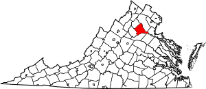
Culpeper County in Virginia is home to many important historical places. These places are so special that they are listed on the National Register of Historic Places. This is like a national list of buildings, sites, and objects that are important to American history. When a place is on this list, it means it's worth protecting and learning about.
There are 29 different places in Culpeper County that are on this special list. Each one tells a unique story about the past. You can even find some of these places on a map using their exact locations!
Exploring Historic Places in Culpeper County
Many buildings and areas in Culpeper County have been recognized for their historical importance. Let's explore some of them.
The Graffiti House: A Civil War Story
One of the most fascinating places is the Graffiti House in Brandy Station.
Soldiers' Messages from the Past
During the American Civil War, this house was used as a hospital for injured soldiers. While they were recovering, many soldiers wrote their names and drew pictures on the walls. These drawings and writings are still there today! They give us a direct look into what life was like for soldiers during that time. It's like a time capsule of their thoughts and feelings.
Culpeper National Cemetery: Honoring Heroes
The Culpeper National Cemetery is another very important site.
A Resting Place for Soldiers
Located in Culpeper, this cemetery is where many soldiers who fought for the United States are buried. It's a peaceful place that reminds us of the sacrifices made by brave men and women throughout history. It was officially added to the National Register in 1996.
Historic Districts: Stepping Back in Time
Some entire areas, not just single buildings, are also on the National Register. These are called "historic districts."
Culpeper Historic District
The Culpeper Historic District includes a large part of downtown Culpeper. This area has many old buildings that show how the town looked long ago. Walking through it is like taking a trip back in time to see the architecture and layout of an older American town. The Culpeper County Courthouse is a key part of this district.
Rapidan Historic District
Another important district is the Rapidan Historic District in Rapidan. This area includes several historic buildings, like the old Rapidan Passenger Depot. Train stations were very important in the past for travel and trade.
Homes of Important People
Many historic homes in Culpeper County belonged to notable figures.
A. P. Hill Boyhood Home
The A. P. Hill Boyhood Home in Culpeper was where Ambrose Powell Hill, a famous general during the Civil War, grew up. Learning about his childhood home helps us understand more about his life and the times he lived in.
Other Notable Homes
Other historic homes include Auburn in Brandy Station, Greenwood in Culpeper, and Locust Grove in Rapidan. These homes often show the building styles and daily life of people from different periods in history.
Historic Churches and Schools
Churches and schools also play a big part in a community's history.
Little Fork Church
The Little Fork Church near Rixeyville is a very old church. It was built a long time ago and shows the early architecture of the area. It's a great example of how people built places of worship centuries ago.
Mitchells Presbyterian Church
The Mitchells Presbyterian Church in Mitchells is another historic church. These buildings often served as important centers for communities, not just for religious services but also for social gatherings.
Eckington School
The Eckington School is an example of an old school building. Schools are important because they show how education has changed over time and how communities valued learning.
Other Interesting Sites
There are many other unique places on the list.
Pitts Theatre
The Pitts Theatre in Culpeper is an old movie theater. Imagine watching movies there many years ago! It's a reminder of how entertainment has evolved.
Madden's Tavern
Madden's Tavern in Lignum was likely a place where travelers could stop for food and rest in earlier times. Taverns were important gathering spots and places for news to spread.
Images for kids


