
National Register of Historic Places listings in downtown Denver facts for kids
This page is a list of amazing old buildings and places in Downtown Denver, Colorado, that are special enough to be on the National Register of Historic Places.
The National Register of Historic Places is like a special list kept by the United States government. It includes buildings, sites, objects, and districts that are important in American history, architecture, archaeology, engineering, or culture. When a place is on this list, it means it's recognized for its value and often gets help to be preserved.
Downtown Denver is a big area that includes several neighborhoods: Capitol Hill, the Central Business District, Civic Center, Five Points, North Capitol Hill, and Union Station. There are 303 historic places listed in all of Denver, and 148 of them are right here in Downtown Denver! One of these is even a National Historic Landmark, which is an even higher level of importance.
What Makes a Place Historic?
Historic places are often chosen because they tell a story about the past. Maybe a famous person lived there, an important event happened there, or the building itself shows a unique style of architecture from a long time ago. Protecting these places helps us remember and learn about history.
Cool Buildings and Landmarks in Downtown Denver
Downtown Denver has many fantastic buildings that are part of the National Register. Let's look at some of them!
Famous Hotels and Buildings
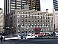
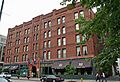
- Brown Palace Hotel: This beautiful hotel at 17th Street and Tremont Place was listed in 1970. It's known for its stunning architecture and long history.
- Oxford Hotel: Located at 1612 17th Street, the Oxford Hotel was added to the list in 1979. It's one of Denver's oldest and most elegant hotels.
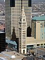
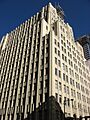
- Daniels and Fisher Tower: Standing tall at 1101 16th Street, this tower was listed in 1969. It's a landmark that looks like a famous tower in Venice, Italy!
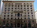
- Equitable Building: Found at 730 17th Street, this building from 1892 was listed in 1978. It was one of the first really tall buildings in Denver.
- Ideal Building: At 821 17th Street, this building was listed in 1977. It was the first tall building west of the Mississippi River to be built with reinforced concrete, a very strong material.
Important Public Places
- Denver Mint: This important building at W. Colfax Avenue and Delaware Street was listed in 1972. It's where the U.S. government makes coins!
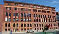
- Denver Municipal Auditorium: Located at 1323 Champa Street, this grand auditorium was listed in 1991. It has hosted many big events and performances over the years.
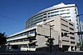
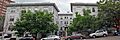
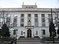
- Denver Public Library: The main library building at 1357 Broadway was listed in 1990. It's a place where people can learn and explore new ideas.
- U.S. Post Office and Federal Building: This large building at 18th and Stout Streets was listed in 1973. It's an important government building.
- Union Station: A major transportation hub at 17th Street and Wynkoop, Union Station was listed in 1974. It's a beautiful old train station that has been brought back to life.
Homes and Mansions
Many grand homes and mansions in Downtown Denver are also on the list, showing how people lived long ago.
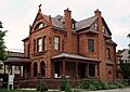
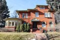
- Molly Brown House: At 1340 Pennsylvania Street, this house was listed in 1972. It was the home of Margaret "Molly" Brown, a famous survivor of the Titanic.
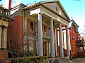
- Grant-Humphreys Mansion: This beautiful mansion at 770 Pennsylvania Street was listed in 1970. It's a great example of Neo-classical style architecture.
- Croke-Patterson-Campbell Mansion: Located at 428-430 E. 11th Avenue, this mansion was listed in 1973. It's known for its unique design.
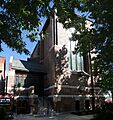
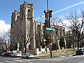
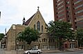
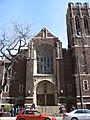
Churches and Religious Buildings
Several churches are recognized for their historical and architectural importance.
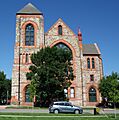
- Cathedral of the Immaculate Conception: This stunning church at the corner of Colfax Avenue and Logan Street was listed in 1975. It's a major landmark in Denver.
- Trinity United Methodist Church: At E. 18th Avenue and Broadway, this church was listed in 1970. It's a beautiful example of church architecture.
- St. John's Cathedral: Located at 14th and Washington Streets, this cathedral was listed in 1975. It's a very important church in the city.
Historic Districts
Some areas are listed as "historic districts" because they have many important buildings grouped together.
- Civic Center Historic District: This large area, roughly bounded by W. Colfax, E. Colfax, Grant, E. 14th, Broadway, E. 13th, W. 13th, Bannock, W. 14th, and Delaware, was listed in 1974. It includes many important government and public buildings. Part of it was even named a National Historic Landmark in 2012!
- Larimer Square: The 1400 block of Larimer Street was listed in 1973. It's a famous block with many restored Victorian buildings, now home to shops and restaurants.
- San Rafael Historic District: This neighborhood, roughly bounded by E. 26th Avenue, Downing Street, E. 20th Avenue, and Washington Street, was listed in 1986. It's full of historic homes.
Places That Were Once Listed
Sometimes, a historic place is removed from the National Register. This usually happens if the building is destroyed, moved, or changed so much that it loses its historic importance. Here are a few places in Downtown Denver that were once on the list but are not anymore:
- 14th Street Viaduct: This bridge was removed from the list in 1994 because it was taken down in 1989.
- Boettcher School for Crippled Children: This school building was removed in 1994 after it was demolished in 1993.
- Constitution Hall: This building was removed in 1979 after it was destroyed by a fire in 1977.
Images for kids
-

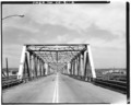
The 19th Street Bridge, listed in 1985.
-
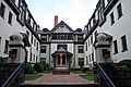
The Arcanum Apartments, listed in 1999.
-
The Arno Apartments, listed in 1987.
-
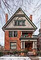
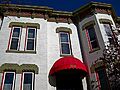
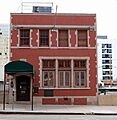
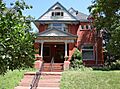
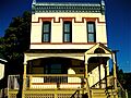
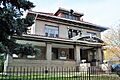
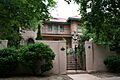
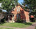
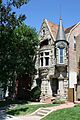
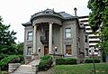
The Bailey House, listed in 1978.
-
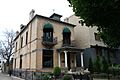
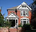
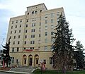
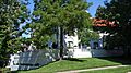
The Caroline Bancroft House, listed in 1990.
-
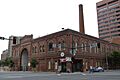
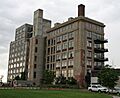
The Baur Confectionery Company building, listed in 2006.
-
The Bennett-Field House, listed in 2010.
-
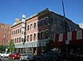
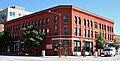
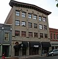
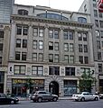
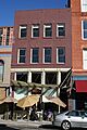
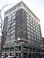
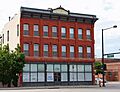
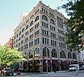
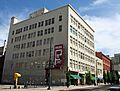
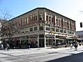
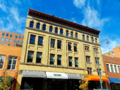
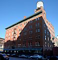
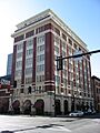
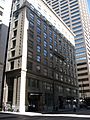
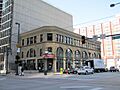
The Boston Building, listed in 1978.
-
The Bouvier-Lothrop House, listed in 1980.
-
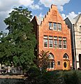
The Brinker Collegiate Institute, listed in 1977.
-
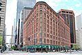
The Brown Palace Hotel, listed in 1970.
-
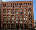
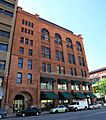
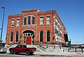
The J.S. Brown Mercantile Building, listed in 1988.
-
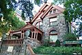
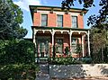
The Molly Brown House, listed in 1972.
-
The Buerger Brothers Building and Annex, listed in 1998.
-
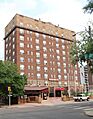
The Burlington Hotel, listed in 1998.
-
The Alfred Butters House, listed in 1982.
-
The Byers-Evans House, listed in 1970.
-
The Capitol Life Insurance Building, listed in 1997.
-
The Carter-Rice Building, listed in 1984.
-
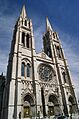
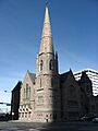
The Cathedral of the Immaculate Conception, listed in 1975.
-
The Central Presbyterian Church, listed in 1974.
-
The Chamber of Commerce Building, listed in 2001.
-
The Chateau, listed in 2007.
-
The Christ Methodist Episcopal Church, listed in 1976.
-
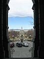
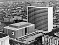
The Civic Center Historic District, listed in 1974.
-
The Clements Rowhouse, listed in 1980.
-
The Colburn Hotel, listed in 2020.
-
The Colorado Governor's Mansion, listed in 1969.
-
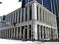
The Colorado National Bank Building, listed in 2010.
-
The Colorado State Capitol Annex Building and Boiler Plant, listed in 1991.
-
The Cornwall Apartments, listed in 1976.
-
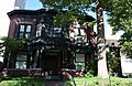
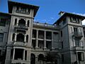
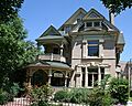
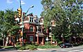
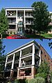
The Crawford Hill Mansion, listed in 1990.
-
The Creswell Mansion, listed in 1977.
-
The F.W. Crocker and Company Steam Cracker Factory, listed in 1984.
-
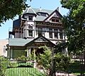
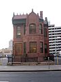
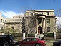
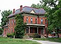
The Croke-Patterson-Campbell Mansion, listed in 1973.
-
The Curry-Chucovich House, listed in 1978.
-
The Curtis-Champa Streets District, listed in 1975.
-
The Daniels and Fisher Tower, listed in 1969.
-
The Denver Athletic Club, listed in 1979.
-
The Denver City Cable Railway Building, listed in 1979.
-
The Denver City Railway Company Building, listed in 1984.
-
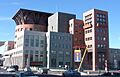
The Denver Civic Center Classroom Building, listed in 1990.
-
The Denver-Colorado Springs-Pueblo Motor Way Company Inc. Garages, listed in 2017.
-
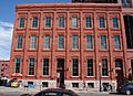
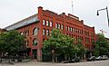
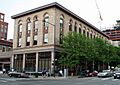
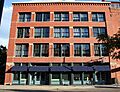
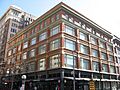
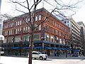
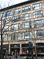
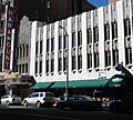
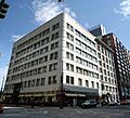
The Denver Dry Goods Company Building, listed in 1978.
-
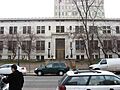
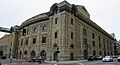
The Denver Mint, listed in 1972.
-
The Denver Municipal Auditorium, listed in 1991.
-
The Denver Press Club, listed in 2017.
-
The Denver Public Library, listed in 1990.
-
The Downtown Denver Central YMCA and Annex, listed in 2004.
-
The Dunning-Benedict House, listed in 1984.
-
The John Elsner House, listed in 1979.
-
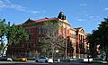
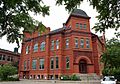
The Emerson School, listed in 1997.
-
The Enterprise Hill Historic District, listed in 1979.
-
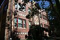
The Eppich Apartments, listed in 1984.
-
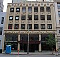
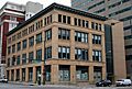
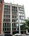
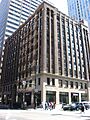
The Equitable Building, listed in 1978.
-
The Evans School, listed in 1980.
-
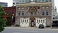
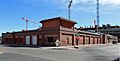
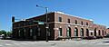
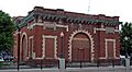
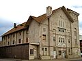
Fire Station No. 1, listed in 1979.
-
The First Baptist Church of Denver, listed in 2005.
-
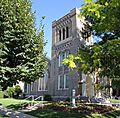
The First Congregational Church, listed in 1987.
-
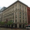
The First National Bank Building, listed in 1996.
-
The William G. Fisher House, listed in 1974.
-
The Fleming-Hanington House, listed in 1982.
-
The John S. Flower House, listed in 1980.
-
The Flower-Vaile House, listed in 1982.
-
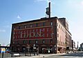
The Barney L. Ford Building, listed in 1976.
-
The Justina Ford House, listed in 1984.
-
The A.C. Foster Building, listed in 1978.
-
The Gebhard Mansion, listed in 1992.
-
The General Electric Building, listed in 1983.
-
The Glenarm Place Historic Residential District, listed in 1983.
-
The Grafton, listed in 1982.
-
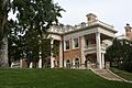
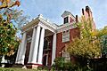
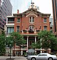
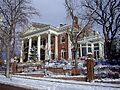
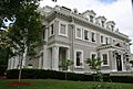
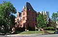
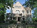
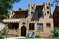
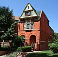
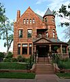
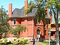
The Grant-Humphreys Mansion, listed in 1970.
-
The Grimm Block, listed in 1992.
-
The Guerrieri-Decunto House, listed in 1979.
-
The George Hamburger Block, listed in 1990.
-
The Haskell House, listed in 1983.
-
The Helene Apartment Building, listed in 1998.
-
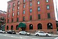
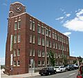
The Hendrie and Bolthoff Warehouse Building, listed in 1988.
-
The W.A. Hover and Company Building, listed in 1999.
-
The Ideal Building, listed in 1977.
-
The Harry C. James House, listed in 2020.
-
The Joslin Dry Goods Company Building, listed in 1997.
-
The Jeffery and Mary Keating House, listed in 1980.
-
The Kistler Stationery Company Building, listed in 1997.
-
The Kistler-Rodriguez House, listed in 1983.
-
The Kittredge Building, listed in 1977.
-
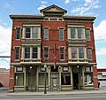
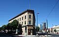
Kopper's Hotel and Saloon, listed in 1999.
-
The William Lang Townhouse, listed in 1983.
-
Larimer Square, listed in 1973.
-
The A.T. Lewis and Son Department Store, listed in 1994.
-
The A.T. Lewis New Building, listed in 1994.
-
The Littleton Creamery-Beatrice Foods Cold Storage Warehouse, listed in 1985.
-
The Masonic Temple Building, listed in 1977.
-
The McClintock Building, listed in 2005.
-
The McPhee and McGinnity Building, listed in 1984.
-
The McPhee and McGinnity Paint Factory, listed in 2003.
-
The Midland Savings Building, listed in 2001.
-
Moffat Station, listed in 1976.
-
Montgomery Court, listed in 1986.
-
The Dora Moore Elementary School, listed in 1978.
-
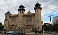
The Mosque of the El Jebel Shrine, listed in 1997.
-
The Neusteter Building, listed in 1987.
-
The New Terrace, listed in 1987.
-
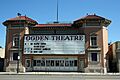
The Ogden Theatre, listed in 1995.
-
The Orlando Flats, listed in 1984.
-
The Oxford Hotel, listed in 1979.
-
The Pacific Express Stable, listed in 1984.
-
The Judge Peter L. Palmer House, listed in 1982.
-
The Palmer-Ferril House, listed in 1992.
-
The Paramount Theater, listed in 1980.
-
The Peters Paper Company Warehouse, listed in 1988.
-
The Pierce-Haley House, listed in 1984.
-
The Pride of the Rockies Flour Mill, listed in 1995.
-

The Public Service Building, listed in 1978.
-
The Railway Exchange Addition and Railway Exchange New Building, listed in 1997.
-
The Ray Apartments Buildings, listed in 2001.
-
The Rocky Mountain Bank Note Company Building, listed in 1999.
-
The Rossonian Hotel, listed in 1995.
-
St. Andrew's Episcopal Church, listed in 1975.
-
St. John's Cathedral, listed in 1975.
-
St. Mark's Parish Church, listed in 1975.
-
St. Paul's English Evangelical Lutheran Church, listed in 1997.
-
The San Rafael Historic District, listed in 1986.
-
The George Schleier Mansion, listed in 1977.
-
The Sheedy Mansion, listed in 2004.
-
The Sherman Street Historic District, listed in 2004.
-

Speer Boulevard, listed in 1986.
-
The Spratlen-Anderson Wholesale Grocery Company-Davis Brothers Warehouse, listed in 1985.
-
The Stearns House, listed in 1982.
-
The Sugar Building, listed in 1978.
-
The Swallow Hill Historic District, listed in 1988.
-
Tammen Hall, listed in 2019.
-
The Telephone Building, listed in 2005.
-
Temple Emanuel (Curtis Street), listed in 1978.
-
Temple Emanuel (Pearl Street), listed in 1987.
-
The H.H. Thomas House, listed in 1975.
-
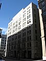
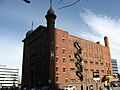
The Tramway Building, listed in 1978.
-
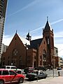
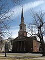
Trinity United Methodist Church, listed in 1970.
-
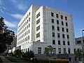
The U.S. Courthouse and Federal Office Building, listed in 2016.
-
The U.S. Customhouse, listed in 1979.
-
The U.S. Post Office and Federal Building, listed in 1973.
-
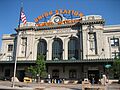
Union Station, listed in 1974.
-
The Union Warehouse, listed in 1982.
-
The US National Bank, listed in 1994.
-
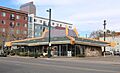
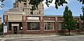
The White Spot Restaurant, listed in 2019.
-
The Wood-Morris-Bonfils House, listed in 1974.
-
The Adolph J. Zang House, listed in 1979.
-
The Adolph Zang Mansion, listed in 1977.
-
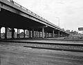
The 14th Street Viaduct, delisted in 1994.
-
The 20th Street Viaduct, delisted in 1994.
-

The Boettcher School for Crippled Children, delisted in 1994.
-
The Ghost Building, delisted in 1979.


.jpg)

