
National Register of Historic Places listings in Durham County, North Carolina facts for kids

Welcome to Durham County, North Carolina! Did you know that many buildings, places, and even whole neighborhoods here are super old and important? They are so special that they are listed on the National Register of Historic Places. This is like a special list kept by the United States government. It helps protect places that tell us about history.
When a place is on this list, it means it's a big part of our country's story. It could be a building where something important happened, or a place that shows how people used to live. Exploring these sites helps us learn about the past. It's like stepping back in time!
Contents
- Historic Places in Durham County
- American Tobacco Company Manufacturing Plant
- Bennett Place State Historic Site
- Bull Durham Tobacco Factory
- Duke Homestead and Tobacco Factory
- Duke Memorial United Methodist Church
- Durham Hosiery Mill
- Downtown Durham Historic District
- North Carolina Central University
- North Carolina Mutual Life Insurance Company Building
- Stagville
- Trinity Historic District
- Watts Hospital
- West Point on the Eno
- Images for kids
Historic Places in Durham County
Durham County is full of amazing historic sites. These places help us understand the past of North Carolina and the United States. Let's explore some of them!
American Tobacco Company Manufacturing Plant
This huge area was once a busy tobacco factory. It's called the American Tobacco Historic District. Imagine all the people working here long ago! This district shows how important the tobacco industry was to Durham. It was added to the list in 2000.
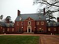
Bennett Place State Historic Site
This is a very important spot in American history. It's where the largest surrender of Confederate troops happened during the American Civil War. This took place on April 26, 1865. It was a big step towards ending the war. You can visit this site and learn about this key moment. It was listed in 1970.
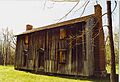
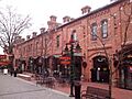
Bull Durham Tobacco Factory
This factory is also known as the W. T. Blackwell and Company Tobacco Factory. It was a major place for making tobacco products. The "Bull Durham" brand was very famous. This factory helped Durham become known as "Tobacco City." It became a historic landmark in 1974.
Duke Homestead and Tobacco Factory
This is another key place connected to tobacco history. It's the home and first tobacco factory of the Duke family. They became very rich and famous from tobacco. The Duke family later helped create Duke University. This site was added to the list in 1966.
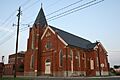
Duke Memorial United Methodist Church
This beautiful church is an important part of Durham's history. It shows the strong community spirit of the area. Many historic churches like this one are still used today. It was listed in 1985.
Durham Hosiery Mill
Beyond tobacco, textiles (like socks and clothes) were also big in Durham. The Durham Hosiery Mill was a large factory that made hosiery. This mill was a major employer in the area. It shows the industrial past of Durham. It was added to the list in 1978.
Downtown Durham Historic District
The heart of Durham has many old and important buildings. This district includes many streets and buildings that show how the city grew. It's a great place to see historic architecture. It was listed in 1977.
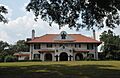
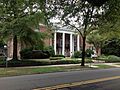
North Carolina Central University
This university is a very important part of African American history and education. It was founded in 1910. It was the first public liberal arts college for African Americans in the nation. It continues to be a vital center for learning. The campus was recognized as a historic district in 1986.
North Carolina Mutual Life Insurance Company Building
This building is special because it was home to one of the most successful African American-owned businesses in the United States. The North Carolina Mutual Life Insurance Company helped many Black families. It was a symbol of economic strength and self-reliance. It became a historic landmark in 1975.
Stagville
Stagville is a former plantation. It helps us learn about the lives of enslaved people and the history of slavery in North Carolina. It's a place for education and remembering the past. It was listed in 1973.
Trinity Historic District
This neighborhood is full of historic homes and buildings. It shows how people lived and built their communities in the past. It's a beautiful area to walk through and imagine life long ago. It was recognized as a historic district in 1986.
Watts Hospital
Watts Hospital was an important medical center in Durham. It served the community for many years. Historic hospitals like this show the progress of medicine and healthcare over time. It was listed in 1980.
West Point on the Eno
This park is a beautiful natural area with historic buildings. It includes an old mill and other structures along the Eno River. It's a great place to learn about early industries and enjoy nature. It was listed in 1985.
Images for kids
-
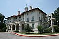
The American Tobacco Campus, once a busy factory.
-
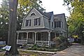
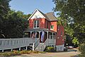
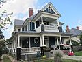
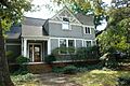
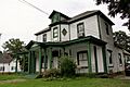
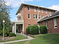
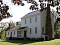
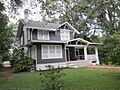
The historic Bassett House.
-
Bennett Place, where the largest Civil War surrender happened.
-
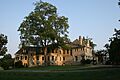
The Mary Duke Biddle Estate.
-
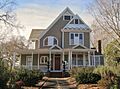
The Richard D. Blacknall House.
-
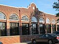
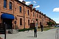
Brightleaf Square, part of the Bright Leaf Historic District.
-
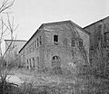
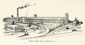
Remnants of the Bull Durham Tobacco Factory.
-
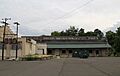
The Bullington Warehouse.
-
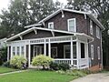
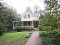
A home in the Burch Avenue Historic District.
-
The City Garage Yard and Fire Drill Tower.
-
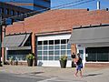
The Clark and Sorrell Garage.
-
A building in the Cleveland Street District.
-
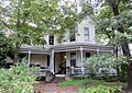
The Cranford-Wannamaker House.
-
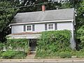
The Crowell House.
-
The Dillard-Gamble Houses.
-
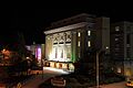
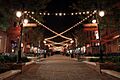
The Carolina Theatre in the Downtown Durham Historic District.
-
The Duke Homestead and Tobacco Factory.
-
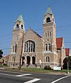
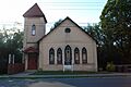
Duke Memorial United Methodist Church.
-
The Durham Hosiery Mill.
-
The Durham Hosiery Mills Dye House.
-
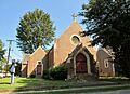
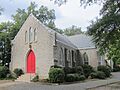
The Emmanuel AME Church.
-
Ephphatha Church.
-
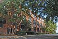
Erwin Cotton Mills Company Mill No. 1 Headquarters Building.
-
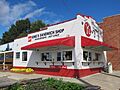
King's Sandwich Shop in the Foster and West Geer Streets Historic District.
-
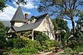
Greystone Manor.
-
The John Sprunt Hill House.
-
A house in the Holloway Street District.
-
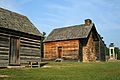
Horton Grove Complex.
-
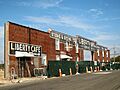
Liberty Warehouse Nos. 1 and 2.
-
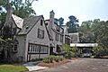
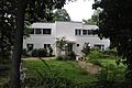
Meadowmont House.
-
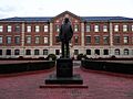
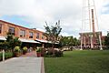
A statue at North Carolina Central University.
-
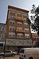
The North Carolina Mutual Life Insurance Company Building.
-
The former North Durham County Prison Camp.
-
A building in the North Durham-Duke Park District.
-
The William Thomas O'Brien House.
-
Pearl Mill Village.
-
The Pegram House.
-
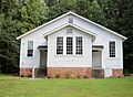
Russell School.
-
St. Joseph's African Methodist Episcopal Church.
-
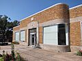
Scott and Roberts Dry Cleaning Plant, Office, and Store.
-
Smith Warehouse.
-
The Bennehan House at Stagville.
-
The King's Daughters Inn in the Trinity Historic District.
-
Watts and Yuille Warehouses.
-
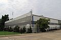
Watts Hospital.
-
The Oscar Bowden House in the Watts-Hillandale Historic District.
-
St. Joseph's Episcopal Church in the West Durham Historic District.
-
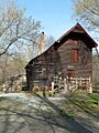
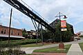
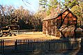
West Point Mill at West Point on the Eno.
-
Wright's Automatic Machinery Company building.


.jpg)


.jpg)

_Emmanuel_AME_Church,_view_2.JPG)


_04.jpg)


