
National Register of Historic Places listings in Gloucester, Massachusetts facts for kids

Gloucester, Massachusetts, is a historic city with many important places. These special spots are listed on something called the National Register of Historic Places. This list helps protect and celebrate buildings, objects, and areas that are important to American history.
Gloucester is part of Essex County, Massachusetts, which has over 450 places on this list. Gloucester itself has 34 of these amazing historic sites!
Contents
What is the National Register of Historic Places?
The National Register of Historic Places is like a special club for important historical sites in the United States. It's managed by the National Park Service. When a place is added to this list, it means it's recognized for its history, architecture, or what it means to American culture.
Being on the Register helps protect these places. It also makes people more aware of their value. It's a way to make sure these important parts of our past are saved for future generations to learn from and enjoy.
Historic Treasures in Gloucester
Gloucester has a rich history, especially linked to the ocean and fishing. Many of its historic places tell stories of brave sailors, beautiful homes, and important community spots. Let's explore some of these cool places!
Famous Ships and Shipwrecks
Gloucester's history is deeply tied to the sea. Some of the most interesting listings are ships and even shipwrecks!
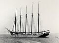
- The Adventure (schooner) is a famous fishing boat built in 1926. It's a type of ship called a schooner, known for its speed and grace. The Adventure is a National Historic Landmark, which is an even higher level of historical importance. It's currently being restored so people can see what these old fishing boats were like.
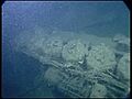
- The Frank A. Palmer and Louis B. Crary are two shipwrecks found in the Stellwagen Bank National Marine Sanctuary. These sunken ships tell a story of past voyages and the dangers of the sea.
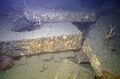
- The Joffre and Lamartine are other shipwrecks in the Stellwagen Bank National Marine Sanctuary. They are underwater museums, giving clues about maritime history.
- The Portland is another shipwreck in the Stellwagen Bank National Marine Sanctuary. It was a large passenger steamship that sank in a terrible storm in 1898.
Lighthouses and Landmarks
Lighthouses have always been important guides for ships. Gloucester has some beautiful ones!
- The Annisquam Harbor Light Station is a charming lighthouse on Wigwam Point. It has guided ships safely into Annisquam Harbor for many years.
- The Eastern Point Light Station stands at the entrance to Gloucester Harbor. It's a well-known landmark, helping sailors find their way and offering beautiful views.
- The Ten Pound Island Light is located on Ten Pound Island in Gloucester Harbor. It's a smaller lighthouse with a long history of helping navigate the busy waters.
- The Gloucester Fisherman's Memorial is a powerful statue honoring the thousands of Gloucester fishermen lost at sea. It's a very important symbol for the city and its fishing heritage.
Unique Homes and Districts
Many historic homes and entire neighborhoods in Gloucester are also on the Register. They show how people lived in the past.
- Beauport, Sleeper-McCann House is a truly unique mansion. It was designed by Henry Davis Sleeper, a famous interior designer. It has 40 rooms, each decorated in a different style. It's like stepping into a storybook!
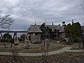
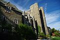
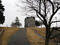
- The Hammond Castle is another amazing home. It was built by inventor John Hays Hammond Jr. in the style of a medieval castle. It has secret passages, a great hall, and even a working drawbridge!
- The Central Gloucester Historic District is an area with many old buildings. It includes parts of Middle, Main, and Prospect Streets. Walking through this district feels like going back in time.
- The East Gloucester Square Historic District is another historic neighborhood. It's near the harbor and has many buildings that show the area's fishing and maritime past.
- The Fitz Henry Lane House belonged to a famous American painter, Fitz Henry Lane. He was known for his beautiful paintings of ships and the sea.
- The Gloucester City Hall is the main government building for the city. It's an important civic building with a long history.
- The Our Lady of Good Voyage Church is a beautiful church with a tall spire. It's a significant landmark and a spiritual home for many in Gloucester.
Images for kids
-

The schooner Adventure being restored.
-

The Annisquam Bridge, a historic footbridge.
-
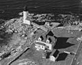
The Annisquam Harbor Light Station.
-

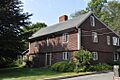
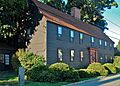
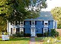
The historic Babson-Alling House.
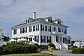
-
Beauport, the Sleeper-McCann House.
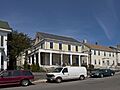
-
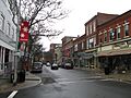
A street view of the Central Gloucester Historic District.
-
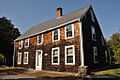
The Davis-Freeman House.
-

The Dyke-Wheeler House.
-
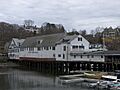
Eastern Wharf in the East Gloucester Square Historic District.
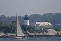
-
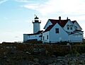
The Eastern Point Light Station.
-
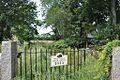
The entrance to the First Parish Burial Ground.
-
The shipwreck of the Louis B. Crary.
-
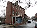
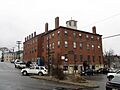
The Front Street Block.
-
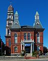
Gloucester City Hall.
-
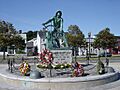
The Gloucester Fisherman's Memorial.
-
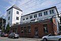
The Gloucester Net and Twine Company building.
-
Hammond Castle.
-
The Edward Harraden House.
-
The William Haskell House.
-
The Ella Proctor Herrick House.
-
The shipwreck of the Joffre.
-
The shipwreck of the Lamartine.
-
The Fitz Henry Lane House.
-
The Norwood-Hyatt House.
-
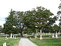
Oak Grove Cemetery.
-
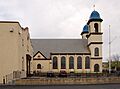
Our Lady of Good Voyage Church.
-
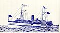
The sidewheeler Portland.
-
The Puritan House.
-
The George O. Stacy House.
-
The Ten Pound Island Light.
-
The Webster-Lane House.
-
The White-Ellery House.
-
The Whittemore House.


.jpg)


