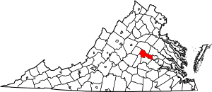
National Register of Historic Places listings in Goochland County, Virginia facts for kids
Have you ever wondered about old buildings or special places that tell a story about the past? In Goochland County, Virginia, there are many such places! They are so important that they are listed on something called the National Register of Historic Places.
This list helps protect and celebrate buildings, sites, and objects that are important to American history, architecture, archaeology, engineering, or culture. Think of it like a special hall of fame for historic spots! When a place is on this list, it means it's recognized as a valuable part of our shared heritage.
In Goochland County, there are 25 different properties and areas on this special list. One of them is even more important and is called a National Historic Landmark! This means it has a very high level of historical significance to the entire country.
What is the National Register of Historic Places?
The National Register of Historic Places is the official list of the United States' historic places worth saving. It's managed by the National Park Service. When a place is added to this list, it helps people understand its history and why it's special. It also encourages people to take care of these places for future generations.
Why are places listed?
Places get listed for many reasons. Maybe a very important event happened there. Or perhaps a famous person lived or worked there. Sometimes, a building is listed because it's a great example of a certain type of architecture, like an old church or a unique house. Other times, it's an archaeological site that teaches us about ancient cultures.
How does it help?
Being on the National Register doesn't mean the government owns the property. Owners can still use their property as they wish. However, it does offer some benefits. For example, owners might get special tax breaks to help them fix up and maintain their historic buildings. It also helps protect these places from certain federal projects that might harm them.
Historic Treasures in Goochland County
Goochland County is full of history, and its listed places show this. These sites include old homes, churches, schools, and even entire historic districts. Each one tells a part of the county's story, from early settlements to important events in American history.
Notable Goochland Landmarks
While there are 25 amazing places, one stands out as a National Historic Landmark: Tuckahoe Plantation.
Tuckahoe Plantation
Tuckahoe Plantation is a very old plantation house located near Manakin-Sabot. It's famous for being the childhood home of Thomas Jefferson, who later became the third President of the United States. The house was built in the early 1700s and is a wonderful example of colonial architecture. It's a place where you can really feel like you've stepped back in time and imagine what life was like hundreds of years ago.
Other Important Sites
Many other places in Goochland County are also on the National Register. These include:
- Byrd Presbyterian Church: An old church that has been a center for the community for many years.
- Elk Hill: A historic estate with a long past.
- First Union School: An important school building that tells the story of education in the county.
- Goochland County Court Square: This area includes the historic courthouse and other buildings where important county decisions were made. It's the heart of the county's government history.
- Jackson Blacksmith Shop: A place where a blacksmith worked, showing us what daily life and work were like in the past.
- Powell's Tavern: An old tavern, which was a place where travelers could stop for food, drink, and a place to sleep.
- Rochambeau Farm: Another historic farm that has seen many changes over the years.
- Second Union School: Like the First Union School, this building is a reminder of the history of schooling in the area.
- Woodlawn: A historic house that represents the architectural styles of its time.
These places, along with many others, help us remember and learn about the rich history of Goochland County and the people who lived there. They are like open books, each telling a unique story from the past.
Images for kids


