National Register of Historic Places listings in Greene County, Virginia facts for kids
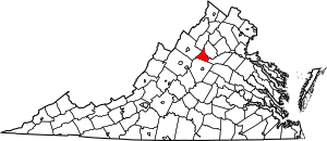
Welcome to Greene County, Virginia! This page is all about the amazing and historic places here that are listed on the National Register of Historic Places. Think of this register as a special list of buildings, areas, or objects that are super important to the history of the United States.
When a place is on this list, it means it's recognized for its history, architecture, or even what happened there. It helps protect these places so future generations can learn from them. In Greene County, there are 9 special spots on this list, and one of them is even a National Historic Landmark – that's an even higher level of importance!
Let's explore some of these cool historic places in Greene County!
Historic Places in Greene County
Beadles House
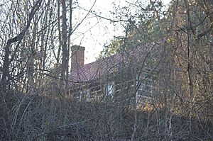
The Beadles House is a historic home located in Stanardsville. It was added to the National Register of Historic Places on November 22, 2000. This house is a great example of the kind of homes people lived in a long time ago in this area. It helps us understand the past and how communities grew.
Gibson Memorial Chapel and Martha Bagby Battle House at Blue Ridge School
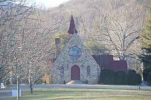
These two buildings are part of the Blue Ridge School, located near Dyke. They were added to the National Register on April 29, 1993. The Gibson Memorial Chapel is a beautiful church building, and the Martha Bagby Battle House is another important structure on the school's campus. They show the history of education and community life in Greene County.
Greene County Courthouse
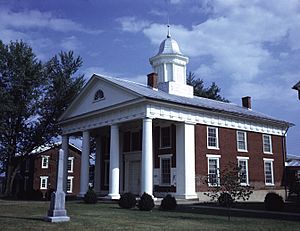
The Greene County Courthouse is a very important building in Stanardsville. It was built in 1838 and has been a center for local government and justice for many years. It was added to the National Register on February 26, 1970. Courthouses often have interesting stories about how laws were made and how communities were run in the past.
Locust Grove
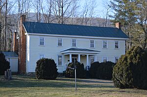
Locust Grove is a historic property found in Amicus. It joined the National Register on September 25, 1987. Historic homes like Locust Grove give us a peek into the daily lives and architecture of people who lived in Greene County many years ago.
Octonia Stone
The Octonia Stone is a unique historical marker located north of Stanardsville. It was added to the National Register on September 15, 1970. This stone is important because it marks a historic boundary, showing how land was divided and claimed a long time ago. It's a cool piece of history right there on a hilltop!
Powell-McMullan House
The Powell-McMullan House is another historic home in Stanardsville. It was recognized and added to the National Register on November 21, 2002. Like other historic houses, it tells a story about the families who lived there and the architectural styles popular in the area during different times.
Skyline Drive Historic District
The Skyline Drive Historic District is a very special and large area within Shenandoah National Park. It stretches from the northern entrance at Front Royal all the way to the southern entrance at Rockfish Gap. This entire scenic road and its surroundings were added to the National Register on April 28, 1997. It's even a National Historic Landmark! Skyline Drive is famous for its amazing views, and it's a great example of how nature and human engineering can create something truly historic.
Stanardsville Historic District
The Stanardsville Historic District includes a large part of the town of Stanardsville, mainly along Main Street. This district was added to the National Register on May 27, 2004. A historic district means that many buildings in that area together tell an important story about the town's past. Walking through it is like stepping back in time!


