National Register of Historic Places listings in Hamblen County, Tennessee facts for kids
Welcome to Hamblen County, Tennessee! Did you know that many special places here are protected because of their history? These places are listed on the National Register of Historic Places. It's like a special list kept by the United States government. When a building or area is on this list, it means it's really important to our country's history and culture.
This article will tell you about the amazing historic places in Hamblen County. You'll learn about old churches, homes, and other spots that have cool stories from the past. There are 13 places in Hamblen County on this list, and each one helps us understand what life was like long ago.
Historic Places in Hamblen County
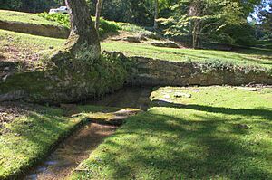
Barton Springs
Barton Springs is a historic spot located about 3 miles (4.8 km) east of Morristown. It was added to the National Register of Historic Places on May 22, 1978. This area is known for its natural springs, which have been important to people living in the area for a very long time.
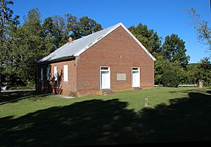
Bethesda Presbyterian Church
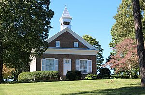
The Bethesda Presbyterian Church is a beautiful old church located southwest of Russellville. It was built a long time ago and has seen many important events. During the American Civil War, this church was even used as a hospital! It was added to the National Register on April 11, 1973.
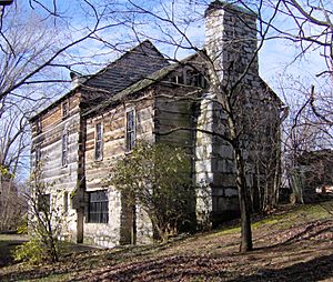
Crockett Tavern Museum
The Crockett Tavern Museum is found at 2002 Morningside Drive in Morristown. This historic tavern is believed to be the childhood home of Davy Crockett's father, John Crockett. It gives us a peek into what life was like for early settlers in Tennessee. The museum became a historic place on December 18, 2013.
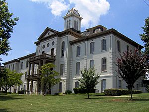
Hamblen County Courthouse
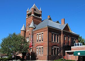
The Hamblen County Courthouse is located at 511 West 2nd North Street in Morristown. This building is where many important decisions for the county have been made over the years. It's a symbol of local government and history. It was added to the National Register on April 13, 1973.
Leeper Farm
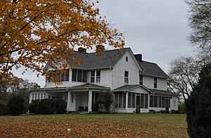
The Leeper Farm is a historic farm located at 5878 Leepers Ferry Road in White Pine. This farm shows us how people lived and worked on the land many years ago. It's a great example of a traditional farm from the past. It was listed on March 21, 2007.
Morristown College Historic District
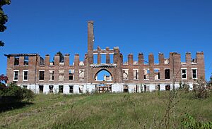
The Morristown College Historic District was once located at 417 North James Street in Morristown. This area was home to Morristown College, an important school that helped educate many people. Sadly, the buildings that made up this historic district were taken down in 2016 and 2017 to make way for new city projects. It was added to the National Register on September 15, 1983, before the buildings were removed.
Morristown Main Street Historic District
The Morristown Main Street Historic District covers a large part of downtown Morristown, including parts of East Main, West Main, North Henry, North Cumberland, and South Cumberland Streets. This district includes many old buildings that show what the town looked like as it grew. It was recognized as a historic district on March 22, 2016.
Phillips House
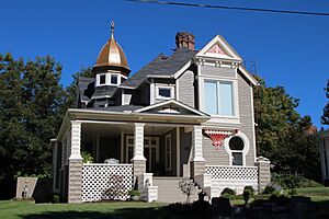
The Phillips House is a historic home located at 307 East 2nd North Street in Morristown. This house is an example of the architecture and lifestyle of people who lived in the area long ago. It was added to the National Register on April 4, 1996.
Rose Center
The Rose Center, originally known as the Rose School, is located at Jackson and West 2nd North Streets in Morristown. This building was once an important school for the community. Today, it serves as a center for arts and culture. It was listed on October 18, 1976.
Rural Mount
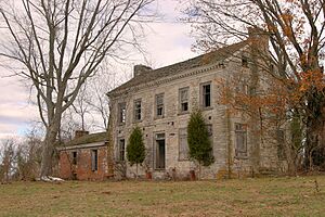
Rural Mount is a historic home located about 8 miles southeast of Morristown. It was built by Alexander Outlaw for his son-in-law, Joseph Hamilton. This old house gives us a glimpse into the lives of important families in early Tennessee. It became a historic place on July 30, 1975.
St. Paul Presbyterian Church
The St. Paul Presbyterian Church is located west of Lowland. This church has been a center for the community for many years, offering a place for worship and gathering. It was added to the National Register on August 10, 1979.
U.S. Post Office (Morristown, Tennessee)
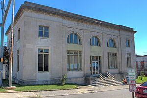
The U.S. Post Office in Morristown is located at 134 North Henry Street. This building has served as an important place for sending and receiving mail for many generations. It's a great example of government buildings from its time. It was listed on April 25, 1983.
Watkins-Witt House
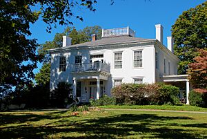
The Watkins-Witt House is located at 6622 West Andrew Johnson Highway in Talbott. This historic house has also been known as Colonel Talbott's and Arrow Hills. It tells a story of the families who lived there and the changes over time. It was added to the National Register on January 31, 1991.


