
White Pine, Tennessee facts for kids
Quick facts for kids
White Pine
|
||
|---|---|---|

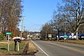
S. State St./US 25E, facing north
|
||
|
||
| Motto(s):
"Deeply Rooted in Heritage & Proudly Growing Toward the Future"
|
||

Location of White Pine in Jefferson and Hamblen counties in Tennessee
|
||
| Country | United States | |
| State | Tennessee | |
| Counties | Jefferson, Hamblen | |
| Settled | 1780s | |
| Founded | 1870 | |
| Incorporated | 1915 | |
| Named for | Eastern White Pine tree once prominently located in town's center | |
| Government | ||
| • Type | Mayor-aldermanic | |
| Area | ||
| • Total | 2.87 sq mi (7.44 km2) | |
| • Land | 2.87 sq mi (7.44 km2) | |
| • Water | 0.00 sq mi (0.00 km2) | |
| Elevation | 1,148 ft (350 m) | |
| Population
(2020)
|
||
| • Total | 2,471 | |
| • Density | 860.38/sq mi (332.16/km2) | |
| Time zone | UTC-5 (Eastern (EST)) | |
| • Summer (DST) | UTC-4 (EDT) | |
| ZIP code |
37890
|
|
| Area code(s) | 865 | |
| FIPS code | 47-80360 | |
| GNIS feature ID | 2406879 | |
White Pine is a small town located in Tennessee, a state in the United States. It sits mostly in Jefferson County and a little bit in Hamblen County. White Pine is part of the larger Morristown metropolitan area. In 2020, about 2,471 people lived there.
Contents
History of White Pine
Early Days and First Settlers
Long ago, before European settlers arrived, the White Pine area was home to early Woodland Indians. They used this land for important burial sites. A trail they used later became a path for the first settlers.
European settlers first came to this area in the late 1700s. The community was first called "Dandridge Crossing." This name came from its closeness to Dandridge, which was the main town of Jefferson County.
How White Pine Got Its Name
After the American Civil War, a railroad was built through the area. This new train route crossed an old stagecoach path. Because of this growth, the town was officially started in 1870.
In 1873, the town changed its name to White Pine. It was named after a very large pine tree that used to stand on Main Street. Twenty years later, in 1915, White Pine officially became an incorporated town. This means it got its own local government.
Fires, Rebuilding, and Growth
In 1905, a big fire destroyed much of the town's downtown area. This led to the town's government being temporarily dissolved. But White Pine didn't give up! By 1915, the downtown area was rebuilt. The town then became incorporated again.
During the 1800s and early 1900s, many businesses opened downtown. These included a medical clinic, a pharmacy, a hardware store, and a grocery store.
White Pine High School was built in 1926. It served students until 1976.
Modern Changes and Interstate 81
In 1963, work began on Interstate 81 in White Pine. When this major highway was finished, many businesses moved. They left the old downtown area to be closer to the highway exits.
Geography and Location
Where is White Pine?
White Pine is located in the northeastern part of Jefferson County. The town's northern border reaches into Hamblen County. You can see this at Interstate 81 exit 8.
The town covers about 2.87 square miles (7.44 square kilometers) of land. There is no water area within the town limits.
White Pine is about 40 miles (64 kilometers) east of Knoxville. The southern and southeastern edges of White Pine are along Douglas Lake.
Population and People
How Many People Live Here?
The population of White Pine has grown over the years.
| Historical population | |||
|---|---|---|---|
| Census | Pop. | %± | |
| 1920 | 421 | — | |
| 1930 | 516 | 22.6% | |
| 1940 | 497 | −3.7% | |
| 1950 | 780 | 56.9% | |
| 1960 | 1,035 | 32.7% | |
| 1970 | 1,532 | 48.0% | |
| 1980 | 1,900 | 24.0% | |
| 1990 | 1,771 | −6.8% | |
| 2000 | 1,997 | 12.8% | |
| 2010 | 2,196 | 10.0% | |
| 2020 | 2,471 | 12.5% | |
| 2023 (est.) | 2,571 | 17.1% | |
| Sources: | |||
In 2020, there were 2,471 people living in White Pine. These people made up 852 households and 509 families.
Who Lives in White Pine?
The table below shows the different groups of people living in White Pine, based on the 2020 census.
| Race | Number | Percentage |
|---|---|---|
| White (non-Hispanic) | 1,998 | 80.86% |
| Black or African American (non-Hispanic) | 31 | 1.25% |
| Native American | 4 | 0.16% |
| Asian | 21 | 0.85% |
| Pacific Islander | 8 | 0.32% |
| Other/Mixed | 97 | 3.93% |
| Hispanic or Latino | 312 | 12.63% |
Economy and Local Businesses
What Businesses are in White Pine?
White Pine is home to some important businesses. Old Dominion Freight Line, a large shipping company, has a regional center here. It is located near exit 4 on I-81.
Walters State Community College Expo Center
The Walters State Community College Great Smokies Mountain Expo Center is also in White Pine. This huge center opened in 1996. It has a 98,000 square-foot building with a large show ring. It can seat up to 3,900 people.
The Expo Center hosts over 60 events every year. These include horse and livestock shows, BMX racing, and boat shows. They also have concerts, high school graduations, and rodeos.
Arts and Culture
Lakeside of the Smokies Balloonfest
From 2019 to 2022, White Pine hosted the annual Lakeside of the Smokies Balloonfest. This was a hot air balloon festival. It celebrated hot air ballooning and the area's farming history. It was known as the largest hot air balloon festival in Tennessee. In 2023, the festival moved to Dandridge.
Education in White Pine
Public Schools
White Pine School serves students from kindergarten through 8th grade. It is part of the Jefferson County Schools District.
High school students from White Pine attend Jefferson County High School. This school is in nearby Dandridge. Students from other parts of Jefferson County also go there.
Private Schools
White Pine also has a private school called Lakeway Christian Academy. It is a Christian academy for students in grades 6 through 12. It opened in the summer of 2020.
Transportation and Roads
Major Highways
White Pine has two exits on Interstate 81 (Exits 4 and 8). I-81 goes northeast 73 miles (117 km) to Bristol. It goes southwest 6 miles (10 km) to where it ends at Interstate 40. If you take I-81 and then I-40, you can reach Knoxville, which is 41 miles (66 km) southwest of White Pine.
Local Roads
- Tennessee State Route 113 is White Pine's Main Street. It goes northeast to US 25E and southwest 10 miles (16 km) to Dandridge.
- Tennessee State Route 341 is also known as White Pine Road. It runs west to east through the western and southern parts of town. It connects I-81 at Exit 4 with US 25E.
- U.S. Route 25E/Tennessee State Route 32 runs north and south through White Pine. It is called State Street. US 25E goes north 8 miles (13 km) to Morristown and south 12 miles (19 km) to Newport.
- Tennessee State Route 66 goes through a small part of the western side of town.
Media and News
Local Papers
- Jefferson County Post – This is a county newspaper published online every day.
- The Standard Banner – This county newspaper is published twice a week.
Images for kids
-
S. State St./US 25E, facing north
-

Location of White Pine in Jefferson and Hamblen counties in Tennessee
See also
 In Spanish: White Pine (Tennessee) para niños
