National Register of Historic Places listings in Hancock County, Indiana facts for kids
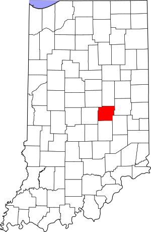
Welcome to Hancock County, Indiana! Did you know that some buildings and places here are so special that they're listed on something called the National Register of Historic Places? This list is like a hall of fame for important historical spots across the United States. It helps protect and celebrate places that tell us about the past.
In Hancock County, there are 12 amazing places that are currently on this list. These include old houses, a school, a bridge, and even a historic airplane! Two other places were once on the list but have since been removed.
When you see a place listed, it will usually show the town it's in, like Greenfield. If it's not in a town, it will show the name of the township instead. Sometimes, a place might even be in more than one area!
Cool Historic Places in Hancock County
Let's explore some of the fascinating historic places you can find in Hancock County! Each one has a unique story to tell.
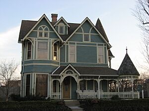
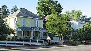
Charles Barr House
- What it is: The Charles Barr House
- Where it is: 25 West Walnut Street, Greenfield
- When it was listed: December 22, 2008
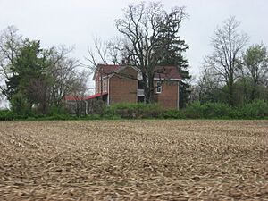
Rufus and Amanda Black House
- What it is: The Rufus and Amanda Black House
- Where it is: 222 South 200 West, near Philadelphia in Sugar Creek Township
- When it was listed: September 30, 2014
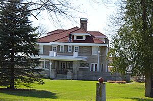
Browne-Rafert House
- What it is: The Browne-Rafert House
- Where it is: 534 North Merrill Street, near Fortville in Vernon Township
- When it was listed: September 14, 2015
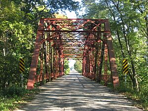
County Line Bridge
- What it is: The County Line Bridge
- Where it is: County Road 900 East over the Big Blue River, northeast of Morristown. This bridge actually stretches into Rush County too!
- When it was listed: November 25, 1994
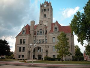
Greenfield Courthouse Square Historic District
- What it is: A whole area called the Greenfield Courthouse Square Historic District
- Where it is: Roughly around North, Hinchman, South, and Pennsylvania Streets in Greenfield
- When it was listed: March 7, 1985
- Cool fact: This isn't just one building; it's a collection of historic buildings around the courthouse square!
Greenfield Residential Historic District
- What it is: Another historic area, the Greenfield Residential Historic District
- Where it is: Roughly bounded by Hendricks, South, and Wood Streets, and Boyd Avenue in Greenfield
- When it was listed: December 15, 2011
- Cool fact: This district includes many historic homes and buildings where people live.
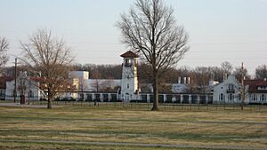
Lilly Biological Laboratories
- What it is: The Lilly Biological Laboratories
- Where it is: West of Greenfield, off U.S. Route 40
- When it was listed: November 23, 1977
- Cool fact: This site was important for scientific research and development.
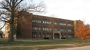
Lincoln Park School
- What it is: Lincoln Park School
- Where it is: 600 West North Street, Greenfield
- When it was listed: June 17, 2009
- Cool fact: This old school building is now recognized for its historical importance.
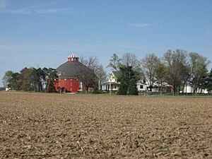
Frank Littleton Round Barn
- What it is: The Frank Littleton Round Barn
- Where it is: Near the crossing of County Roads 600 North and 500 West, northeast of Mount Comfort in Vernon Township
- When it was listed: April 2, 1993
- Cool fact: Round barns are quite rare and were built for specific farming reasons, like making it easier to feed animals or store hay.
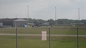
Lockheed PV-2 Harpoon No. 37396
- What it is: A historic airplane, the Lockheed PV-2 Harpoon No. 37396
- Where it is: 3867 North Aviation Way at the Indianapolis Regional Airport in Buck Creek Township
- When it was listed: May 1, 2009
- Cool fact: This is a real airplane that played a part in history, now preserved!
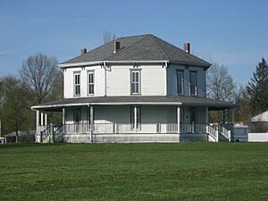
Jane Ross Reeves Octagon House
- What it is: The Jane Ross Reeves Octagon House
- Where it is: 400 South Railroad Street, Shirley
- When it was listed: September 16, 2001
- Cool fact: This house has eight sides, which was a popular but unusual design in the mid-1800s!
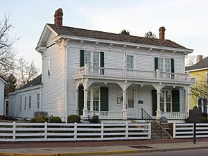
James Whitcomb Riley House
- What it is: The James Whitcomb Riley House (also known as the Riley Birthplace and Museum)
- Where it is: 250 West Main Street, Greenfield
- When it was listed: September 28, 1977
- Cool fact: This is the birthplace of famous Hoosier poet James Whitcomb Riley, known for poems like "Little Orphant Annie."
Former Historic Listings
Sometimes, a place might be removed from the National Register of Historic Places. This can happen for different reasons, like if the building is changed too much or is no longer standing. Here are two places that were once on the list in Hancock County:
- Greenfield High School: This school was located at North and Pennsylvania Streets in Greenfield. It was listed on April 22, 1982, but removed on June 18, 1986.
- New Palestine School: This school was on Larrabee Street at its junction with Depot Street in New Palestine. It was listed on June 14, 1991, but removed on March 17, 1992.


