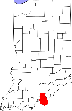
National Register of Historic Places listings in Harrison County, Indiana facts for kids
Have you ever wondered about the oldest and most important places in your community? In Harrison County, Indiana, there are several special spots that are listed on the National Register of Historic Places. This is a list of places across the United States that are recognized for their historical or architectural importance. It's like a special club for buildings, battlefields, and even archaeological sites that tell us about the past!
This list helps us keep track of these important places in Harrison County. You can even find their exact locations on a map using their coordinates. There are 6 amazing places in the county that have made it onto this national list. Some are in towns, and others are in the countryside.
Historic Places in Harrison County
These are the cool places in Harrison County that are on the National Register of Historic Places. Each one has a unique story!
| Name on the Register | Image | Date listed | Location | City or town | Description | |
|---|---|---|---|---|---|---|
| 1 | Corydon Battle Site |
(#79000017) |
South of Corydon on State Road 135 38°12′01″N 86°07′45″W / 38.200278°N 86.129167°W |
Harrison Township | This site marks where the Battle of Corydon happened during the American Civil War. It was the only Civil War battle fought in Indiana! | |
| 2 | Corydon Historic District |
(#73000017) |
Corydon: roughly bounded by Summit, Maple, and Walnut Sts., College Ave., Chestnut, and Capitol, Poplar, Water, Beaver, and Mulberry Sts. 38°12′42″N 86°07′26″W / 38.211667°N 86.123889°W |
Corydon | This area includes many historic buildings in downtown Corydon. Corydon was once the capital of Indiana, and you can still see many old buildings from that time. | |
| 3 | Kintner House Hotel |
(#87000099) |
201 S. Capital 38°12′37″N 86°07′36″W / 38.210278°N 86.126667°W |
Corydon | The Kintner House Hotel is a beautiful old building in Corydon. It was built in the 1800s and has a lot of history within its walls. | |
| 4 | Kintner-McGrain House |
(#83000032) |
740 N. Capital Ave. 38°13′05″N 86°07′33″W / 38.218056°N 86.125833°W |
Corydon | This historic house is another important building in Corydon. It shows us what homes looked like in the past. | |
| 5 | Kintner-Withers House |
(#80000039) |
South of Laconia on Kintner Bottoms Rd. 37°58′27″N 86°03′34″W / 37.974167°N 86.059444°W |
Boone Township | Located outside of towns, this house is a great example of older architecture in the countryside of Harrison County. | |
| 6 | Swan's Landing Archeological Site (12HR304) |
(#87000517) |
Mile 658 on the Ohio River, north of New Amsterdam at the end of Lickford Bridge Rd. 38°07′55″N 86°16′08″W / 38.131806°N 86.268889°W |
Washington Township | This site is a very important archaeological dig. Scientists have found tools and other items here that tell us about ancient people who lived along the Ohio River thousands of years ago. |


