National Register of Historic Places listings in Hopkinton, Rhode Island facts for kids
This article lists places in Hopkinton, Rhode Island that are special enough to be on the National Register of Historic Places. This is a list kept by the United States government to recognize important buildings, sites, and objects. These places tell us about the history of Hopkinton and the people who lived there long ago.
Contents
Historic Places in Hopkinton
Hopkinton, Rhode Island, is home to several places that have been recognized for their historical importance. These sites help us understand the past, from old farms and villages to special rock shelters.
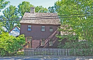
Black Farm
The Black Farm is a historic farm located near the Wood River and Rockville-Alton Road (Route 112). It was added to the National Register of Historic Places on November 7, 1995. This farm helps us learn about how people lived and farmed in this area many years ago. It shows us what a traditional farm looked like in the past.
Bradford Village Historic District
The Bradford Village Historic District is a special area that includes parts of both Hopkinton and Westerly. It became a historic district on May 30, 1996. This district covers streets like Bowling Lane and Main Street, showing how the village was laid out and developed over time. It's like a living museum of old buildings and streets.
Hope Valley Historic District
The Hope Valley Historic District is found along Main Street in Hopkinton. It was added to the National Register on July 3, 2004. This district helps preserve the history of the Hope Valley community. It includes buildings that show the architecture and way of life from earlier times in this part of Rhode Island.
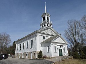
Hopkinton City Historic District
The Hopkinton City Historic District is located right in Hopkinton. It was recognized as a historic place on May 1, 1974. This district protects the historic center of Hopkinton, showing what the town looked like in its early days. It includes important buildings that tell the story of the town's growth and development.
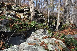
Tomaquag Rock Shelters
The Tomaquag Rock Shelters are very old sites in Hopkinton. They were added to the National Register on August 12, 1977. These rock shelters were used by Native American people long ago. They are important archaeological sites that help us understand the lives and cultures of the first people in this region. Because they are so important and fragile, their exact location is kept private to protect them.
Upper Rockville Mill
The Upper Rockville Mill is an old mill building located at 332 Canonchet Road in Hopkinton. It was listed on the National Register on July 5, 2006. This mill is a reminder of the area's industrial past. Mills like this were very important for making goods and providing jobs in the past.
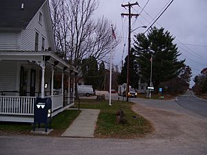
Wyoming Village Historic District
The Wyoming Village Historic District includes parts of both Hopkinton and Richmond. It became a historic district on May 2, 1974. This district is roughly bounded by Routes 3 and 138, and other local roads. It preserves the historic character of Wyoming Village, showing how this community developed around its industries and transportation routes.


