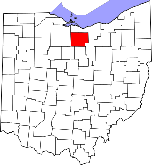
National Register of Historic Places listings in Huron County, Ohio facts for kids
Have you ever wondered about the old buildings and places in your town? Some of them are so special that they are officially recognized for their history! In Huron County, Ohio, many important places are listed on the National Register of Historic Places. This is like a special list kept by the United States government. It helps to protect and celebrate buildings, sites, and objects that have played a big part in American history, architecture, archaeology, engineering, or culture.
When a place is on this list, it means it's considered very important to our country's past. Huron County has 17 places currently on this list. There were also two other places that were once listed but have since been removed. Let's explore some of these amazing historic spots!
Contents
Historic Places in Huron County
Huron County is full of interesting places that tell stories from long ago. These sites help us understand how people lived and what was important in the past.
Homes with History
Many of the places on the National Register are old houses. These homes often show us how people built houses in different time periods.
Seth Brown House
The Seth Brown House is located in Monroeville. It was added to the list on May 3, 1974. Imagine living in a house that's been around for so long!
Dunton House
In Norwalk, you can find the Dunton House at 130 Benedict Avenue. This house became a historic site on December 16, 1982.
Gregory House
The Gregory House is in New London. It's right on East Main Street and was recognized on February 24, 1984.
John Hosford House
Another interesting home in Monroeville is the John Hosford House. It's located at 64 Sandusky Street and was listed on May 3, 1974, the same day as the Seth Brown House.
Mead-Zimmerman House
East of Greenwich Township, you'll find the Mead-Zimmerman House on State Route 13. This historic home was added to the list on March 30, 1978.
Miller-Bissell Farmstead
The Miller-Bissell Farmstead is a historic farm located north of New London. It's at 581 State Route 60 and was recognized on September 23, 2002. This site helps us remember the farming history of the area.
John Wright Mansion
The John Wright Mansion is a grand house located west of State Route 4, northeast of Bellevue. It was added to the list on February 27, 1974.
Important Public Buildings and Areas
Besides homes, other types of buildings and even whole areas can be historic. These places often served important roles in the community.
Hunts Corners
Hunts Corners is a historic district in Lyme Township. It's where Sandhill Road and State Route 547 meet. This area is special because it's one of Huron County's oldest communities, founded way back in 1811! It was listed on September 2, 1993.
Huron County Children's Home
The Huron County Children's Home in Norwalk is another important building. Located at 190 Benedict Avenue, it was added to the list on October 27, 2004. This building likely helped many children over the years.
Huron County Courthouse and Jail
The Huron County Courthouse and Jail in Norwalk is a very important landmark. It's at the corner of East Main Street and Benedict Avenue. This building has been a center for justice in the county for a long time. It was listed on July 12, 1974.
Macksville Tavern
The Macksville Tavern is located on Peru Hollow Road in Peru Township. Taverns were important gathering places in the past. This one was recognized on May 3, 1976.
Norwalk Memorial Hospital
The Norwalk Memorial Hospital at 269 West Main Street in Norwalk was added to the list on June 21, 2007. Hospitals are crucial parts of any community's history.
Phoenix Mills
The Phoenix Mills are located east of Steuben on Mill Road in Greenfield Township. Mills were vital for grinding grain and other tasks in early communities. This site was listed on May 28, 1975.
Tremont House
The Tremont House is in Bellevue, at 101-103 East Main Street. This building was recognized on March 31, 2006.
West Main Street District
The West Main Street District in Norwalk is not just one building, but a whole area! It includes both sides of West Main Street for six blocks. This district shows how a part of the city developed over time. It was listed on February 27, 1974.
Zion Episcopal Church
The Zion Episcopal Church in Monroeville is located at Ridge Street and Monroe Street. Churches are often central to a community's history and culture. This church was added to the list on May 3, 1974.
Places No Longer Listed
Sometimes, a place might be removed from the National Register. This can happen if the building is changed too much, or if it is torn down.
Baltimore and Ohio Railroad Depot
The Baltimore and Ohio Railroad Depot in Willard was once a historic site. It was a railroad junction for the famous Baltimore and Ohio Railroad. It was delisted in 1978.
Dr. David De Forest Benedict House
The Dr. David De Forest Benedict House in Norwalk was listed on January 23, 1975. However, it was removed from the list on May 12, 2016.
Images for kids


