Huron County, Ohio facts for kids
Quick facts for kids
Huron County
|
|||
|---|---|---|---|

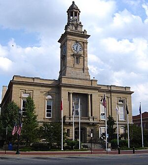
Huron County Courthouse
|
|||
|
|||

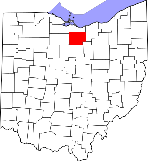
Location within the U.S. state of Ohio
|
|||
 Ohio's location within the U.S. |
|||
| Country | |||
| State | |||
| Founded | April 1, 1815 | ||
| Named for | Huron tribe | ||
| Seat | Norwalk | ||
| Largest city | Norwalk | ||
| Area | |||
| • Total | 495 sq mi (1,280 km2) | ||
| • Land | 491 sq mi (1,270 km2) | ||
| • Water | 3.3 sq mi (9 km2) 0.7%% | ||
| Population
(2020)
|
|||
| • Total | 58,565 | ||
| • Density | 118.31/sq mi (45.68/km2) | ||
| Time zone | UTC−5 (Eastern) | ||
| • Summer (DST) | UTC−4 (EDT) | ||
| Congressional district | 5th | ||
Huron County is a county in the state of Ohio, USA. It is located in the northern part of Ohio. In 2020, about 58,565 people lived there. The main town, or county seat, is Norwalk.
Huron County was officially created in 1809 and started operating in 1815. It is part of a larger area that includes cities like Cleveland, Akron, and Canton.
Contents
History of Huron County
Huron County got its name from the Huron Indians. These Native Americans were an important tribe in the Great Lakes region. The word "Huron" might come from the French language, but this is not certain.
In the late 1700s, this area was part of the Northwest Territory of the U.S. It was also a special part of land called the Connecticut Western Reserve. This specific area was known as the Firelands.
Connecticut had claimed this land a long time ago. They wanted to use it to give land to soldiers who fought in wars, instead of paying them money. Later, a group called the Connecticut Land Company bought this land. They planned to sell it and develop it. Many towns in Huron County are named after places in Connecticut.
Geography
Huron County covers about 495 square miles. Most of this area, about 491 square miles, is land. The rest, about 3.3 square miles, is water.
Neighboring Counties
Huron County shares its borders with several other counties:
- Erie County (to the north)
- Lorain County (to the east)
- Ashland County (to the southeast)
- Richland County (to the south)
- Crawford County (to the southwest)
- Seneca County (to the west)
- Sandusky County (to the northwest)
Population Changes
The population of Huron County has changed over many years. Here is a look at how many people have lived there since 1820:
| Historical population | |||
|---|---|---|---|
| Census | Pop. | %± | |
| 1820 | 6,675 | — | |
| 1830 | 13,341 | 99.9% | |
| 1840 | 23,933 | 79.4% | |
| 1850 | 26,203 | 9.5% | |
| 1860 | 29,616 | 13.0% | |
| 1870 | 28,532 | −3.7% | |
| 1880 | 31,609 | 10.8% | |
| 1890 | 31,949 | 1.1% | |
| 1900 | 32,330 | 1.2% | |
| 1910 | 34,206 | 5.8% | |
| 1920 | 32,424 | −5.2% | |
| 1930 | 33,700 | 3.9% | |
| 1940 | 34,800 | 3.3% | |
| 1950 | 39,353 | 13.1% | |
| 1960 | 47,326 | 20.3% | |
| 1970 | 49,587 | 4.8% | |
| 1980 | 54,608 | 10.1% | |
| 1990 | 56,240 | 3.0% | |
| 2000 | 59,487 | 5.8% | |
| 2010 | 59,626 | 0.2% | |
| 2020 | 58,565 | −1.8% | |
| U.S. Decennial Census 1790-1960 1900-1990 1990-2000 2020 |
|||
In 2010, there were about 59,626 people living in the county. Most people were white (94.9%). About 5.6% of the population was of Hispanic or Latino background. Many people in Huron County have German, Irish, or English family roots.
Education
To learn more about schools in the area, see:
Roads and Transportation
Main Highways
Many important roads pass through Huron County:
 US Route 20
 US Route 224
 US Route 250
 State Route 4
 State Route 13
 State Route 18
 State Route 60
 State Route 61
 State Route 99
 State Route 103
 State Route 113
 State Route 162
 State Route 269
 State Route 303
 State Route 547
 State Route 598
 State Route 601
 State Route 603
Towns and Villages
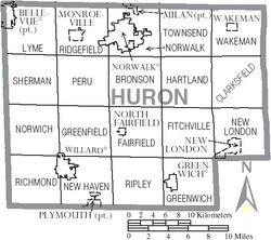
Huron County has several communities, including cities, villages, and townships.
Cities
Villages
Townships
- Bronson
- Clarksfield
- Fairfield
- Fitchville
- Greenfield
- Greenwich
- Hartland
- Lyme
- New Haven
- New London
- Norwalk
- Norwich
- Peru
- Richmond
- Ridgefield
- Ripley
- Sherman
- Townsend
- Wakeman
Other Communities
- Celeryville (a census-designated place)
- Collins (a census-designated place)
- Holiday Lakes (a census-designated place)
- New Haven (a census-designated place)
- Boughtonville (an unincorporated community)
- Centerton (an unincorporated community)
- Clarksfield (an unincorporated community)
- Delphi (an unincorporated community)
- East Townsend (an unincorporated community)
- Fitchville (an unincorporated community)
- Havana (an unincorporated community)
- Hunts Corners (an unincorporated community)
- New Pittsburgh (an unincorporated community)
- North Monroeville (an unincorporated community)
- Olena (an unincorporated community)
- Steuben (an unincorporated community)
Famous People from Huron County
- Ezekiel S. Sampson – A politician who served as a Congressman for Iowa. He was born in Huron County.
- Paul Brown – A very famous American football coach. He is in the Pro Football Hall of Fame.
- Lefty Grove – A legendary American baseball player. He is a member of the Baseball Hall of Fame.
See also
 In Spanish: Condado de Huron (Ohio) para niños
 | Janet Taylor Pickett |
 | Synthia Saint James |
 | Howardena Pindell |
 | Faith Ringgold |


