Richland County, Ohio facts for kids
Quick facts for kids
Richland County
|
|||
|---|---|---|---|

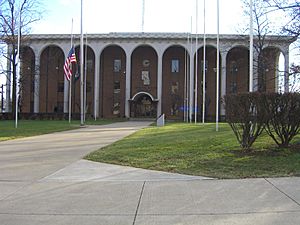
Richland County Courthouse
|
|||
|
|||

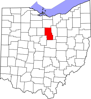
Location within the U.S. state of Ohio
|
|||
 Ohio's location within the U.S. |
|||
| Country | |||
| State | |||
| Founded | March 1, 1813 | ||
| Named for | their fertile soil | ||
| Seat | Mansfield | ||
| Largest city | Mansfield | ||
| Area | |||
| • Total | 500 sq mi (1,000 km2) | ||
| • Land | 495 sq mi (1,280 km2) | ||
| • Water | 4.8 sq mi (12 km2) 1.0%% | ||
| Population
(2020)
|
|||
| • Total | 124,936 |
||
| • Density | 250/sq mi (100/km2) | ||
| Time zone | UTC−5 (Eastern) | ||
| • Summer (DST) | UTC−4 (EDT) | ||
| Congressional district | 4th | ||
Richland County is a county located in the state of Ohio. In 2020, about 124,936 people lived there. Its main city, called the county seat, is Mansfield.
The county was created in 1808 and officially started running in 1813. It's named 'Richland' because of its rich, fertile soil, which is great for farming! Richland County is part of the larger Mansfield area. This area also includes nearby cities like Ashland and Bucyrus. It is also part of Northeast Ohio.
Contents
History
When Richland County was first formed in 1806, it was much bigger. Most of the land was covered in forests. Settlers came and cleared the land to start farms. As more people moved in, the population grew.
Later, in 1846, a new county called Ashland County was created. Most of the land for Ashland County came from the eastern part of Richland County.
Geography
Richland County covers a total area of about 500 square miles. Most of this area, about 495 square miles, is land. The rest, about 4.8 square miles, is water.
Neighboring Counties
Richland County shares its borders with these counties:
- Huron County (to the north)
- Ashland County (to the east)
- Knox County (to the south)
- Morrow County (to the southwest)
- Crawford County (to the west)
Population Changes
| Historical population | |||
|---|---|---|---|
| Census | Pop. | %± | |
| 1820 | 9,169 | — | |
| 1830 | 24,006 | 161.8% | |
| 1840 | 44,532 | 85.5% | |
| 1850 | 30,879 | −30.7% | |
| 1860 | 31,158 | 0.9% | |
| 1870 | 32,516 | 4.4% | |
| 1880 | 36,306 | 11.7% | |
| 1890 | 38,072 | 4.9% | |
| 1900 | 44,289 | 16.3% | |
| 1910 | 47,667 | 7.6% | |
| 1920 | 55,178 | 15.8% | |
| 1930 | 65,902 | 19.4% | |
| 1940 | 73,853 | 12.1% | |
| 1950 | 91,305 | 23.6% | |
| 1960 | 117,761 | 29.0% | |
| 1970 | 129,997 | 10.4% | |
| 1980 | 131,205 | 0.9% | |
| 1990 | 126,137 | −3.9% | |
| 2000 | 128,852 | 2.2% | |
| 2010 | 124,475 | −3.4% | |
| 2020 | 124,936 | 0.4% | |
| U.S. Decennial Census 1790-1960 1900-1990 1990-2000 2020 |
|||
In 2010, there were 124,475 people living in Richland County. There were about 48,921 households, which are groups of people living together. The average age of people in the county was about 40.9 years old.
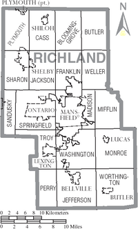
Communities
Cities
Villages
- Bellville
- Butler
- Crestline (partly in this county)
- Lexington
- Lucas
- Plymouth (partly in this county)
- Shiloh
Townships
- Bloominggrove
- Butler
- Cass
- Franklin
- Jackson
- Jefferson
- Madison
- Mifflin
- Monroe
- Perry
- Plymouth
- Sandusky
- Sharon
- Springfield
- Troy
- Washington
- Weller
- Worthington
Census-designated places
These are areas that are like towns but are not officially incorporated as cities or villages:
- Lincoln Heights
- Roseland
Unincorporated communities
These are small communities that are not part of any city or village:
- Bangorville
- Olivesburg
Ghost towns
These are towns that used to exist but are now abandoned:
See also
 In Spanish: Condado de Richland (Ohio) para niños
 | Sharif Bey |
 | Hale Woodruff |
 | Richmond Barthé |
 | Purvis Young |


