Shiloh, Richland County, Ohio facts for kids
Quick facts for kids
Shiloh, Ohio
|
|
|---|---|
|
Village
|
|

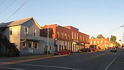
Main Street downtown
|
|

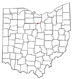
Location of Shiloh, Richland County, Ohio
|
|

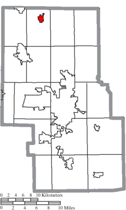
Location of Shiloh in Richland County
|
|
| Country | United States |
| State | Ohio |
| County | Richland |
| Founded | 1852 |
| Incorporated | 1874 (village) |
| Area | |
| • Total | 0.92 sq mi (2.38 km2) |
| • Land | 0.92 sq mi (2.37 km2) |
| • Water | 0.00 sq mi (0.01 km2) |
| Elevation | 1,083 ft (330 m) |
| Population
(2020)
|
|
| • Total | 619 |
| • Density | 675.76/sq mi (260.80/km2) |
| Time zone | UTC-5 (Eastern (EST)) |
| • Summer (DST) | UTC-4 (EDT) |
| ZIP code |
44878
|
| Area code(s) | 419 |
| FIPS code | 39-72298 |
| GNIS feature ID | 2399808 |
| Website | Village of Shiloh, Ohio |
Shiloh is a small village located in Richland County, in the state of Ohio. It is part of the larger Mansfield area. In 2020, about 619 people lived there.
Contents
History of Shiloh
Shiloh was first planned out in September 1852. It was built where two important railroads met: the Sandusky and Mansfield Railroad and the Cleveland and Columbus Railroad. A main road between the cities of Tiffin and Wooster also crossed here.
Early Names and Changes
The village was first called "Salem Station." This was because it was close to an older village named Salem. However, Salem soon disappeared after Shiloh was founded.
In 1862, the name was changed to "Shiloh." People aren't completely sure why the name changed. Some said it was named after the Battle of Shiloh, a big battle during the American Civil War that happened in 1862. Others believed it was named after the biblical city mentioned in the Bible.
Growth and Development
Shiloh officially became a village in 1874. By the end of the 1800s, the two railroads helped the village's businesses grow a lot. Shiloh also had its own natural gas supply. This gas provided energy for the village and even a little extra to send to nearby towns.
One special place in Shiloh is the Silas Ferrell House. It is so important that it is listed on the National Register of Historic Places.
Geography of Shiloh
Shiloh is a small village. According to the United States Census Bureau, the village covers a total area of about 0.91 square miles (2.37 square kilometers). All of this area is land.
Population Information
| Historical population | |||
|---|---|---|---|
| Census | Pop. | %± | |
| 1870 | 297 | — | |
| 1880 | 661 | 122.6% | |
| 1890 | 644 | −2.6% | |
| 1900 | 597 | −7.3% | |
| 1910 | 555 | −7.0% | |
| 1920 | 430 | −22.5% | |
| 1930 | 514 | 19.5% | |
| 1940 | 519 | 1.0% | |
| 1950 | 655 | 26.2% | |
| 1960 | 724 | 10.5% | |
| 1970 | 817 | 12.8% | |
| 1980 | 857 | 4.9% | |
| 1990 | 778 | −9.2% | |
| 2000 | 721 | −7.3% | |
| 2010 | 649 | −10.0% | |
| 2020 | 619 | −4.6% | |
| Sources: | |||
Shiloh's Population in 2010
In 2010, the village of Shiloh had 649 people living there. There were 235 households, which are groups of people living together in one home. About 170 of these households were families.
The village had about 713 people per square mile. Most of the people living in Shiloh were White (97.8%). A small number of residents were African American, Native American, or Asian. Some people identified with two or more races. About 0.5% of the population was Hispanic or Latino.
Households and Ages
In 2010, about 35.7% of households had children under 18 living with them. More than half (51.1%) were married couples. Some households were led by a single parent.
The average age of people in Shiloh was 38.4 years old. About 25% of residents were under 18. About 11.9% were 65 years old or older. The number of males and females in the village was almost equal.
Education in Shiloh
Students in Shiloh attend schools within the Plymouth-Shiloh Local School District. This school district manages three public schools. These schools are located in the nearby village of Plymouth. They include Plymouth-Shiloh Elementary School, Shiloh Middle School, and Plymouth High School.
See also
- In Spanish: Shiloh (Ohio) para niños
 | Calvin Brent |
 | Walter T. Bailey |
 | Martha Cassell Thompson |
 | Alberta Jeannette Cassell |

