
U.S. Route 250 facts for kids
Quick facts for kids
|
|
|---|---|
| Lua error in Module:Infobox_road/map at line 15: attempt to index field 'wikibase' (a nil value). | |
| Route information | |
| Auxiliary route of US 50 | |
| Length | 514 mi (827 km) |
| Existed | 1928–present |
| Major junctions | |
| West end | |
|
|
| East end | |
| Highway system | |
| United States Numbered Highways List • Bannered • Divided • Replaced |
|

U.S. Route 250 (or US 250) is a long road that is part of the U.S. Highway System. This system is a special network of important roads across the country. US 250 is like a branch off a bigger road, U.S. Route 50.
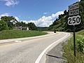
This highway stretches for about 514 miles (827 kilometers). It starts in Sandusky, Ohio, and ends in Richmond, Virginia. Along its journey, US 250 travels through three states: Ohio, West Virginia, and Virginia.
Some of the major cities it passes through include Richmond, Virginia, Charlottesville, Virginia, Staunton, Virginia, and Wheeling, West Virginia. For a short part of its path, US 250 even shares the same road with its "parent" road, US 50, near Pruntytown, West Virginia. This is called an "overlap" or "concurrency."
You might notice that the signs for US 250 change direction depending on the state. In West Virginia, it is signed as a north-south road. But in Ohio and Virginia, it is signed as an east-west road.
Images for kids
-
View south along US 250 Truck in Philippi
_at_U.S._Route_119_(Mansfield_Drive)_in_Philippi,_Barbour_County,_West_Virginia.jpg)
See also
 In Spanish: U.S. Route 250 para niños
