National Register of Historic Places listings in Iowa County, Iowa facts for kids
Have you ever wondered about old buildings or special places that tell a story about the past? In Iowa County, Iowa, there are several amazing spots that are so important, they've been added to a special list called the National Register of Historic Places. This list helps protect and celebrate places that are important to American history, architecture, archaeology, engineering, or culture.
These places are like treasures that show us how people lived, worked, and built things a long time ago. When a place is on this list, it means it's recognized as a significant part of our country's heritage. In Iowa County, there are 11 such places, and one of them is even a super important "National Historic Landmark"!
Special Places in Iowa County
Here's a list of the historic places in Iowa County that are on the National Register. Each one has its own unique story!
| Name on the Register | Image | Date listed | Location | City or town | Description | |
|---|---|---|---|---|---|---|
| 1 | Amana Villages |
(#66000336) |
Northeastern Iowa County 41°47′59″N 91°55′15″W / 41.799722°N 91.920833°W |
Middle Amana | The Amana Colonies are a group of seven villages. They were settled by German immigrants who wanted to live a simple, community-focused life. Today, they are famous for their unique history, crafts, and food. | |
| 2 | E.J. Baird House |
(#82002622) |
Jackson and Fremont Sts. 41°34′21″N 92°09′31″W / 41.5725°N 92.158611°W |
Millersburg | This historic house is located in Millersburg. | |
| 3 | David and M. Maria Hughes House |
(#96000697) |
101 W. Penn St. 41°39′34″N 92°00′27″W / 41.659444°N 92.0075°W |
Williamsburg | This house in Williamsburg is recognized for its historical importance. | |
| 4 | Indian Fish Weir |
(#88001122) |
Address Restricted |
Middle Amana | An Indian Fish Weir was a structure built in a river to catch fish. This particular one is believed to be covered by river silt and can no longer be seen. It shows how early people used the land. | |
| 5 | Iowa County Courthouse |
(#81000247) |
Court Ave. 41°47′53″N 92°04′14″W / 41.798056°N 92.070556°W |
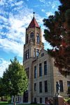
Marengo | The Iowa County Courthouse is where important government activities happen for the county. It's an impressive building with a lot of history. | |
| 6 | Ladora Savings Bank |
(#90001196) |
811 Pacific St. 41°45′17″N 92°11′01″W / 41.754722°N 92.183611°W |
Ladora | This old bank building in Ladora is a reminder of the town's past and how people managed their money long ago. | |
| 7 | Lenox Township Church of the New Jerusalem |
(#83000370) |
South of Norway 41°50′50″N 91°55′41″W / 41.847222°N 91.928056°W |
Lenox Township | This church in Lenox Township is a historic place of worship. | |
| 8 | Pilot Grove |
(#77000519) |
Southwest of Williamsburg 41°37′49″N 92°05′03″W / 41.630278°N 92.084167°W |
Williamsburg | Pilot Grove is a special natural area that has been preserved. It helps protect important plants and animals. | |
| 9 | Plagmann Round Barn |
(#86001440) |
Off Iowa Highway 209 41°43′30″N 92°03′11″W / 41.725°N 92.053056°W |
Conroy | Round barns are quite rare! This unique barn design was sometimes used to make farming more efficient. | |
| 10 | St. Michael's Church, Cemetery, Rectory and Ancient Order of Hibernians Hall |
(#83000371) |
East of Parnell on F 52 41°35′24″N 91°54′48″W / 41.59°N 91.913333°W |
Parnell | This historic site includes a church, a cemetery, a rectory (where the priest lives), and a hall for a group called the Ancient Order of Hibernians. | |
| 11 | Fred G. Turner House |
(#85001381) |
Iowa Highway 149 41°33′25″N 92°03′56″W / 41.556944°N 92.065556°W |
North English | The Fred G. Turner House is another important historic home in Iowa County. |


