National Register of Historic Places listings in Ipswich, Massachusetts facts for kids
Ipswich, Massachusetts, is a town full of history! It's home to many special buildings and places that are so important, they've been added to a list called the National Register of Historic Places. This list helps protect and celebrate America's historic sites. Think of it like a Hall of Fame for old buildings and areas that tell us about the past.
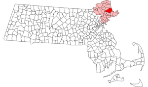
In all of Essex County, Massachusetts, where Ipswich is located, there are 461 places on this special list. Ipswich itself is lucky enough to have 31 of these amazing historic spots! Let's explore some of them.
Contents
What is the National Register of Historic Places?
The National Register of Historic Places is the official list of the nation's historic places worthy of preservation. It's managed by the National Park Service in the United States. When a building, site, or even a whole neighborhood is added to this list, it means it has a unique story or special design that's important to American history, architecture, archaeology, engineering, or culture. Being on the list helps people learn about these places and sometimes helps with getting funds to keep them in good shape.
Ipswich's Historic Treasures
Ipswich has many individual buildings and even entire neighborhoods listed on the National Register. These places show us how people lived, worked, and built things many years ago. From old houses to historic bridges and even former factories, each spot has a piece of Ipswich's rich past.
Historic Homes and Buildings
Many of Ipswich's historic listings are old houses, some dating back hundreds of years! These homes often show unique building styles from different time periods.
- Bailey House: Located at 40 Market Street, this historic house was added to the list in 1980.
- Brown's Manor: You can find this historic building at 115 High Street. It joined the list in 1980.
- James Burnham House: This house at 37 Heartbreak Road became a historic listing in 1990.
- Burnham-Patch House: Found at 1 Turkey Shore Road, this house was recognized as historic in 1980.
- Benjamin Stickney Cable Memorial Hospital: This former hospital, located at the junction of MA 1A and MA 133, was listed in 1990.
- Caldwell Block: This historic block of buildings on South Main Street was added to the list in 1983.
- Dr. John Calef House: At 7 Poplar Street, this house has been on the list since 1980.
- Giddings-Burnham House: This house at 37 Argilla Road joined the list in 1990.
- Isaac Goodale House: Located at 153 Argilla Road, this house was listed in 1990.
- Benjamin Grant House: You can find this historic home at 47 County Street, listed in 1980.
- Heard-Lakeman House: This house at 2 Turkey Shore Road was recognized in 1980.
- House on Labor-in-Vain Road: This unique house on Labor in Vain Road was added to the list in 1990.
- Howe Barn: Originally a 17th-century barn, this structure at 421 Linebrook Road was converted into a house and listed in 1990.
- Thomas Low House: Located at 36 Heartbreak Road, this house became a historic listing in 1990.
- Merrifield House: At 7 Woods Lane, this house was added to the list in 1980.
- Paine-Dodge House: This house at 49 Jeffrey's Neck Road is part of the The Trustees of Reservations Greenwood Farm property and was listed in 1990.
- Ross Tavern: Found at 52 Jeffrey's Neck Road, this old tavern was recognized in 1990.
- Nathaniel Rust Mansion: This grand home at 83 County Street was listed in 1980.
- Smith House: At 168 Argilla Road, this house was added to the list in 1990.
- Turner Hill: This historic estate at 315 Topsfield Road was listed in 1982.
- Wade House: Located at 5 Woods Lane, this house was recognized in 1980.
- John Whipple House: This very old and important house at 53 South Main Street has been a National Historic Landmark since 1966!
- Shoreborne Wilson House: At 4 South Main Street, this house was added to the list in 1980.
Historic Districts
Sometimes, it's not just one building that's historic, but a whole area! These are called historic districts. They help preserve the look and feel of an old neighborhood.
- Brown Stocking Mill Historic District: This area includes several streets like Broadway Avenue and Brownville Avenue, showing a piece of Ipswich's industrial past. It was listed in 1996.
- East End Historic District: This district on East Street was recognized in 1980 for its historic character.
- High Street Historic District: The High Street area became a historic district in 1980.
- Ipswich Mills Historic District: This district, near Union Street and the Ipswich River, highlights the town's history as a mill town. It was listed in 1996.
- Meetinghouse Green Historic District: This area on North Main Street, often a central part of old towns, was recognized in 1980.
- South Green Historic District: Located along MA 1A, this district was added to the list in 1980.
Other Notable Historic Sites
Ipswich also has other types of historic places that aren't just houses or districts.
- Castle Hill: Located east of Ipswich on Argilla Road, this grand estate is a National Historic Landmark, recognized in 1977. It's famous for its beautiful mansion and grounds.
- Choate Bridge: This historic bridge, carrying MA 133/1A over the Ipswich River, is a very old and important structure. It was listed in 1972.
These historic places help us understand the long and interesting story of Ipswich and the people who lived there. They are important parts of our shared heritage!
Images for kids


