National Register of Historic Places listings in Jackson County, South Dakota facts for kids
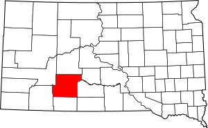
This is a list of the National Register of Historic Places listings in Jackson County, South Dakota.
This is intended to be a complete list of the properties and districts on the National Register of Historic Places in Jackson County, South Dakota, United States. The locations of National Register properties and districts for which the latitude and longitude coordinates are included below, may be seen in a map.
There are 8 properties and districts listed on the National Register in the county.
Current listings
| Name on the Register | Image | Date listed | Location | City or town | Description | |
|---|---|---|---|---|---|---|
| 1 | Chicago, Milwaukee, and St. Paul Railroad Depot |
(#86001478) |
Southern end of Kadoka adjacent to the former Chicago, Milwaukee, St. Paul and Pacific railroad line 43°49′55″N 101°30′34″W / 43.831944°N 101.509444°W |
Kadoka | ||
| 2 | Tom Jones Ranch |
(#90001653) |
5½ miles south of Midland 43°59′34″N 101°10′58″W / 43.992778°N 101.182778°W |
Midland | ||
| 3 | Lip's Camp |
(#75002104) |
Address Restricted |
Wanblee | ||
| 4 | Minuteman Missile National Historic Site |
(#01000275) |
Off of Interstate 90, north of Rapid City 43°55′52″N 102°09′38″W / 43.9311°N 102.1606°W |
Rapid City | A National Historic Site; extends into Pennington County | |
| 5 | Mt. Moriah Masonic Lodge No. 155 |
(#04000765) |
101 Main St., S. 43°50′11″N 101°30′35″W / 43.836389°N 101.509722°W |
Kadoka | ||
| 6 | Pearl Hotel |
(#07000587) |
South Main 43°50′02″N 101°30′38″W / 43.833889°N 101.510556°W |
Kadoka | ||
| 7 | Prairie Homestead |
(#74001891) |
21070 South Dakota Highway 240 43°48′04″N 101°54′23″W / 43.801177°N 101.906256°W |
Interior | ||
| 8 | Triangle Ranch |
(#94000563) |
On the south fork of the Bad River, about 11 miles southwest of Philip 43°55′56″N 101°47′24″W / 43.932222°N 101.79°W |
Philip |

All content from Kiddle encyclopedia articles (including the article images and facts) can be freely used under Attribution-ShareAlike license, unless stated otherwise. Cite this article:
National Register of Historic Places listings in Jackson County, South Dakota Facts for Kids. Kiddle Encyclopedia.


