National Register of Historic Places listings in Ketchikan Gateway Borough, Alaska facts for kids
This is a list of the National Register of Historic Places listings in Ketchikan Gateway Borough, Alaska.
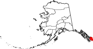
This is intended to be a complete list of the properties and districts on the National Register of Historic Places in Ketchikan Gateway Borough, Alaska, United States. The locations of National Register properties and districts for which the latitude and longitude coordinates are included below, may be seen in an online map.
There are 20 properties and districts listed on the National Register in the borough. Another 2 properties were once listed but have been removed.
Current listings
| Name on the Register | Image | Date listed | Location | City or town | Description | |
|---|---|---|---|---|---|---|
| 2 | Burkhart-Dibrell House |
(#82004902) |
500 Main Street 55°20′38″N 131°38′54″W / 55.343889°N 131.648333°W |
Ketchikan | ||
| 3 | Chief Kashakes House |
(#93000338) |
Mile 2.5 South Tongass Highway 55°19′05″N 131°35′49″W / 55.318170°N 131.597078°W |
Saxman | ||
| 4 | Clover Pass School |
(#05000898) |
Potter Road off Knudson Cove Road 55°28′22″N 131°47′32″W / 55.4728°N 131.7922°W |
Knudson Cove | ||
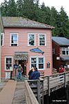
| 5 | Creek Street Historic District |
(#14000454) |
Creek St., Married Man's Trail & Totem Way 55°20′32″N 131°38′30″W / 55.3423°N 131.6417°W |
Ketchikan | ||
| 6 | First Lutheran Church |
(#87000716) |
1200 Tongass Avenue 55°20′43″N 131°39′28″W / 55.345278°N 131.657778°W |
Ketchikan | ||
| 7 | Gilmore Building |
(#89001415) |
326 Front Street 55°20′32″N 131°38′52″W / 55.342361°N 131.647778°W |
Ketchikan | ||
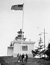
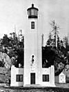
| 8 | Guard Island Lighthouse |
(#03001378) |
Guard Islands in the Clarence Strait at the northern end of Tongass Narrows, 9.6 miles northwest of Ketchikan 55°25′52″N 131°51′46″W / 55.431111°N 131.862778°W |
Ketchikan | ||
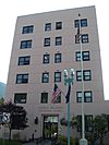
| 9 | Ketchikan Federal Building |
(#05000897) |
648 Mission St. 55°20′30″N 131°38′34″W / 55.341667°N 131.642778°W |
Ketchikan | ||
| 10 | Ketchikan Ranger House |
(#87000645) |
309 Gorge St. 55°20′50″N 131°39′32″W / 55.347222°N 131.658889°W |
Ketchikan | ||
| 11 | Mary Island Light Station |
(#05000645) |
Eastern shore of the northern end of Mary Island, between the Revillagigedo Channel and Felice Strait about 6-3/8 miles south of Revillagiedo 55°05′57″N 131°10′53″W / 55.099167°N 131.181389°W |
Ketchikan | ||
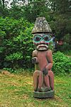
| 12 | Saxman Totem Park |
(#79003758) |
S. Tongass Highway 55°19′11″N 131°35′41″W / 55.319722°N 131.594722°W |
Saxman | ||
| 13 | Stedman-Thomas Historic District |
(#96000062) |
Stedman, Thomas, Inman, Brown, and Tatsudu Sts. 55°20′25″N 131°38′17″W / 55.340278°N 131.638056°W |
Ketchikan | ||
| 14 | Storehouse No. 3 |
(#77001575) |
Northeast of Ketchikan at Halibut Bay Estuary 55°14′08″N 130°06′05″W / 55.235556°N 130.101389°W |
Ketchikan | ||
| 15 | The Star |
(#93000336) |
5 Creek St. 55°20′35″N 131°38′22″W / 55.343056°N 131.639444°W |
Ketchikan | ||
| 16 | Totem Bight State Historic Site |
(#70000916) |
Western side of Revillagigedo Island 55°25′23″N 131°46′17″W / 55.423056°N 131.771389°W |
Ketchikan | ||
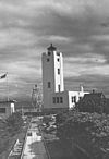
| 17 | Tree Point Lighthouse |
(#04001177) |
Western coast of the mainland on the eastern side of the southern entrance to the Revillagigedo Channel, about 4.25 miles north of Cape Fox 54°48′10″N 130°56′02″W / 54.802778°N 130.933889°W |
Ketchikan | ||
| 18 | Walker-Broderick House |
(#82004903) |
541 Pine St. 55°20′40″N 131°38′48″W / 55.344583°N 131.646667°W |
Ketchikan | ||
| 19 | Ziegler House |
(#85001161) |
623 Grant St. 55°20′40″N 131°38′43″W / 55.344444°N 131.645278°W |
Ketchikan |
Former listings
| Name on the Register | Image | Date listed | Date removed | Location | City or town | Summary | |
|---|---|---|---|---|---|---|---|
| 1 | Ayson Hotel |
(#86003366) |
|
301-305 Stedman St. |
Ketchikan | ||
| 2 | McKay Marine Ways |
(#88001569) |
|
1935 Tongass Ave. |
Ketchikan |

All content from Kiddle encyclopedia articles (including the article images and facts) can be freely used under Attribution-ShareAlike license, unless stated otherwise. Cite this article:
National Register of Historic Places listings in Ketchikan Gateway Borough, Alaska Facts for Kids. Kiddle Encyclopedia.

