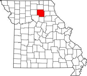
National Register of Historic Places listings in Macon County, Missouri facts for kids
Have you ever wondered about the old buildings and places in your town that tell a story? In Macon County, Missouri, there are several special spots that are so important, they've been added to a list called the National Register of Historic Places. This list is like a hall of fame for buildings, structures, and areas that have played a big part in American history, architecture, archaeology, engineering, or culture.
When a place is on this list, it means it's recognized for its unique value and efforts are made to protect it for future generations. Macon County has 9 such amazing places! Let's explore some of them and learn about their past.
Historic Places in Macon County
Macon County is home to a variety of historic sites, from old schools to grand houses and even a town square. Each one has a story to tell about the people and times that shaped this part of Missouri.
Buildings in Macon City
The city of Macon has a few important buildings on the National Register.
Blees Military Academy
The Blees Military Academy is an old school building located on U.S. Route 63. It was added to the list in 1979. Military academies are schools where students learn about military life, discipline, and leadership. This building stands as a reminder of a time when such schools were common.
Macon County Courthouse and Annex
The Macon County Courthouse and Annex is a very important building in Macon. It's where many local government decisions are made. This courthouse, located on Courthouse Square, was recognized for its history in 1978. Courthouses often have interesting architecture and are central to a community's civic life.
Wardell House
The Wardell House is a beautiful historic home located at 1 Wardell Road in Macon. It was added to the National Register in 1986. Old houses like the Wardell House often show us how people lived and what kind of styles were popular many years ago.
Historic Spots in La Plata
The town of La Plata also has several historic places that are worth knowing about.
Lester and Norma Dent House
The Lester and Norma Dent House is a historic home at 225 N. Church Street in La Plata. It was listed in 1990. Homes like this are often important because of the people who lived there or their unique architectural style.
John T. and Mary M. Doneghy House
Another significant home in La Plata is the John T. and Mary M. Doneghy House at 301 N. Owensby Street. This house joined the National Register in 1990. It's a great example of the kind of homes built in the area long ago.
Gilbreath-McLorn House
The Gilbreath-McLorn House is found at 225 N. Owenby in La Plata. It was added to the list in 1978. These historic houses give us a peek into the past and how families lived in earlier times.
La Plata Square Historic District
Instead of just one building, the La Plata Square Historic District includes a whole area along parts of Gex, Sanders, and Moore Streets. This district was recognized in 2008. A "historic district" means that many buildings in that area together tell an important story about the town's development and history. It's like a collection of historic treasures!
Other Notable Places
Macon County has a few more historic sites outside of its main cities.
Gardner and Tinsley Filling Station
The Gardner and Tinsley Filling Station is an interesting historic site located east of New Cambria. It's on Old U.S. Route 36, about 1.5 miles east of its junction with Route 149. This old gas station was listed in 2002. It reminds us of a time when cars and travel were becoming more common, and these stations were vital stops for drivers.
Johnson Morrow House
The Johnson Morrow House is located on 2nd Street west of its junction with Pine Street in Callao. This historic home was added to the National Register in 1994. Like other historic houses, it helps us understand the architectural styles and daily lives of people from the past in Callao.
Images for kids


