Macon County, Missouri facts for kids
Quick facts for kids
Macon County
|
|
|---|---|

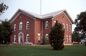
The Macon County Courthouse in Macon
|
|

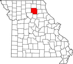
Location within the U.S. state of Missouri
|
|
 Missouri's location within the U.S. |
|
| Country | |
| State | |
| Founded | January 6, 1837 |
| Named for | Nathaniel Macon |
| Seat | Macon |
| Largest city | Macon |
| Area | |
| • Total | 812 sq mi (2,100 km2) |
| • Land | 801 sq mi (2,070 km2) |
| • Water | 11 sq mi (30 km2) 1.4% |
| Population
(2020)
|
|
| • Total | 15,209 |
| • Density | 18.730/sq mi (7.232/km2) |
| Time zone | UTC−6 (Central) |
| • Summer (DST) | UTC−5 (CDT) |
| Congressional district | 6th |
Macon County is a county located in the northern part of Missouri, a state in the United States. In 2020, about 15,209 people lived here. The main town and government center of the county is Macon. Macon County was officially started on January 6, 1837. It was named after Nathaniel Macon, who was a hero in the American Revolutionary War and a politician from North Carolina.
Contents
Geography of Macon County
Macon County covers a total area of about 812 square miles. Most of this area, about 801 square miles, is land. The remaining 11 square miles, or 1.4%, is water.
Counties Nearby
Macon County shares its borders with several other counties:
- Adair County (to the north)
- Knox County (to the northeast)
- Sullivan County (to the northwest)
- Shelby County (to the east)
- Randolph County (to the south)
- Monroe County (to the southeast)
- Chariton County (to the southwest)
- Linn County (to the west)
Main Roads and Highways
These are the major roads that pass through Macon County:
County Townships
Macon County is divided into smaller areas called townships:
- Bevier
- Callao
- Chariton
- Drake
- Eagle
- Easley
- Hudson
- Independence
- Jackson
- Johnston
- La Plata
- Liberty
- Lingo
- Lyda
- Middle Fork
- Morrow
- Narrows
- Richland
- Round Grove
- Russell
- Ten Mile
- Valley
- Walnut Creek
- White
People of Macon County
| Historical population | |||
|---|---|---|---|
| Census | Pop. | %± | |
| 1840 | 1,634 | — | |
| 1850 | 6,565 | 301.8% | |
| 1860 | 14,346 | 118.5% | |
| 1870 | 23,230 | 61.9% | |
| 1880 | 26,222 | 12.9% | |
| 1890 | 30,575 | 16.6% | |
| 1900 | 33,018 | 8.0% | |
| 1910 | 30,868 | −6.5% | |
| 1920 | 27,518 | −10.9% | |
| 1930 | 23,070 | −16.2% | |
| 1940 | 21,396 | −7.3% | |
| 1950 | 18,332 | −14.3% | |
| 1960 | 16,473 | −10.1% | |
| 1970 | 15,432 | −6.3% | |
| 1980 | 16,313 | 5.7% | |
| 1990 | 15,345 | −5.9% | |
| 2000 | 15,762 | 2.7% | |
| 2010 | 15,566 | −1.2% | |
| 2020 | 15,209 | −2.3% | |
| U.S. Decennial Census 1790–1960 1900–1990 1990–2000 2010–2015 |
|||
In 2010, there were about 15,556 people living in Macon County. There were 6,501 households and 4,381 families. The county had about 20 people per square mile.
Most people in the county were White (96.18%). Other groups included Black or African American (2.21%), Native American (0.39%), and Asian (0.16%). About 0.77% of the population was Hispanic or Latino. Many residents had German (22.8%), American (21.8%), English (13.9%), or Irish (10.8%) backgrounds.
About 29.1% of households had children under 18. The average household had 2.38 people, and the average family had 2.92 people.
The median age in the county was 40 years old. About 24.2% of the population was under 18, and 19.0% was 65 or older.
The median income for a household was $30,195. For families, it was $36,370. About 12.5% of the population lived below the poverty line.
2020 Census Information
| Race | Num. | Perc. |
|---|---|---|
| White (NH) | 13,778 | 90.6% |
| Black or African American (NH) | 299 | 2% |
| Native American (NH) | 25 | 0.16% |
| Asian (NH) | 84 | 0.55% |
| Pacific Islander (NH) | 4 | 0.03% |
| Other/Mixed (NH) | 743 | 4.9% |
| Hispanic or Latino | 276 | 1.8% |
Communities in Macon County
Cities
Village
Census-designated place
Other Unincorporated Places
These are smaller communities that are not officially cities or villages:
Ghost Towns
These are places that used to be towns but are now abandoned:
Education in Macon County
Public Schools
- Atlanta C-3 School District – Atlanta
- Atlanta Elementary School (Kindergarten-6th grade)
- Atlanta High School (7th-12th grade)
- Bevier C-4 School District – Bevier
- Bevier Elementary School (Kindergarten-8th grade)
- Bevier High School (9th-12th grade)
- Callao C-8 School District – Callao
- Callao Elementary School (Kindergarten-8th grade)
- La Plata R-II School District – La Plata
- La Plata Elementary School (Pre-Kindergarten-6th grade)
- La Plata High School (7th-12th grade)
- Macon County R-I School District – Macon
- Macon Elementary School (Pre-Kindergarten-5th grade)
- Macon Middle School (6th-8th grade)
- Macon High School (9th-12th grade)
- Macon County R-IV School District – New Cambria
- Macon County Elementary School (Kindergarten-6th grade)
- Macon County High School (7th-12th grade)
Private Schools
- Tri County Christian School – Macon (Pre-Kindergarten-6th grade) – A Christian school
- Immaculate Conception School – Macon (Kindergarten-8th grade) – A Roman Catholic school
Public Libraries
- Laplata Public Library
- Macon Public Library
See also
 In Spanish: Condado de Macon (Misuri) para niños
 | Victor J. Glover |
 | Yvonne Cagle |
 | Jeanette Epps |
 | Bernard A. Harris Jr. |

