Elmer, Missouri facts for kids
Quick facts for kids
Elmer, Missouri
|
|
|---|---|

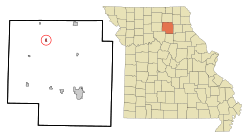
Location of Elmer, Missouri
|
|
| Country | United States |
| State | Missouri |
| County | Macon |
| Area | |
| • Total | 0.25 sq mi (0.66 km2) |
| • Land | 0.25 sq mi (0.66 km2) |
| • Water | 0.00 sq mi (0.00 km2) |
| Elevation | 735 ft (224 m) |
| Population
(2020)
|
|
| • Total | 51 |
| • Density | 201.58/sq mi (77.75/km2) |
| Time zone | UTC-6 (Central (CST)) |
| • Summer (DST) | UTC-5 (CDT) |
| ZIP code |
63538
|
| Area code(s) | 660 |
| FIPS code | 29-21988 |
| GNIS feature ID | 2394672 |
Elmer is a small city located in Macon County, Missouri, in the United States. In 2020, about 51 people lived there. This number was a bit smaller than in 2010, when 80 people called Elmer home.
Contents
History of Elmer
How Elmer Started
Elmer began in 1888. This was when the Atchison, Topeka and Santa Fe Railway built its tracks to this area. The railway helped the town grow.
Elmer's Post Office
A post office opened in Elmer in 1889. It served the community for many years. However, in 2011, the U.S. Postal Service decided to close the Elmer post office for good. This was part of a bigger plan to change post offices across the country.
Geography of Elmer
Where is Elmer Located?
Elmer is in the northern part of Macon County. It is about 9 miles (14 km) southwest of La Plata. It is also about 23 miles (37 km) northwest of Macon, which is the main city of the county.
Rivers and Railways
The BNSF Railway has tracks that go through Elmer. These tracks lead southwest to Marceline and northeast to Fort Madison, Iowa. Elmer is on the east side of the valley of the Chariton River. This river flows south and eventually joins the Missouri River.
Land and Water Area
According to the U.S. Census Bureau, the city of Elmer covers a total area of about 0.25 square miles (0.66 square kilometers). Almost all of this area is land. Only a very tiny part, about 0.001 square miles (0.003 square kilometers), is water.
Population and People
Population Changes Over Time
The number of people living in Elmer has changed quite a bit over the years. Here's a look at how the population has grown and shrunk:
| Historical population | |||
|---|---|---|---|
| Census | Pop. | %± | |
| 1900 | 236 | — | |
| 1910 | 512 | 116.9% | |
| 1920 | 349 | −31.8% | |
| 1930 | 346 | −0.9% | |
| 1940 | 238 | −31.2% | |
| 1950 | 295 | 23.9% | |
| 1960 | 266 | −9.8% | |
| 1970 | 193 | −27.4% | |
| 1980 | 180 | −6.7% | |
| 1990 | 91 | −49.4% | |
| 2000 | 98 | 7.7% | |
| 2010 | 80 | −18.4% | |
| 2020 | 51 | −36.2% | |
| U.S. Decennial Census | |||
Elmer's Population in 2010
Based on the census from 2010, there were 80 people living in Elmer. These people made up 36 households, which are groups of people living in one home. There were also 23 families.
The city had about 320 people per square mile (123.6 people per square kilometer). Most of the people living in Elmer were White, about 97.5%. A small number, 2.5%, were from two or more racial backgrounds. Also, 2.5% of the population identified as Hispanic or Latino.
The average age of people in Elmer in 2010 was 51.6 years old. About 22.5% of the residents were under 18 years old. About 27.5% were 65 years old or older. The city had slightly more males (51.3%) than females (48.8%).
See also
 In Spanish: Elmer (Misuri) para niños
 | William M. Jackson |
 | Juan E. Gilbert |
 | Neil deGrasse Tyson |

