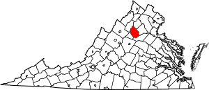
National Register of Historic Places listings in Madison County, Virginia facts for kids
Madison County, Virginia, is home to many important historical places! These special spots are listed on the National Register of Historic Places. This is like a national list of buildings, areas, and sites that are super important to American history and culture. When a place is on this list, it means it's recognized for its unique story and is often protected so future generations can learn from it.
In Madison County, there are 21 places on this list. Two of them are even more special and are called National Historic Landmarks. These landmarks are considered some of the most important historical places in the entire country! You can even find some of these places on a map if their exact location is shared.
Contents
Exploring Madison County's Historic Places
Let's take a closer look at some of the cool historic places you can find in Madison County. Each one has a story to tell about the past!
Camp Hoover: A President's Retreat
One of the most famous places in Madison County is Camp Hoover, also known as Rapidan Camp. This was once the vacation home for President Herbert Hoover and his wife, Lou Henry Hoover. Imagine a president going camping! It's located deep inside Shenandoah National Park. President Hoover loved to fish and relax here, away from the busy life in Washington, D.C. It became a National Historic Landmark in 1988.
Skyline Drive: A Scenic Historic Road
Another National Historic Landmark is the Skyline Drive Historic District. This isn't just one building, but a whole scenic road that winds through the beautiful Shenandoah National Park. It stretches from Front Royal in the north all the way to Rockfish Gap in the south. This road was built during the Great Depression by people working for the Civilian Conservation Corps, a program that helped put Americans back to work. It's famous for its amazing views and is a great example of early park design.
Old Churches and Courthouses
Madison County also has some very old and important buildings:
Hebron Lutheran Church
The Hebron Lutheran Church is a very old church located northeast of the town of Madison. It was built a long, long time ago, in 1740! It's one of the oldest Lutheran churches still standing in the United States. Imagine all the history that has happened there over the centuries. It was added to the National Register in 1971.
Madison County Courthouse
The Madison County Courthouse is another important building. It's right in the heart of Madison and has been a central part of the county's government for many years. This courthouse was built in 1829. It's not just the courthouse itself, but the whole area around it, called the Madison County Courthouse Historic District, that is also on the National Register. This district includes other historic buildings that show what the town looked like in the past. The courthouse was listed in 1969, and the historic district in 1984.
Historic Homes and Sites
Many old homes and even some ancient sites are also recognized:
George T. Corbin Cabin
Deep in Shenandoah National Park, you can find the George T. Corbin Cabin. This rustic cabin shows how some people lived in the mountains many years ago. It's a reminder of the early settlers and their way of life before the national park was created. It was listed in 1989.
Hoffman Round Barn
The Hoffman Round Barn near Wolftown is a unique building. Most barns are rectangular, but this one is round! Round barns were sometimes built because people thought they were more efficient or stronger. This interesting barn was added to the National Register in 2009.
Other Notable Places
- Belle Plaine and Brampton are historic homes that show the architecture and lifestyle of earlier times in the county.
- Graves Mill is an old mill, which would have been very important for grinding grain in the past.
- Locust Hill and The Residence (at Woodberry Forest School) are other historic properties that have been preserved.
- There are also several "Address Restricted" sites like Big Meadows Site, Cliff Kill Site, Gentle Site, and Robertson Mountain Site. These are often archaeological sites where scientists study ancient cultures and artifacts, and their exact locations are kept secret to protect them.
These places help us understand the rich history of Madison County, from early settlements and farming to presidential getaways and important public buildings.
Images for kids


