National Register of Historic Places listings in Muskegon County, Michigan
Muskegon County, Michigan, is home to many special places that are listed on the National Register of Historic Places. This register is like a national scrapbook of important buildings, sites, and objects that tell us about America's past. When a place is on this list, it means it's worth protecting and remembering for future generations. These historic spots in Muskegon County help us learn about the area's history, from old factories and homes to lighthouses and even famous ships!
Contents
What is the National Register of Historic Places?
The National Register of Historic Places (NRHP) is the official list of places in the United States that are important to history. It's managed by the National Park Service. Being on the NRHP means a place has special historical, architectural, archaeological, engineering, or cultural value. It helps people understand and appreciate the past. It also encourages communities to preserve these treasures.
Why are these places important?
These historic places are like time capsules. They show us how people lived, worked, and played long ago. They can be old houses, schools, churches, factories, or even entire neighborhoods. By learning about them, we can connect with the stories of the past. This helps us understand how our communities grew and changed over time.
Historic Buildings in Muskegon
Muskegon County has several buildings that are recognized for their history. These structures often show interesting architectural styles. They also tell stories about the people who built and used them.
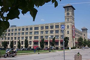
Amazon Hosiery Mill
The Amazon Hosiery Mill was a big factory in Muskegon. It was built a long time ago, in 1982. This mill used to make socks and other clothing items. It was an important part of Muskegon's industrial past. Factories like this provided many jobs for people in the area.
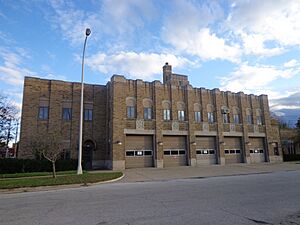
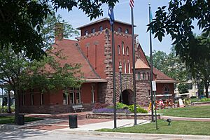
Central Fire Station
The Central Fire Station in Muskegon is another cool historic building. It was built in 1999. This building served as the main fire station for the city. Imagine the brave firefighters who worked here, ready to respond to emergencies! Old fire stations often have unique designs.
Famous Homes and Houses
Muskegon County also has several historic homes. These houses belonged to important people in the community. They often show the fancy styles of architecture from their time.
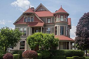
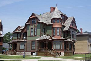
Charles H. Hackley House
The Charles H. Hackley House is a very grand home in Muskegon. It was built in 1970. Charles H. Hackley was a very important person in Muskegon's history. He was a wealthy lumber baron and a generous giver to the community. His house is a beautiful example of Victorian architecture.
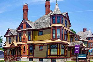
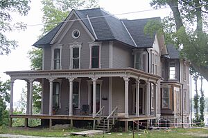
Horatio N. Hovey House
The Horatio N. Hovey House is another historic home. It was built in 1983. Horatio N. Hovey was also a significant figure in Muskegon. His house reflects the style of homes built during his era.
Hume House
The Hume House is located right next to the Hackley House. It was built in 1972. Thomas Hume was Charles Hackley's business partner. Both houses are part of a historic neighborhood. They show how wealthy families lived in Muskegon during the lumber boom.
John C. and Augusta (Covell) Lewis House
In Whitehall, you can find the John C. and Augusta (Covell) Lewis House. This house was built in 2010. It is a great example of a historic family home outside of Muskegon city.
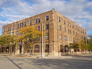
Muskegon YMCA Building
The Muskegon YMCA Building is another historic structure. It was added to the list in 1982. The YMCA is a place where people can go for sports, fitness, and community activities. This building has served many generations of Muskegon residents.
Union Depot
The Union Depot in Muskegon is an old train station. It was recognized in 2000. Train stations were once very busy places. They connected cities and allowed people and goods to travel. This depot played a big role in Muskegon's transportation history.
Historic Districts and Sites
Sometimes, not just one building, but a whole area can be historic. These are called historic districts. There are also important sites that might not have buildings.
Muskegon Historic District
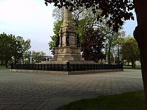
The Muskegon Historic District is a large area in Muskegon. It was added to the list in 1972. This district includes many historic buildings and parks. It gives us a good idea of what Muskegon looked like in the past. It's a great place to walk around and imagine life long ago.
Spring Creek Site
The Spring Creek Site is a very old and important place in Egelston Township. It was added to the list in 1972. This site is an archaeological area. This means it contains clues about ancient people who lived there. Because it's so sensitive, its exact location is kept private.
Historic Lights and Structures on the Water
Muskegon County is on Lake Michigan, so it has important structures related to water travel.
Muskegon South Breakwater Light
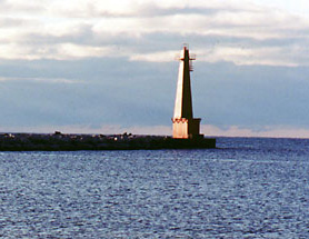
The Muskegon South Breakwater Light is a lighthouse at the end of a long wall (breakwater) in Lake Michigan. It was listed in 2006. Lighthouses are like traffic lights for ships. They guide boats safely into and out of harbors. This light helps ships navigate the entrance to Muskegon Lake.
Muskegon South Pierhead Light
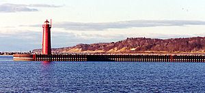
The Muskegon South Pierhead Light is another important light. It stands on the southern pier of the Muskegon Lake entrance channel. It was added to the list in 2006. Together with the breakwater light, it helps ships find their way safely.
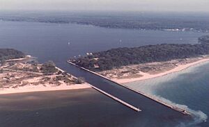
In Whitehall, there are Navigation Structures at White Lake Harbor. These structures help boats enter and leave White Lake. They were recognized in 2000. They are important for safe boating and shipping in the area.
Famous Historic Ships
Muskegon is also home to two very famous historic ships!
SS CLIPPER
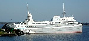
The SS CLIPPER, also known as the Milwaukee Clipper, is a large passenger ship. It was added to the list in 1983. This ship used to carry people and cars across Lake Michigan. It's a beautiful example of an old passenger steamship. Today, it's a museum and a popular attraction in Muskegon.
USS SILVERSIDES
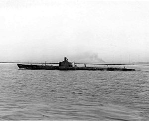
The USS SILVERSIDES is a real submarine from World War II. It was recognized in 1972. This submarine was very brave and successful during the war. It's now a museum in Muskegon. You can even go inside and see what life was like for sailors on a submarine!
Images for kids


