National Register of Historic Places listings in Ness County, Kansas facts for kids
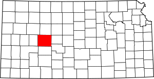
This is a list of the National Register of Historic Places listings in Ness County, Kansas. It is intended to be a complete list of the properties and districts on the National Register of Historic Places in Ness County, Kansas, United States. The locations of National Register properties and districts for which the latitude and longitude coordinates are included below, may be seen in an online map.
There are 8 properties and districts listed on the National Register in the county.
Current listings
| Name on the Register | Image | Date listed | Location | City or town | Description | |
|---|---|---|---|---|---|---|
| 1 | George Washington Carver Homestead Site |
(#77000593) |
1.5 miles (2.4 km) south of Beeler 38°25′44″N 100°11′28″W / 38.428882°N 100.191165°W |
Beeler | ||
| 2 | Indian Village on Pawnee Fork |
(#07000609) |
Address Restricted |
Bazine vicinity | ||
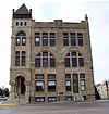
| 3 | Lion Block |
(#08000986) |
216 West Main St. 38°27′15″N 99°54′26″W / 38.454136°N 99.907304°W |
Ness City | ||
| 4 | Ness County Bank |
(#72000519) |
Main St. and Pennsylvania Ave. 38°27′15″N 99°54′19″W / 38.454167°N 99.905278°W |
Ness City | ||
| 5 | Pawnee River Tributary Bridge |
(#85001446) |
8 miles south of Bazine 38°19′21″N 99°41′43″W / 38.322444°N 99.695366°W |
Bazine | ||
| 6 | Thornburg Barn |
(#09000192) |
Ness-Gove county line, 0.5 miles (0.8 km) west of D Road 38°41′45″N 100°10′55″W / 38.695925°N 100.181902°W |
Utica | Agriculture-Related Resources of Kansas MPS | |
| 7 | Henry Tilley House |
(#06001053) |
108 W. 2nd St. 38°38′13″N 99°55′57″W / 38.637045°N 99.93255°W |
Ransom |

All content from Kiddle encyclopedia articles (including the article images and facts) can be freely used under Attribution-ShareAlike license, unless stated otherwise. Cite this article:
National Register of Historic Places listings in Ness County, Kansas Facts for Kids. Kiddle Encyclopedia.


