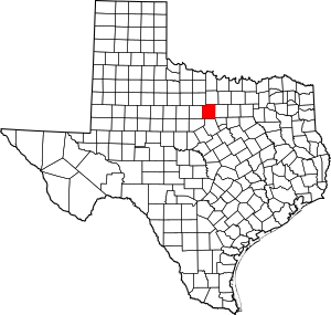
National Register of Historic Places listings in Palo Pinto County, Texas facts for kids
This is a list of the National Register of Historic Places listings in Palo Pinto County, Texas it is intended to be a complete list of properties listed on the National Register of Historic Places in Palo Pinto County, Texas. Nine properties are listed on the National Register in the county. One property is also a Recorded Texas Historic Landmark.
Current listings
| Name on the Register | Image | Date listed | Location | City or town | Description | |
|---|---|---|---|---|---|---|
| 1 | Baker Hotel |
(#82004518) |
200 E. Hubbard St. 32°48′35″N 98°06′00″W / 32.809722°N 98.1°W |
Mineral Wells | ||
| 2 | First Presbyterian Church |
(#79003004) |
410 NW 2nd St. 32°48′41″N 98°06′56″W / 32.811389°N 98.115556°W |
Mineral Wells | ||
| 3 | Gallagher House |
(#11000232) |
2919 Union Hill Rd 32°52′51″N 98°08′51″W / 32.880839°N 98.147406°W |
Mineral Wells vicinity | ||
| 4 | Palo Pinto County Courthouse |
(#97000365) |
520 Oak St. 32°46′03″N 98°17′57″W / 32.7675°N 98.299167°W |
Palo Pinto | ||
| 5 | Palo Pinto County Jail |
(#79003005) |
Elm St. and 5th Ave 32°45′24″N 98°17′53″W / 32.756667°N 98.298056°W |
Palo Pinto | ||
| 6 | State Highway 16, Brazos River Bridge Segment |
(#15000153) |
TX 16 from 7.4 mi. northeast of US 180 to junction of TX 16 & TX 254 32°52′31″N 98°24′44″W / 32.875357°N 98.412202°W |
Graford vicinity | ||
| 7 | US 281 Bridge at the Brazos River |
(#96001126) |
US 281, 2.2 mi (3.5 km) north of Interstate 20 32°38′29″N 98°06′00″W / 32.641389°N 98.1°W |
Santo | ||
| 8 | Weatherford-Mineral Wells and Northwestern Railroad Depot |
(#84001953) |
S. Oak St. 32°48′22″N 98°06′41″W / 32.806111°N 98.111389°W |
Mineral Wells |

All content from Kiddle encyclopedia articles (including the article images and facts) can be freely used under Attribution-ShareAlike license, unless stated otherwise. Cite this article:
National Register of Historic Places listings in Palo Pinto County, Texas Facts for Kids. Kiddle Encyclopedia.


