Santo, Texas facts for kids
Quick facts for kids
Santo
|
|
|---|---|
 |
|
| Country | United States |
| State | Texas |
| County | Palo Pinto |
| Elevation | 830 ft (250 m) |
| Population
(2008)
|
|
| • Total | 315 |
| Time zone | UTC-6 (Central (CST)) |
| • Summer (DST) | UTC-5 (CDT) |
| ZIP codes |
76472
|
| Area code(s) | 940 |
| GNIS feature ID | 1346680 |
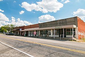
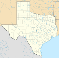
Santo is a small community located in Palo Pinto County, Texas, in the United States. It's known as an unincorporated community, which means it doesn't have its own local city government. It's also a census designated place (CDP). This means the U.S. Census Bureau counts the people living there for official statistics.
Santo is found on Farm to Market Road 4. It is about 14 miles south of the town of Palo Pinto. In 2008, the estimated number of people living in Santo was 315.
Learning in Santo
Students in the Santo area attend schools that are part of the Santo Independent School District. This district helps provide education for the young people living in the community.
Black History Month on Kiddle
African-American Women you should know
 | Anna J. Cooper |
 | Mary McLeod Bethune |
 | Lillie Mae Bradford |

All content from Kiddle encyclopedia articles (including the article images and facts) can be freely used under Attribution-ShareAlike license, unless stated otherwise. Cite this article:
Santo, Texas Facts for Kids. Kiddle Encyclopedia.


