National Register of Historic Places listings in Parker County, Texas facts for kids
Have you ever wondered about old buildings and places that are super important to history? In Parker County, Texas, there are some amazing spots that are officially recognized for their historical value. These places are listed on the National Register of Historic Places. It's like a special list kept by the United States government to help protect and celebrate buildings, sites, and objects that have played a big part in American history.
This list helps people learn about the past and makes sure these important places are preserved for future generations. In Parker County, you'll find a mix of individual buildings and even whole areas (called historic districts) that are on this list. Some of these places are also recognized by Texas as "State Antiquities Landmarks" or "Recorded Texas Historic Landmarks," which means they're extra special to the state's history!
Contents
Historic Places You Can Find in Parker County
Here are some of the cool historic places listed in Parker County:
Byron Farmstead
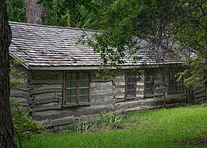
The Byron Farmstead is a historic area located in Weatherford, Texas. It was added to the National Register in 2007. A "farmstead" means it's an old farm, including the farmhouse and other buildings, that shows how people used to live and work on farms a long time ago. This place helps us understand the farming history of the area.
Chandor Gardens
Chandor Gardens is a unique and beautiful place in Weatherford, Texas. It was added to the National Register in 2014. This property is also a "Recorded Texas Historic Landmark," meaning it's very important to Texas history. It features stunning gardens and a mansion, created by artist Douglas Chandor. It's a great example of art and nature coming together.
Parker County Courthouse
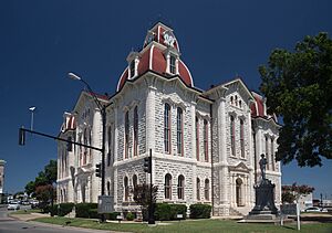
The Parker County Courthouse is a very important building right in the center of Weatherford, Texas. It was listed on the National Register way back in 1971. This courthouse is not only on the National Register, but it's also a "State Antiquities Landmark" and a "Recorded Texas Historic Landmark." Courthouses are often the heart of a county, and this one shows off amazing architecture from the past. It's where many important decisions for the county have been made over the years.
State Highway 89 Bridge at the Brazos River
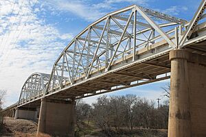
This bridge is a cool piece of engineering history! It's located near Millsap, Texas, and crosses the Brazos River. It was added to the National Register in 1996. Bridges like this one are important because they show how people built roads and connected communities in the past. This bridge helped people travel and transport goods across the river.
Weatherford Downtown Historic District
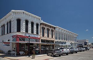
The Weatherford Downtown Historic District is a whole section of downtown Weatherford, Texas, that is recognized for its historical importance. It was added to the National Register in 1990. This district includes many old buildings that together tell the story of how Weatherford grew and developed. Walking through this area is like taking a step back in time! Many buildings here are also "Recorded Texas Historic Landmarks."
A Place That Was Once Listed
Sometimes, a historic place might be removed from the National Register. This usually happens if the building is destroyed or changed so much that it no longer looks like it did historically.
Tin Top Suspension Bridge
The Tin Top Suspension Bridge was once listed on the National Register in 1977. It was located near Weatherford, Texas. Sadly, this bridge collapsed in 1982 because of heavy snow. Even though it's no longer standing, it was an important "State Antiquities Landmark" and a part of the area's history.


