National Register of Historic Places listings in Pawnee County, Kansas facts for kids
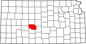
This is a list of the National Register of Historic Places listings in Pawnee County, Kansas. It is intended to be a complete list of the properties and districts on the National Register of Historic Places in Pawnee County, Kansas, United States. The locations of National Register properties and districts for which the latitude and longitude coordinates are included below, may be seen in an online map.
There are 8 properties and districts listed on the National Register in the county.
Current listings
| Name on the Register | Image | Date listed | Location | City or town | Description | |
|---|---|---|---|---|---|---|
| 1 | Babbitt-Doerr House |
(#95000477) |
423 W. 5th St. 38°10′41″N 99°06′11″W / 38.178056°N 99.103056°W |
Larned | ||
| 2 | Coon Creek Crossing on the Santa Fe Trail (Wet Route) |
(#13000493) |
1.5 miles southwest of Garfield on US 56 38°03′55″N 99°15′32″W / 38.065363°N 99.258960°W |
Garfield | Santa Fe Trail Multiple Property Submission | |
| 3 | Fort Larned National Historic Site |
(#66000107) |
6 miles west of Larned on U.S. Route 156 38°09′24″N 99°13′36″W / 38.156667°N 99.226667°W |
Larned | ||
| 4 | Lewis Site |
(#76000836) |
Address restricted |
Larned | ||
| 5 | Ooten House |
(#01000188) |
507 W. 15th St. 38°11′21″N 99°06′14″W / 38.189167°N 99.103889°W |
Larned | ||
| 6 | Patterson House |
(#01000189) |
841 W. 8th St. 38°10′53″N 99°06′32″W / 38.181389°N 99.108889°W |
Larned | ||
| 7 | Pawnee Fork Crossing (Santa Fe Trail Dry Route) and Boyd's Ranch Site |
(#13000494) |
Address Restricted |
Larned | Santa Fe Trail Multiple Property Submission | |
| 8 | Township Line Bridge |
(#85001442) |
Off U.S. Route 156, 3 miles west of Rozel 38°12′18″N 99°27′35″W / 38.205°N 99.459722°W |
Rozel |

All content from Kiddle encyclopedia articles (including the article images and facts) can be freely used under Attribution-ShareAlike license, unless stated otherwise. Cite this article:
National Register of Historic Places listings in Pawnee County, Kansas Facts for Kids. Kiddle Encyclopedia.


